Storm Chase Details
Chase Date: June 3, 2015
Miles Logged: 208
States Chased: KS
Tornadoes Witnessed: 1
Severe Risks: SPC Outlooks
Chase Recap:
Season over?
After expecting to be done chasing for awhile, I got a ‘hail mary’ given to me from work in the form of a broken radar truck computer. I would have to make the trip from Norman to Hays, KS to work on the truck, which was up there for the PECAN project.
This provided an opportunity to chase on the 3rd. After arriving in Hays on the evening of the 2nd I began to pour over models. The obvious target was CO/WY but that would be somewhat out of play for me considering I had to fix a computer in the morning and didn’t want to drive all the way out there.
Outflow Boundary
The next target that stuck out was in northern Kansas along an outflow boundary. If a storm could fire, it would be in a somewhat favorable environment for supercells. The possibility was also there for tornadoes with large/fat CAPE and adequate shear overhead.
Working in Hays
I spent most of the morning and afternoon working on the radar truck and extracting an image in case we needed to restore or otherwise work on an alternative if the radar truck died. Around 3pm I went to the PECAN briefing and started uploading the image to our servers in Norman. Upload time would be 5-6 hours, so I hung out around the ops center before leaving to go get some food around 5.
Lunch Break
On my “lunch break” I decided to meander south towards a cu field. There was some signs of agitation on visible satellite and radar was showing some blips. As I headed south towards Rozel, the updraft became explosive visually.
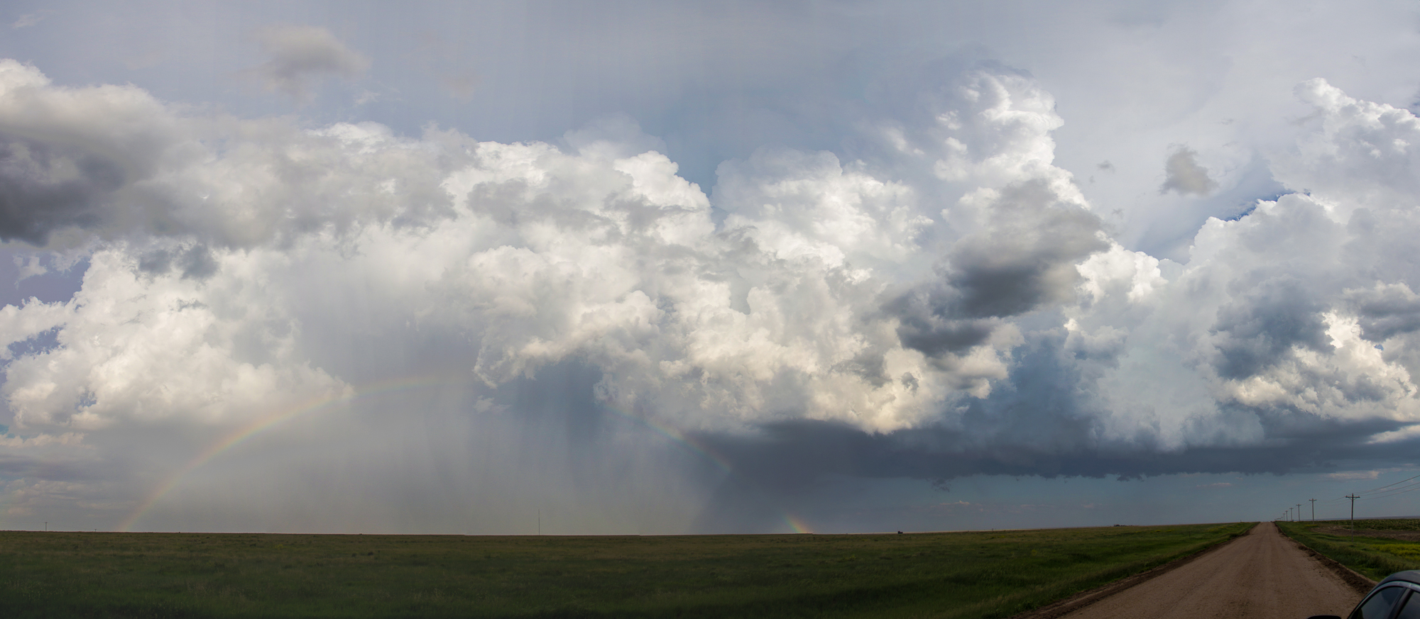
I headed west on a road to the north of the storm. I wasn’t sure what direction, if any, it was moving. A distinct lack of paved roads also caused problems. Getting west of the storm would ensure I had dry dirt roads to use to get into position.
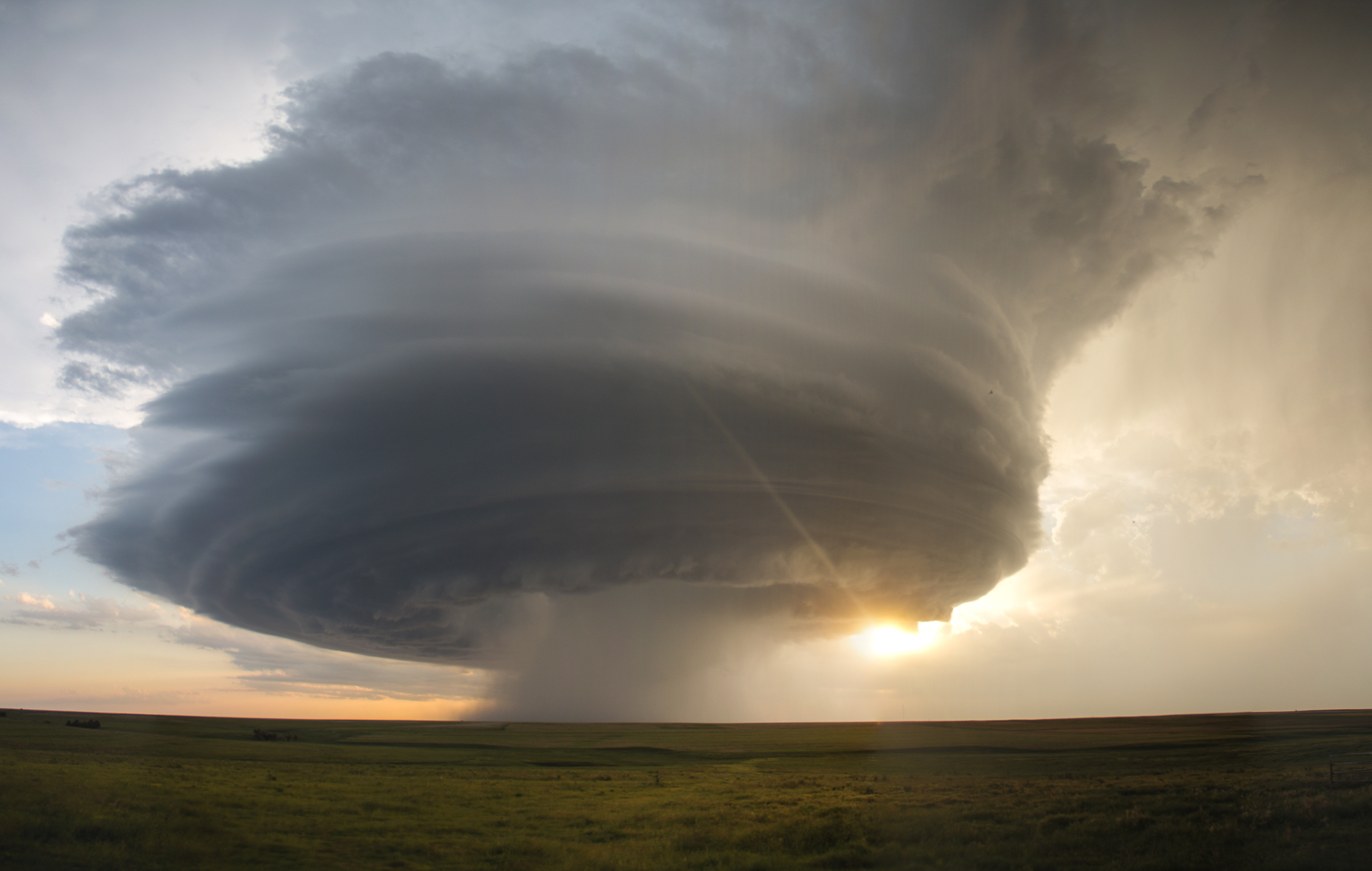
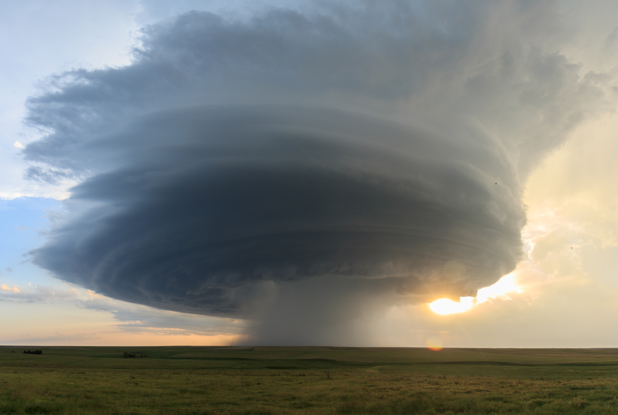
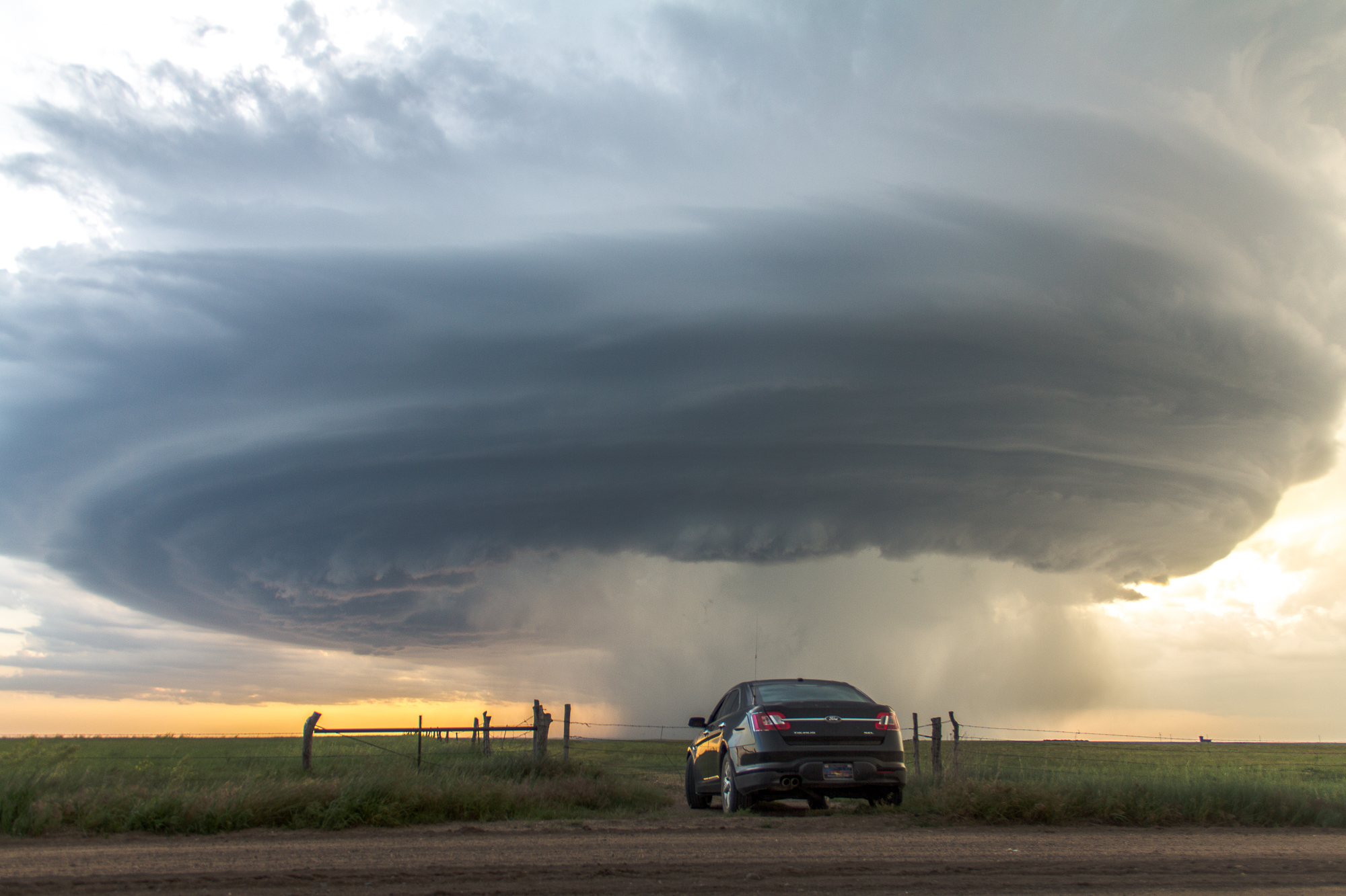
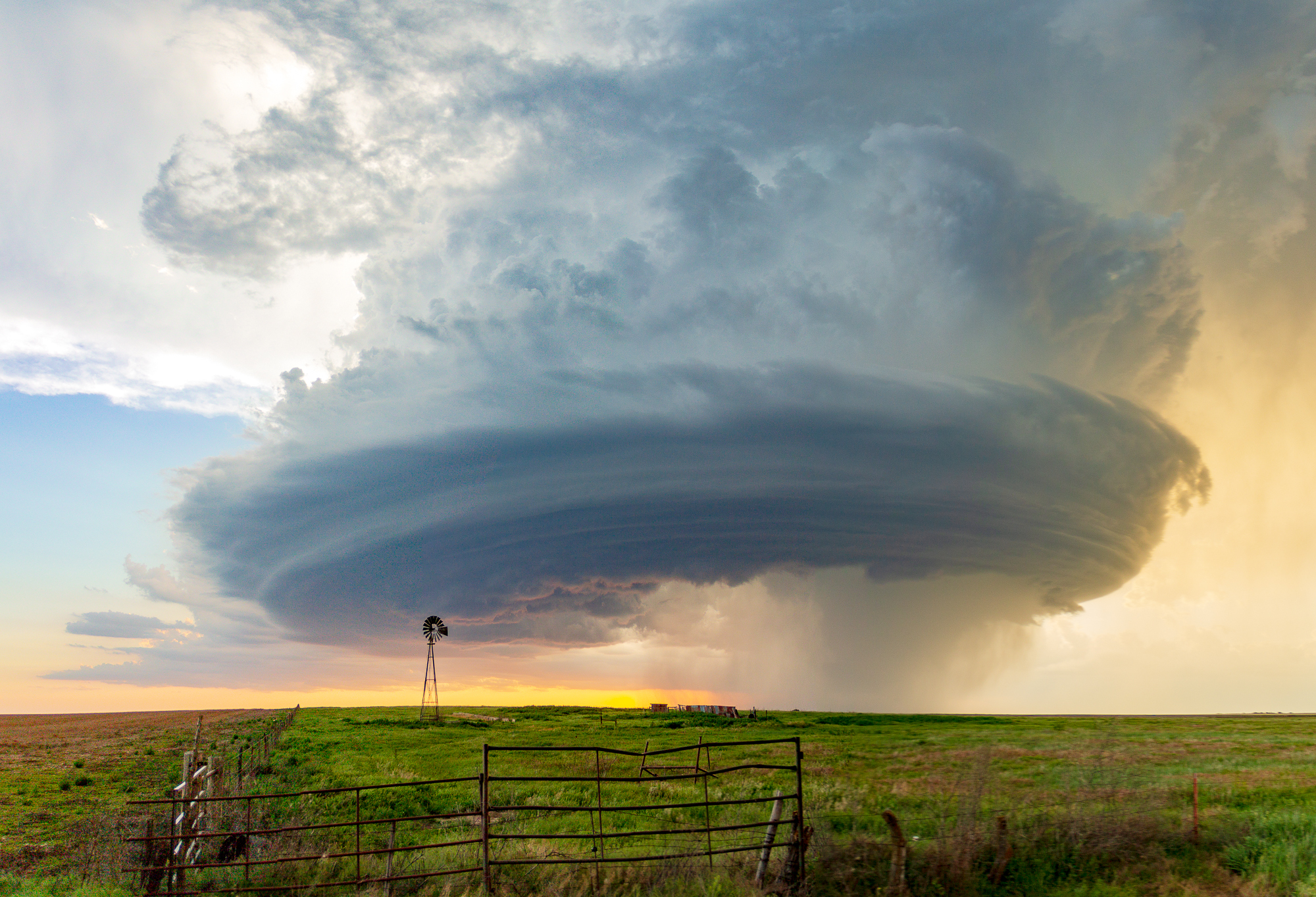
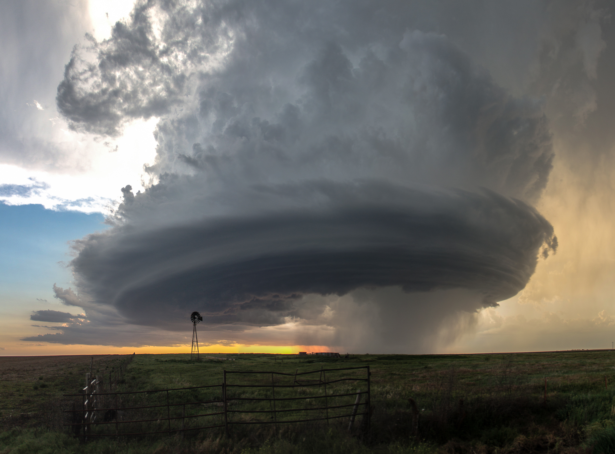
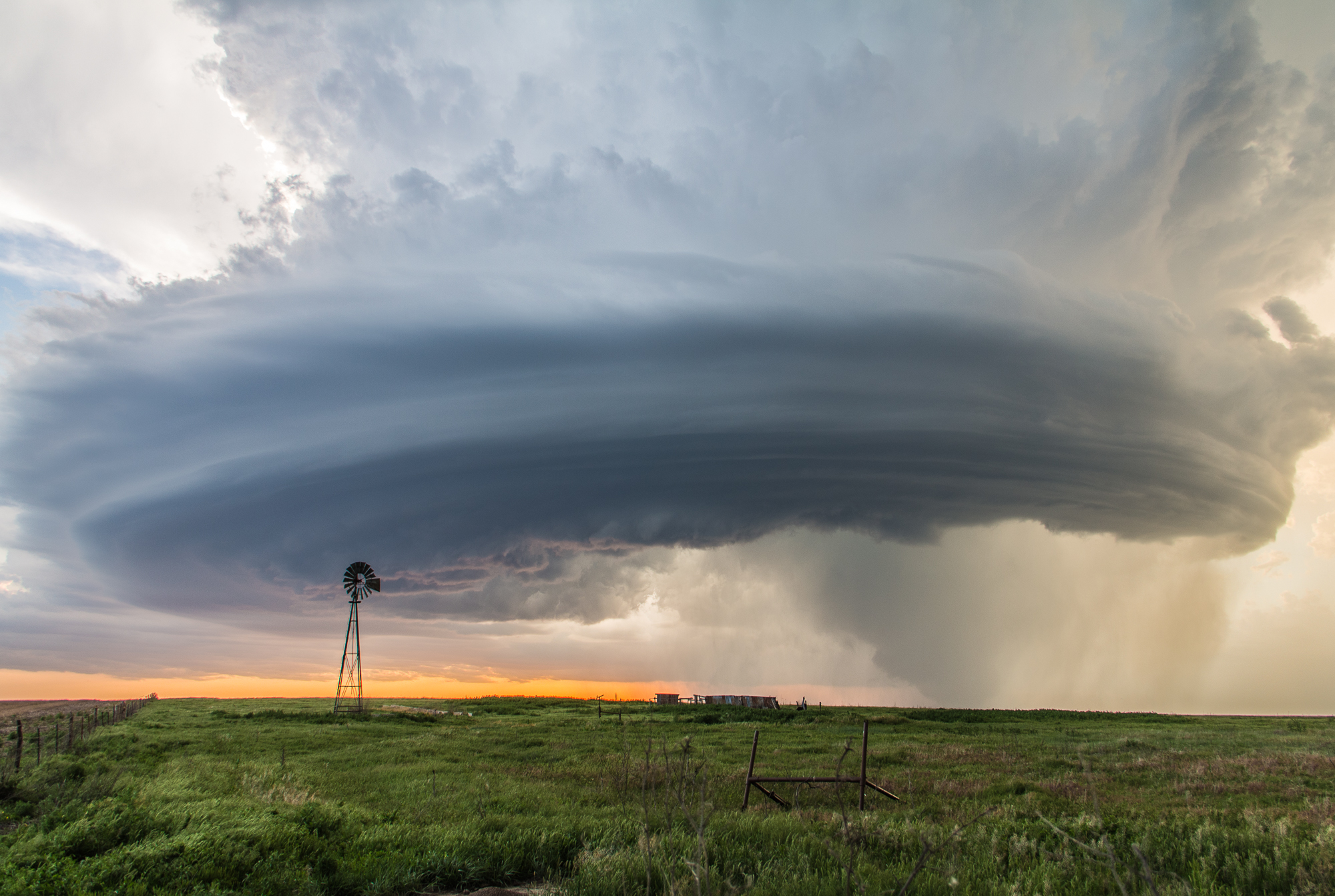
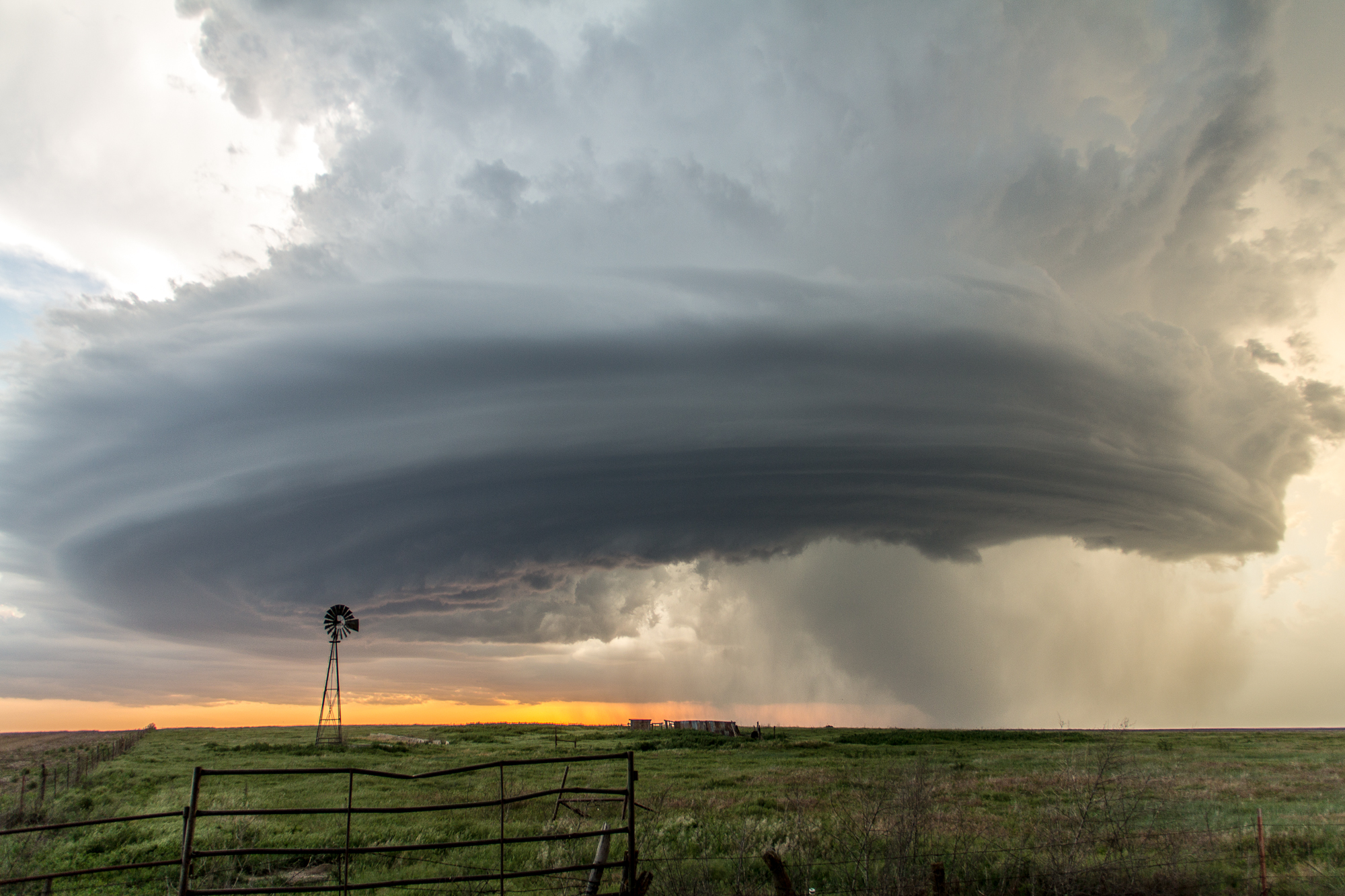
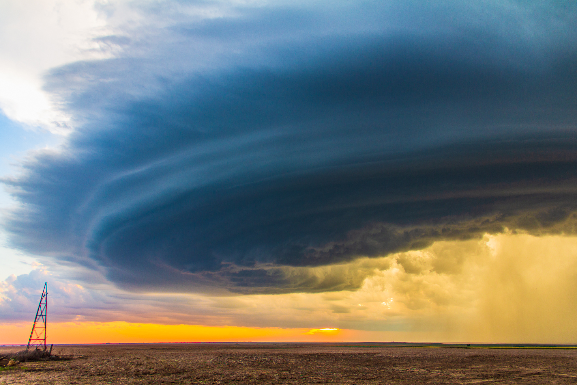
Supercell structure
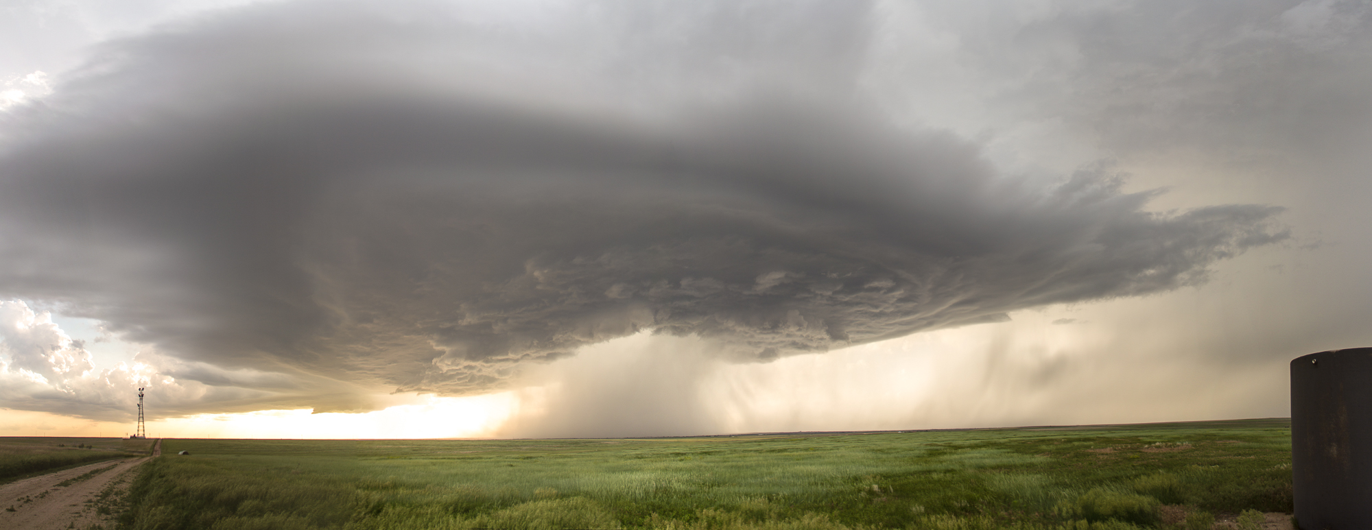
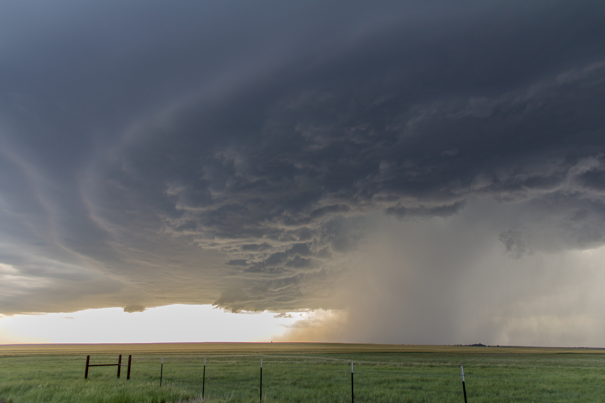
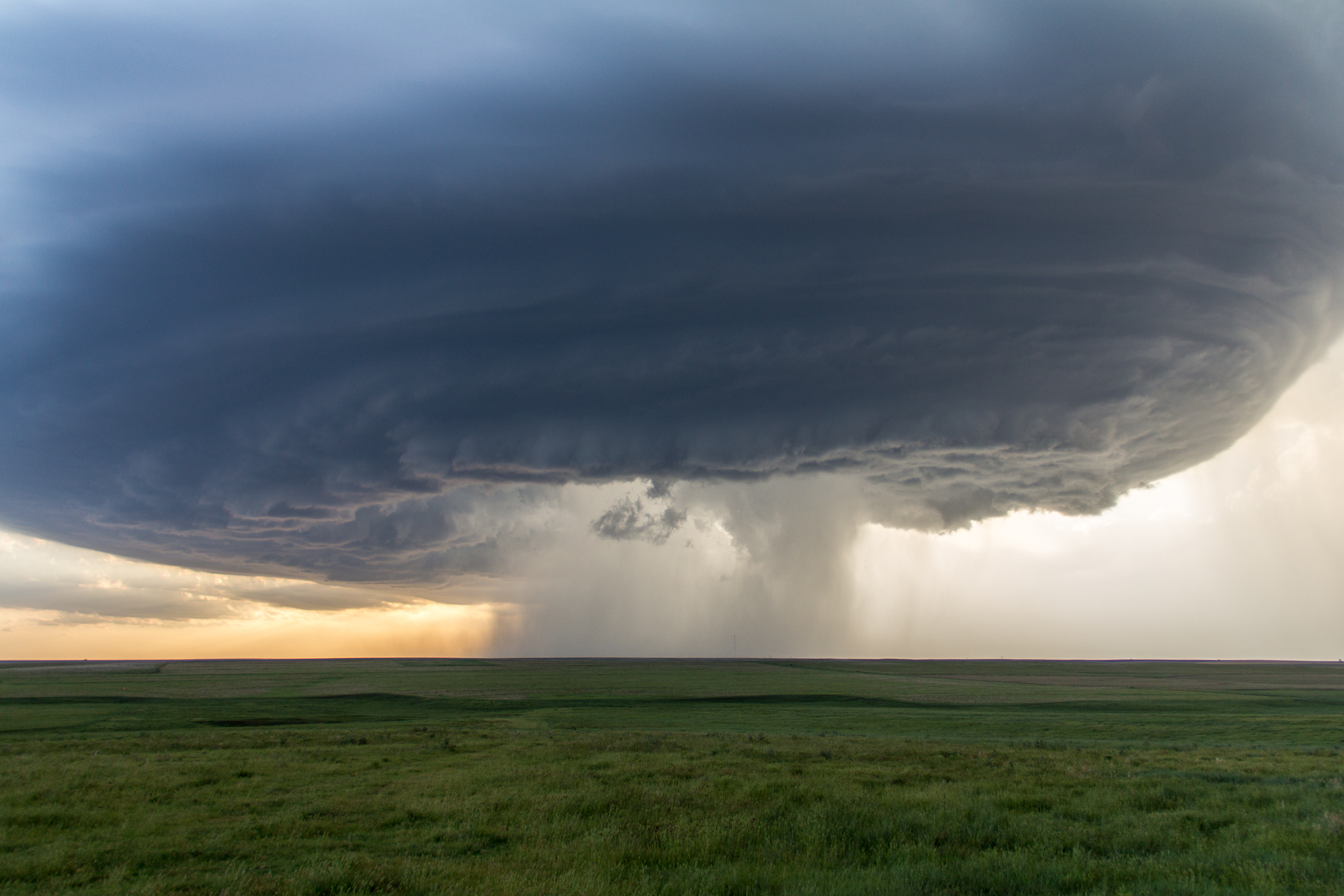
I headed down the back side and stopped for a rainbow shot. The angle of the sun on the updraft gave it perfect lighting. I spent the next couple of hours on this nearly stationary supercell storm near Hanston. The storm put on a show as it morphed into an absolutely gorgeous supercell structure. The mesocyclone was beautifully sculpted. I was kicking myself for not having a tripod, but still managed to take hundreds of images.
Video
Tornado?
For a brief while, it appeared a cone tornado touched down back in the rain, but it’s hard to tell. Using a telephoto zoom lens, I zoomed in and took some photos. There was some motion, but radar didn’t really support the idea of a tornado, and no tornado warning was issued.
My shutter stayed busy as I snapped photos of many angles of the storm. It started to lose its structure and die out around sunset. I bailed west towards 283 and Jetmore before heading back to Hays to finish up my work for the evening.