Storm Chase Details
Miles Logged: 605
States Chased: NE
Tornadoes Witnessed: 3
Largest Hail Encountered: 0.75 in.


Severe Risks: SPC Outlooks
Severe Reports: Storm Reports
Morning
JR Hehnly and I woke up dead center in the target area in York, NE. We slept in as we knew it’d be a long drive home after the chase Monday evening. I had to be back to work Tuesday morning in Norman. Never did we expect we’d witness something like the Bradshaw Nebraska Tornado that day.
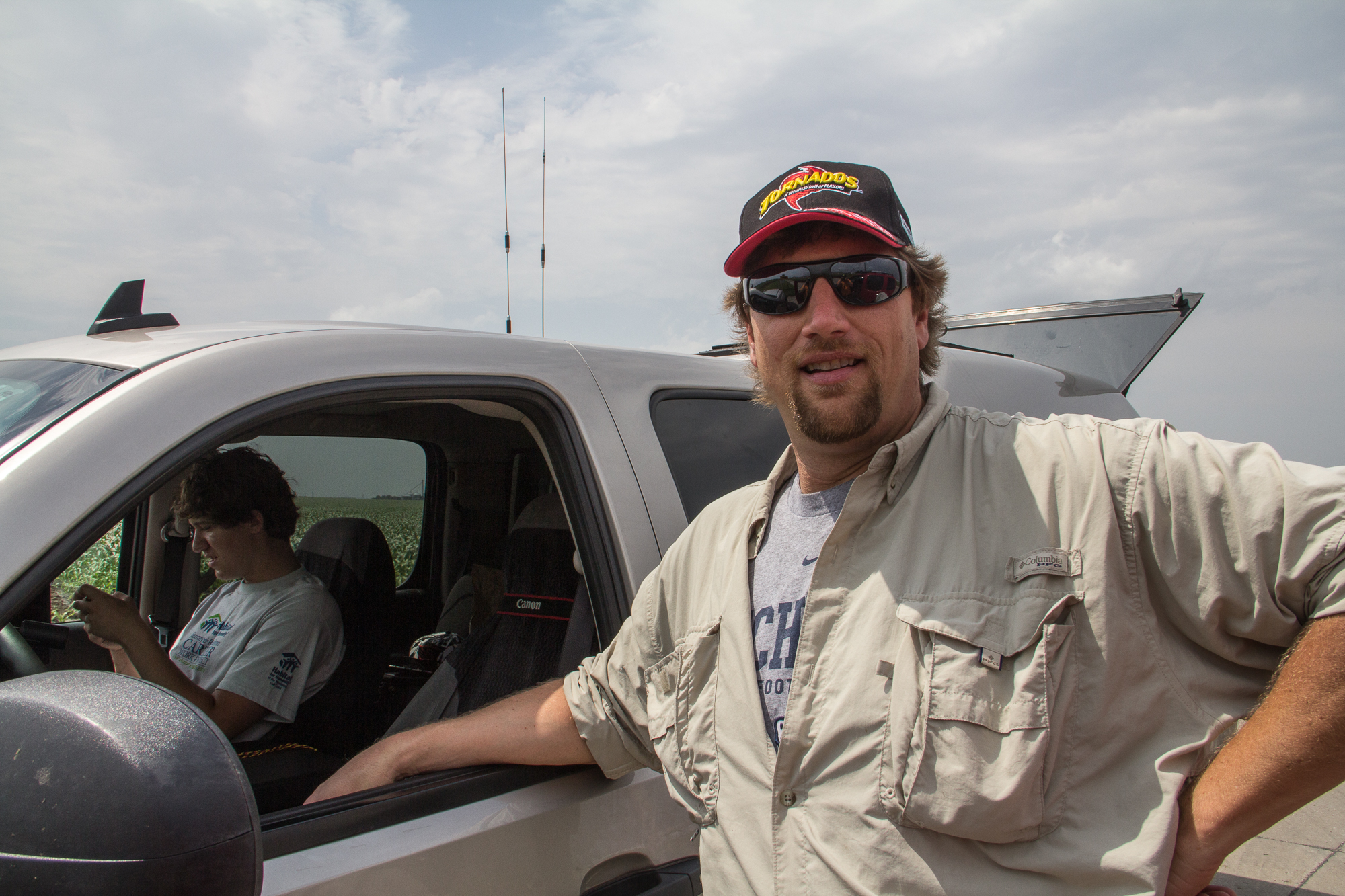
After looking over models in the morning, we decided we liked where we were currently sitting and didn’t want to move very far from York. Eric Treece showed up, and hung out with us in the hotel lobby. Eventually we drifted to our cars and gassed up and went and hid on the west side of York on a deserted road and waited.
Strategy and Waiting
All afternoon we waited, resisting the urge to chase after the bait storms. The “bait storms” were of course producing multiple tornadoes from I-70 in Kansas northward to Kearney. As the tornado icons kept popping up, the thought we had made the wrong decision kept coming to the top of our minds. Our reasoning was pretty sound – Stay in York. Anything that fires that far east should move north-northeast and would be at an optimal angle to ingest moisture rich air with east winds at the surface.
More storms had fired down south near Salina. It seemed inevitable that storms would fire and fill in around the upper level low and move off the dryline. Eventually we decided to move a little west on I-80 as more storms were going up near Grand Island. We didn’t go too far, just getting a little past Aurora before exiting the Interstate. We sat in a quiet spot a couple miles off the highway to watch the storms build.
Storm time
The cell going up near Clay Center was looking the best on radar, so we headed back east to be in position to intercept. As the storm matured, we watched a nice wall cloud and then a funnel. That funnel dissipated and the storm cycled. In that time frame we headed back north towards I-80. Upon arriving at I-80 we had to wait for the light to change on the one lane bridge over I-80. Once we were through that, we went up to US34 before heading east. A long needle rope funnel was coming out of the side of the wall cloud, and we stopped and snapped a few pictures before it dissipated.
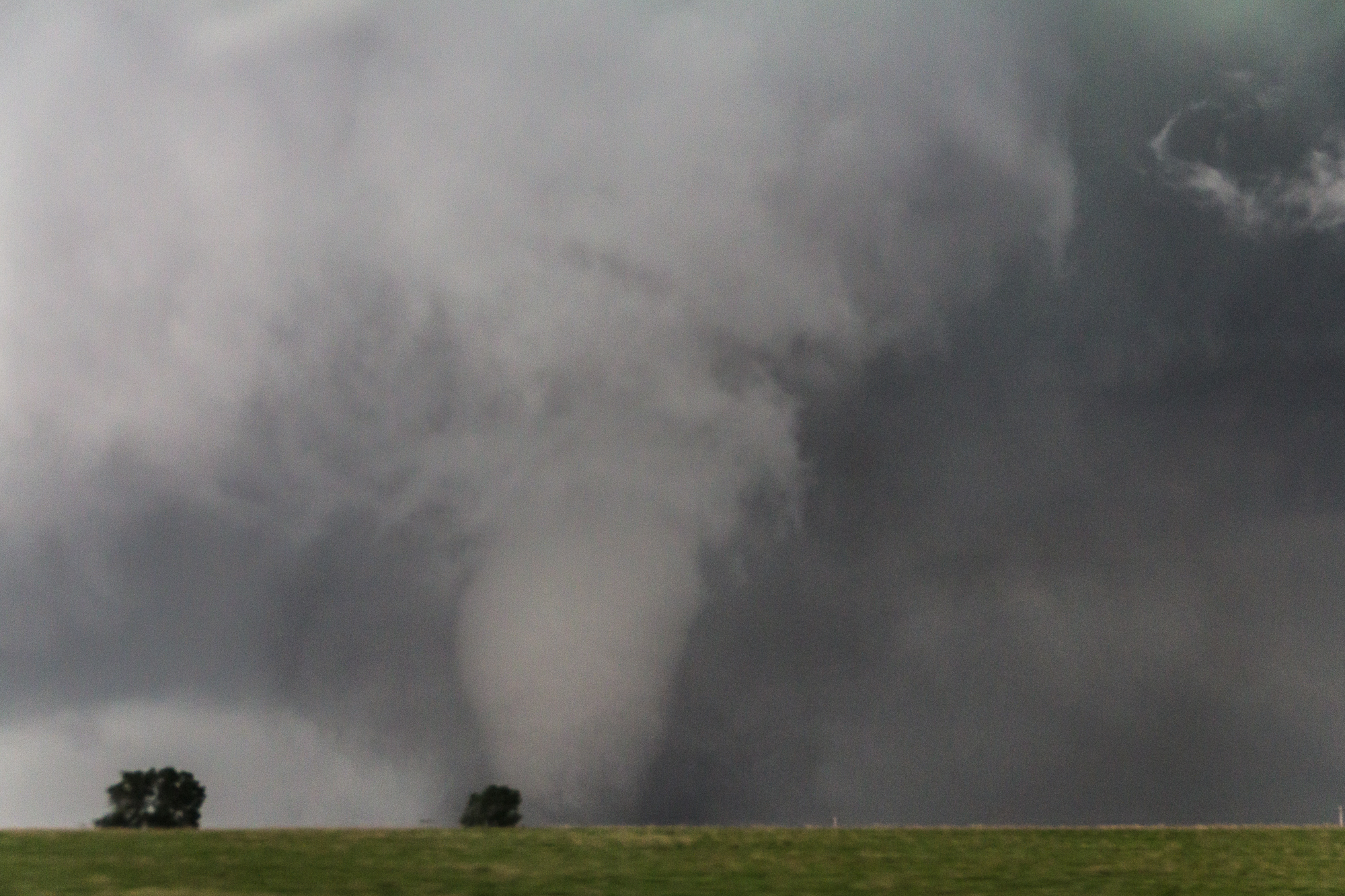
Bradshaw Nebraska Tornado
We got into hail, and Randy Cooper was reporting a cone tornado on the radio, so we were trying to figure out which direction we needed to look and go. I wanted to go west into the crap, JR wanted to go east. We ended up going east, and it turned out to be the correct choice.
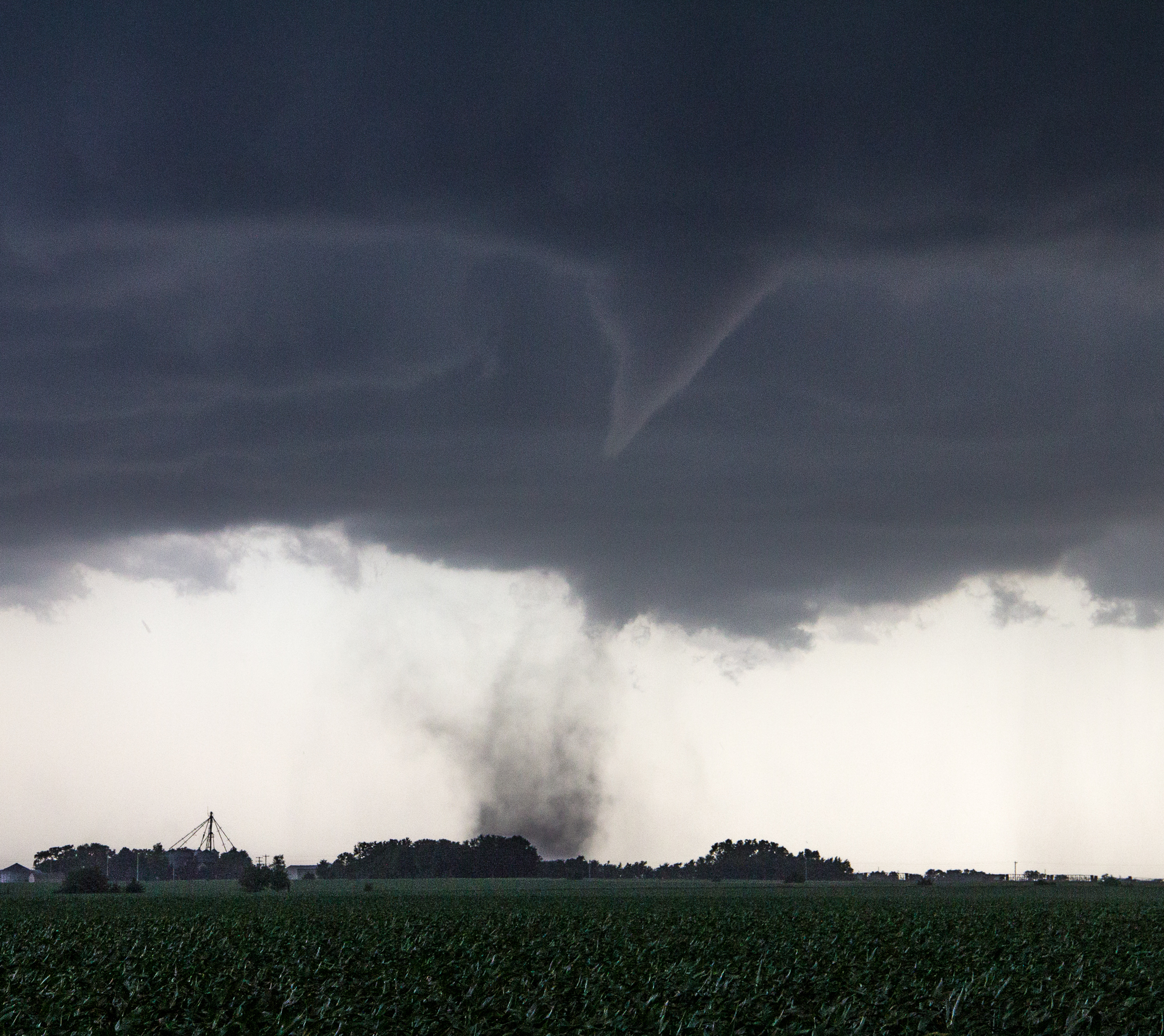
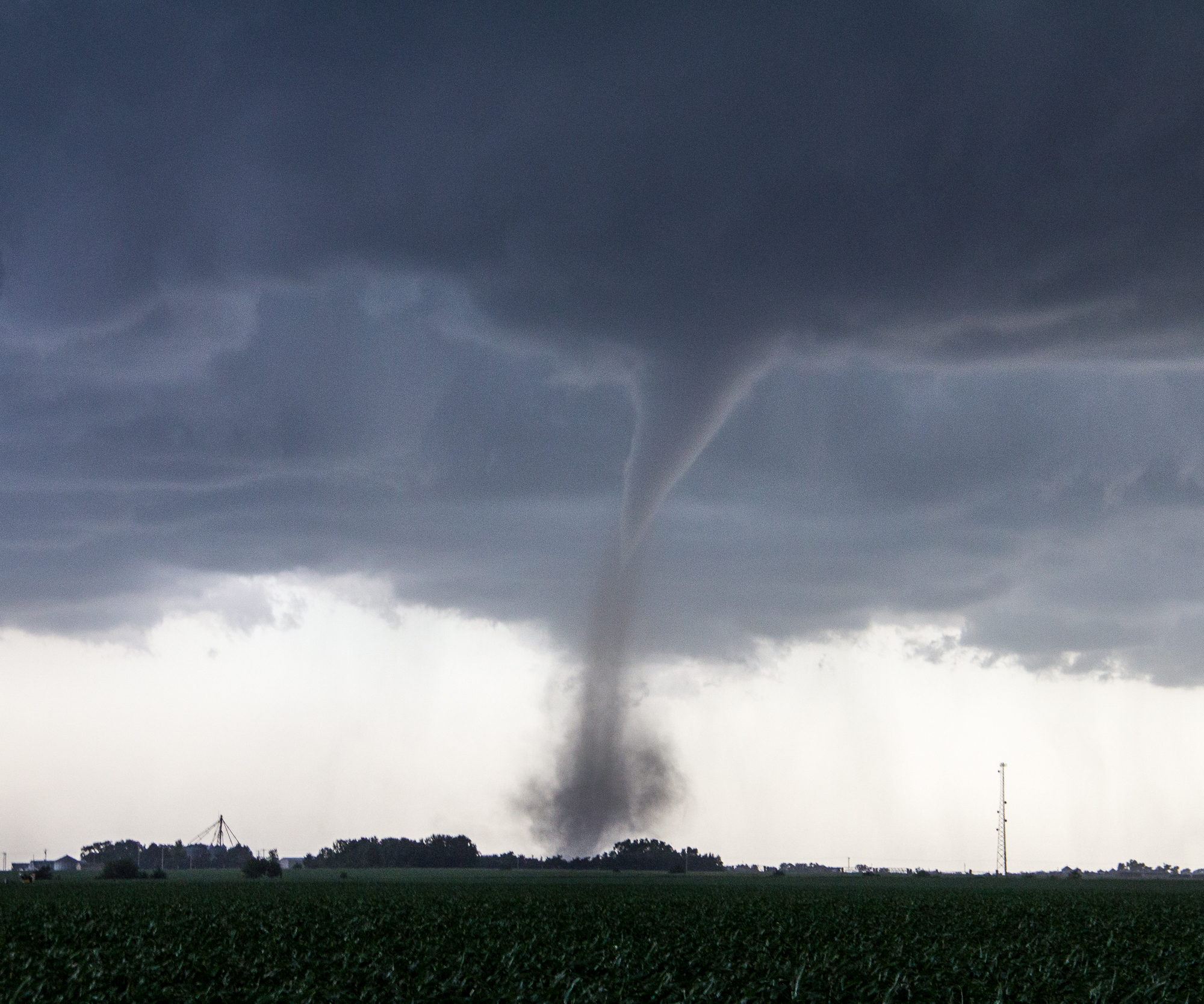
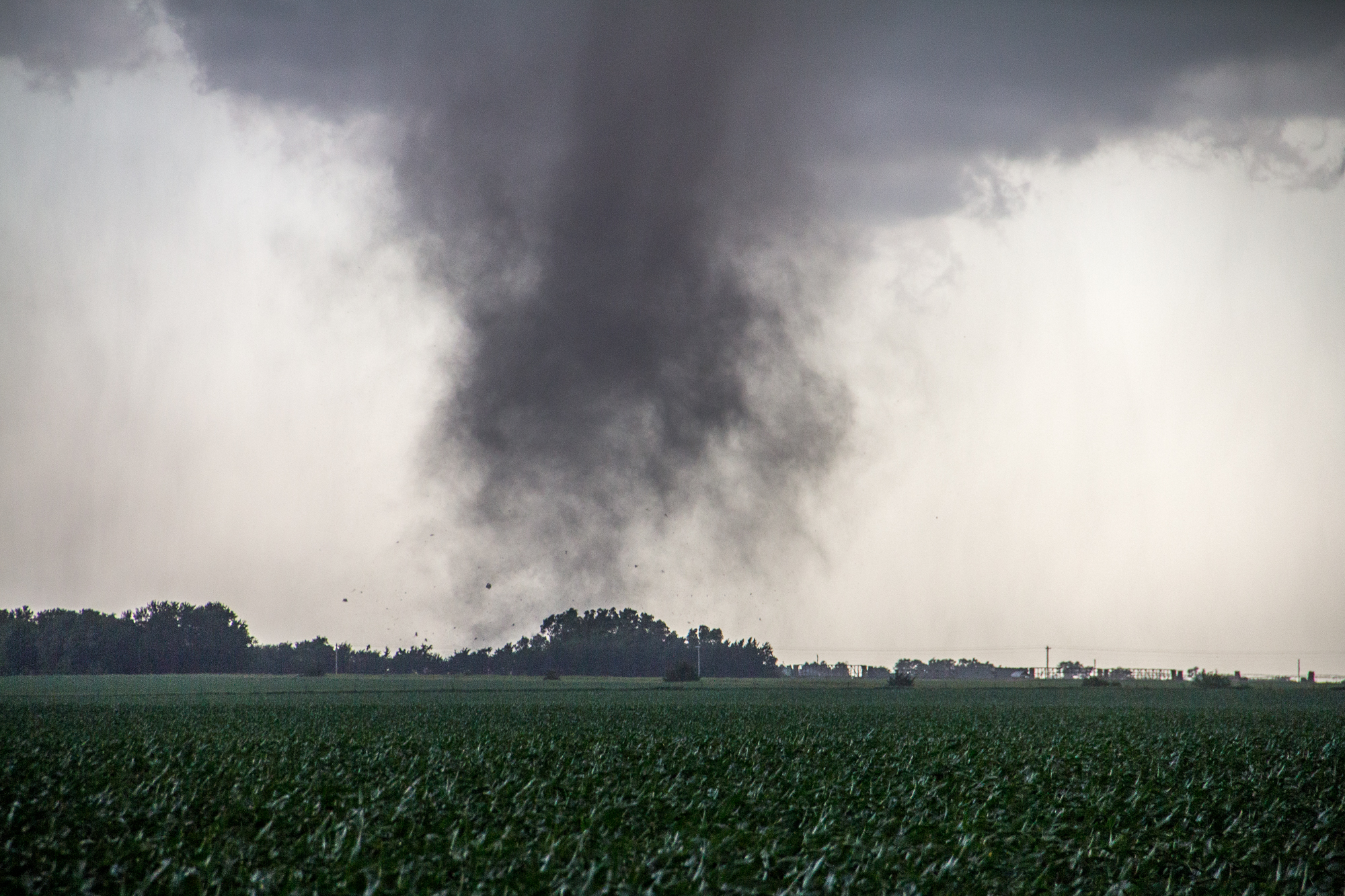
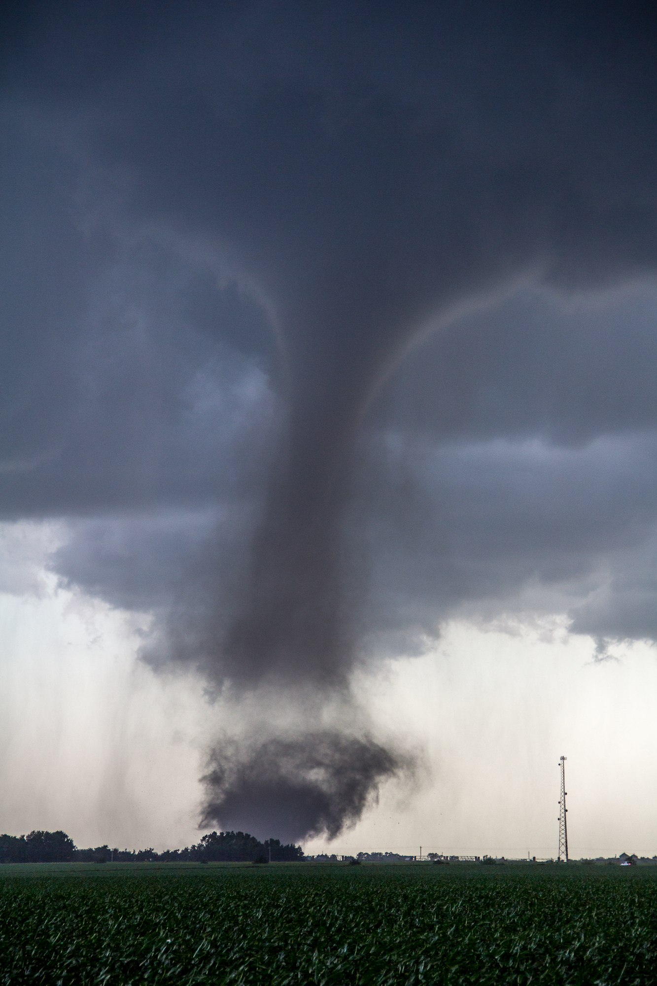
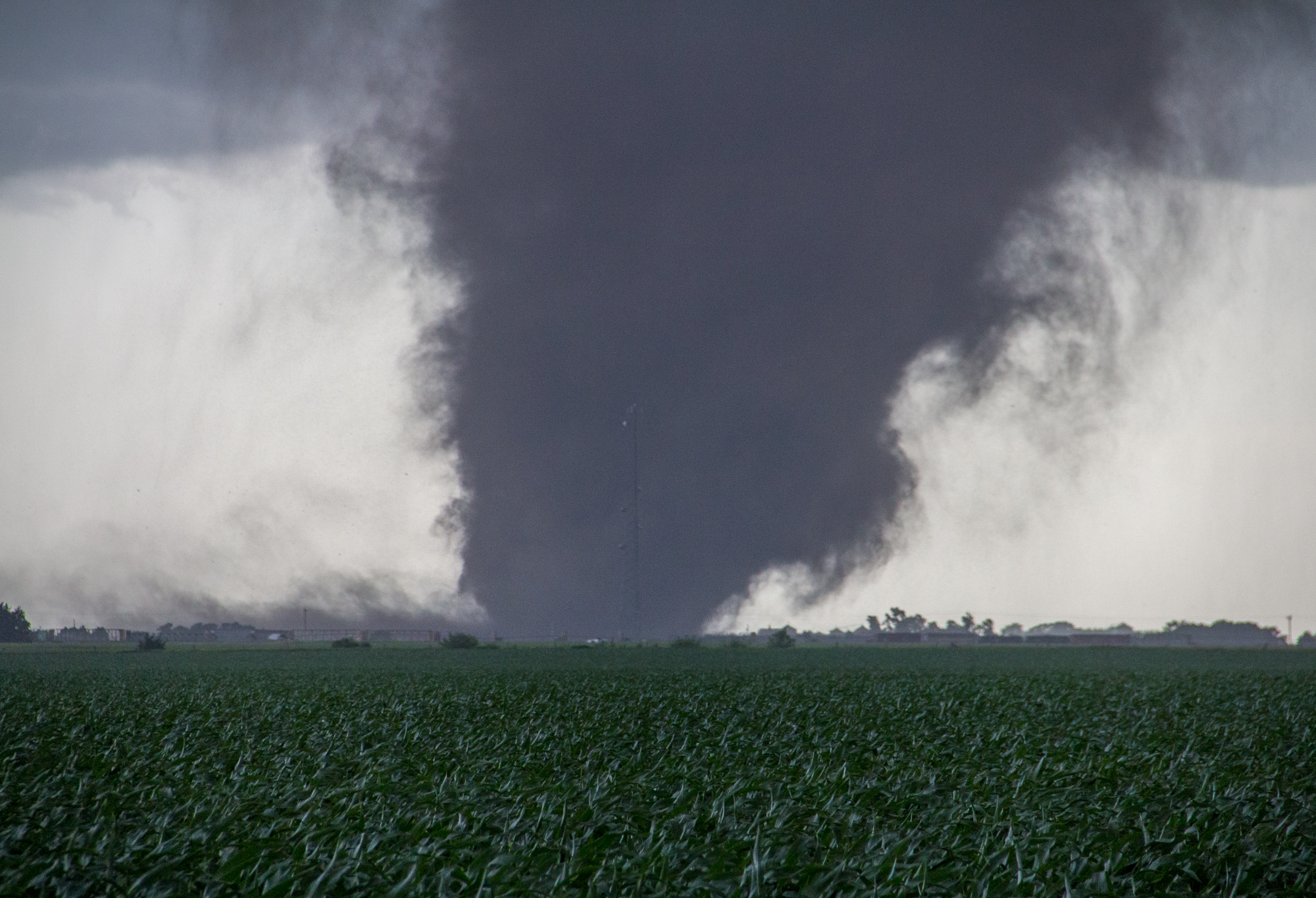
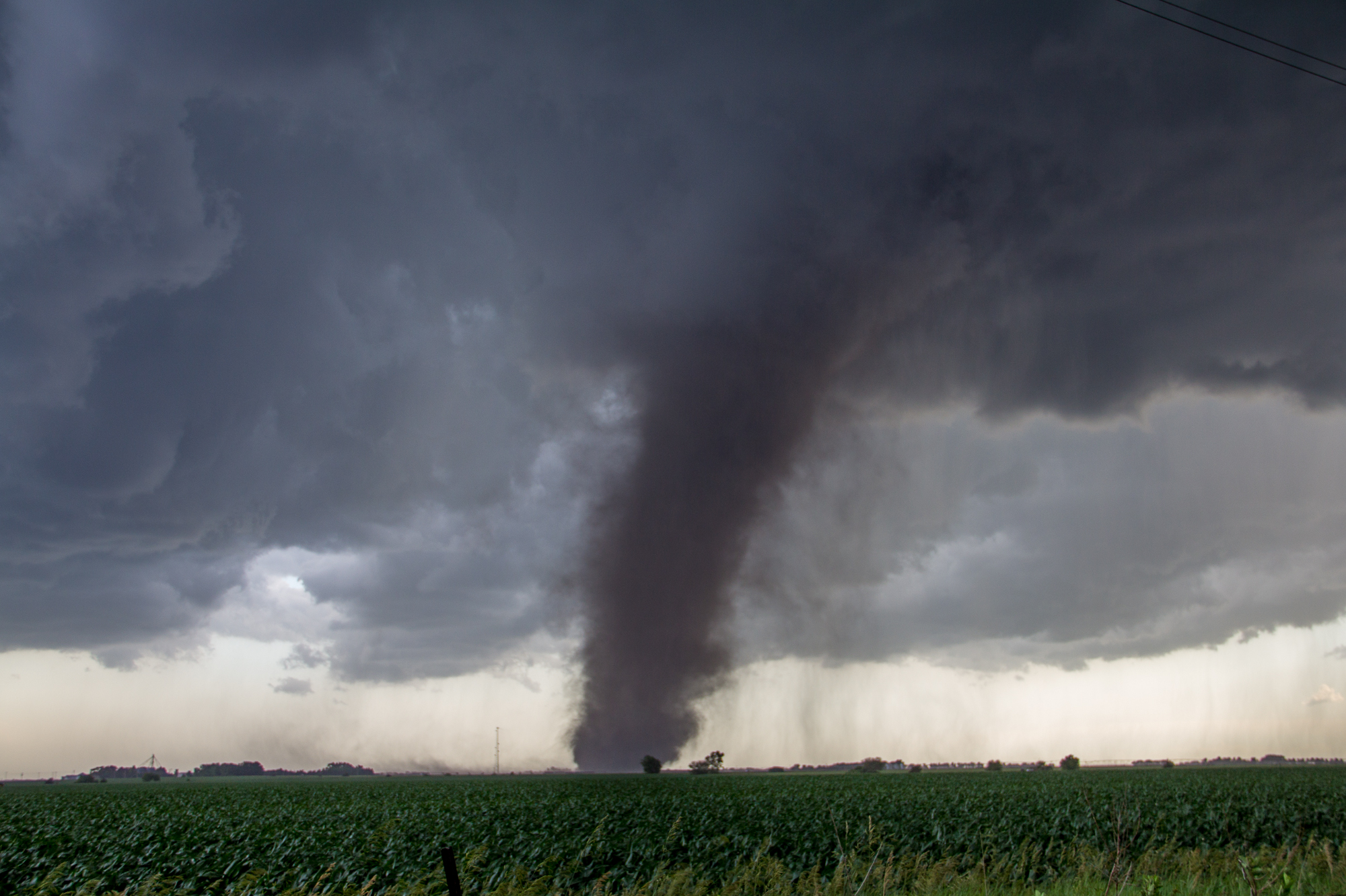
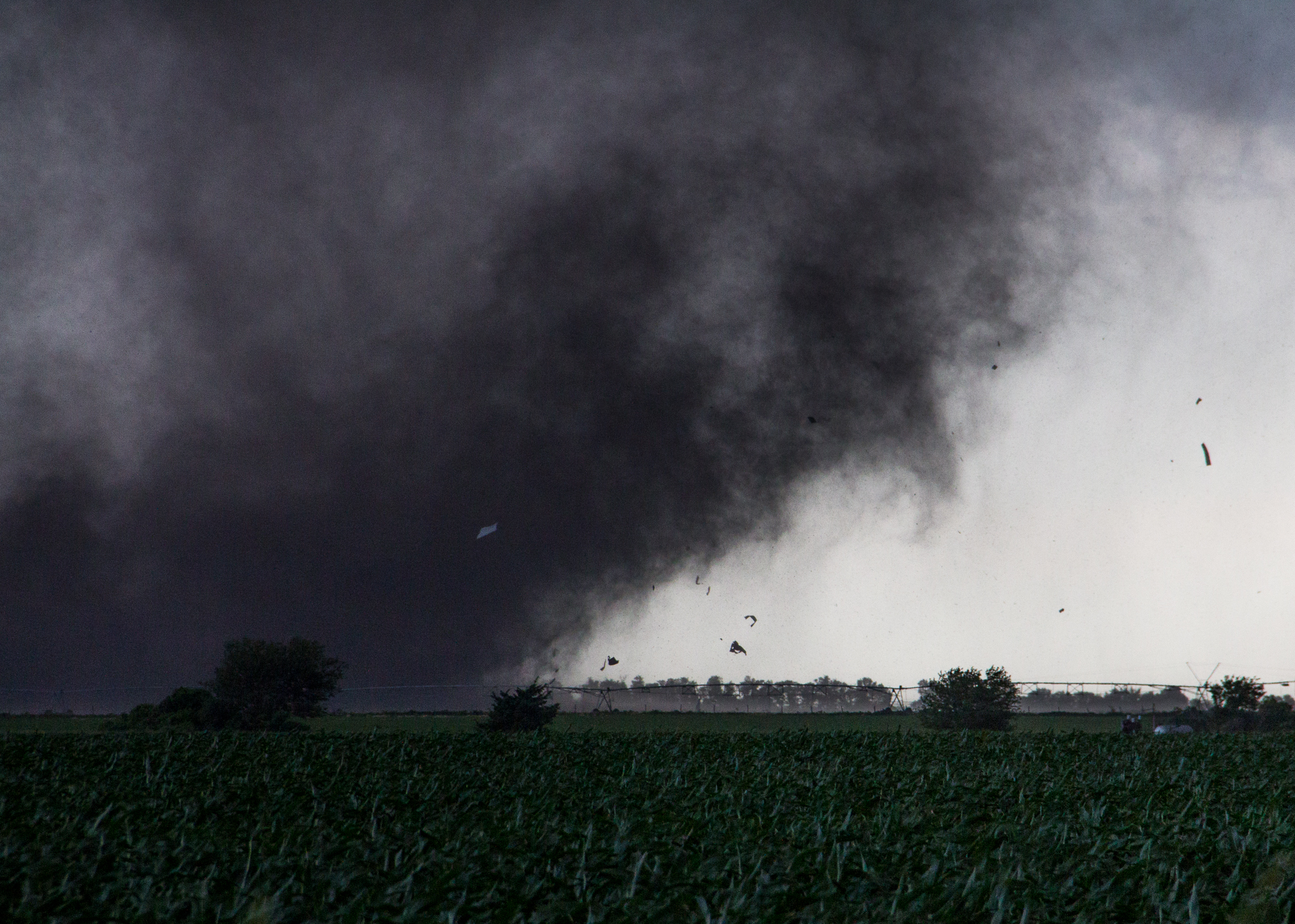
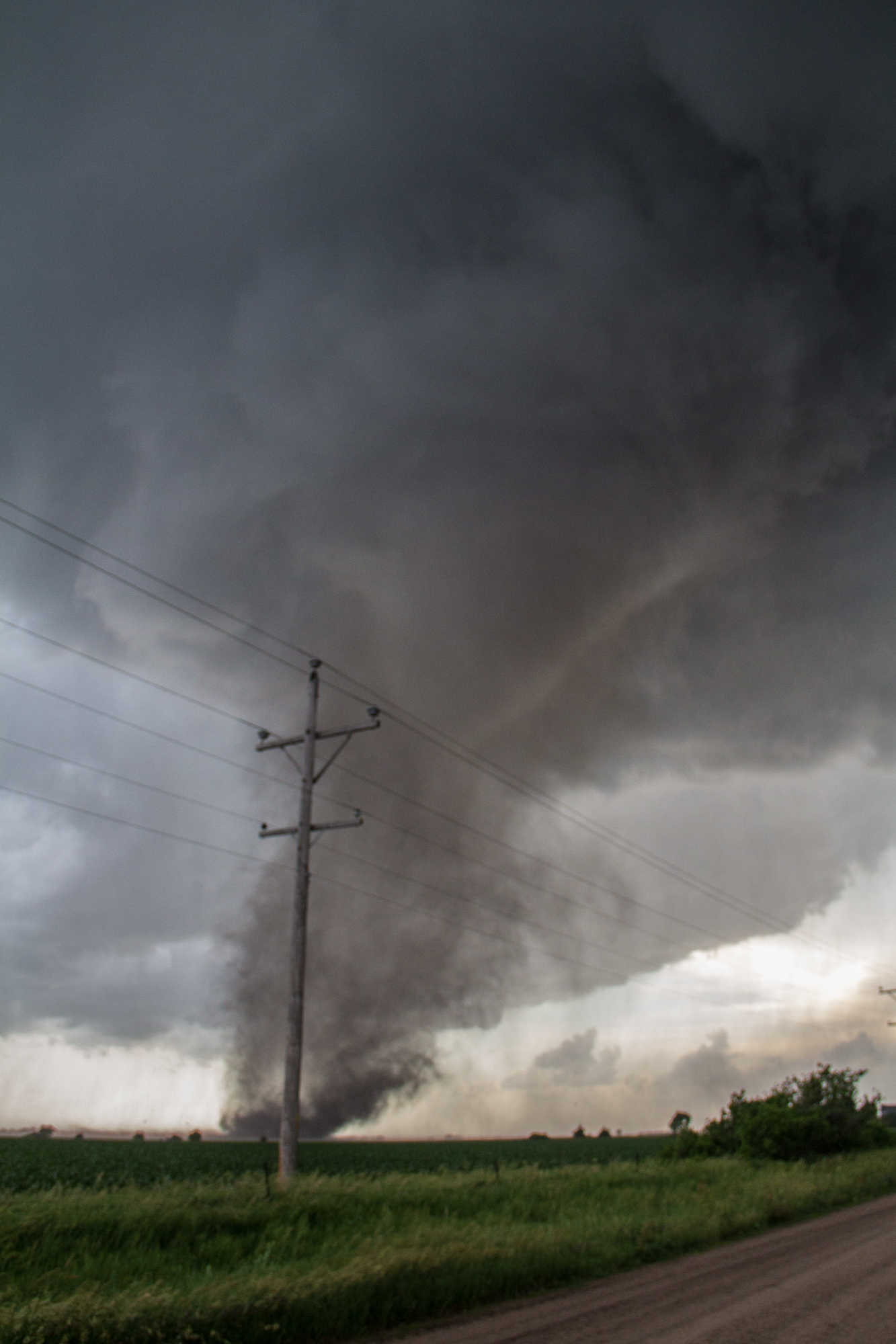
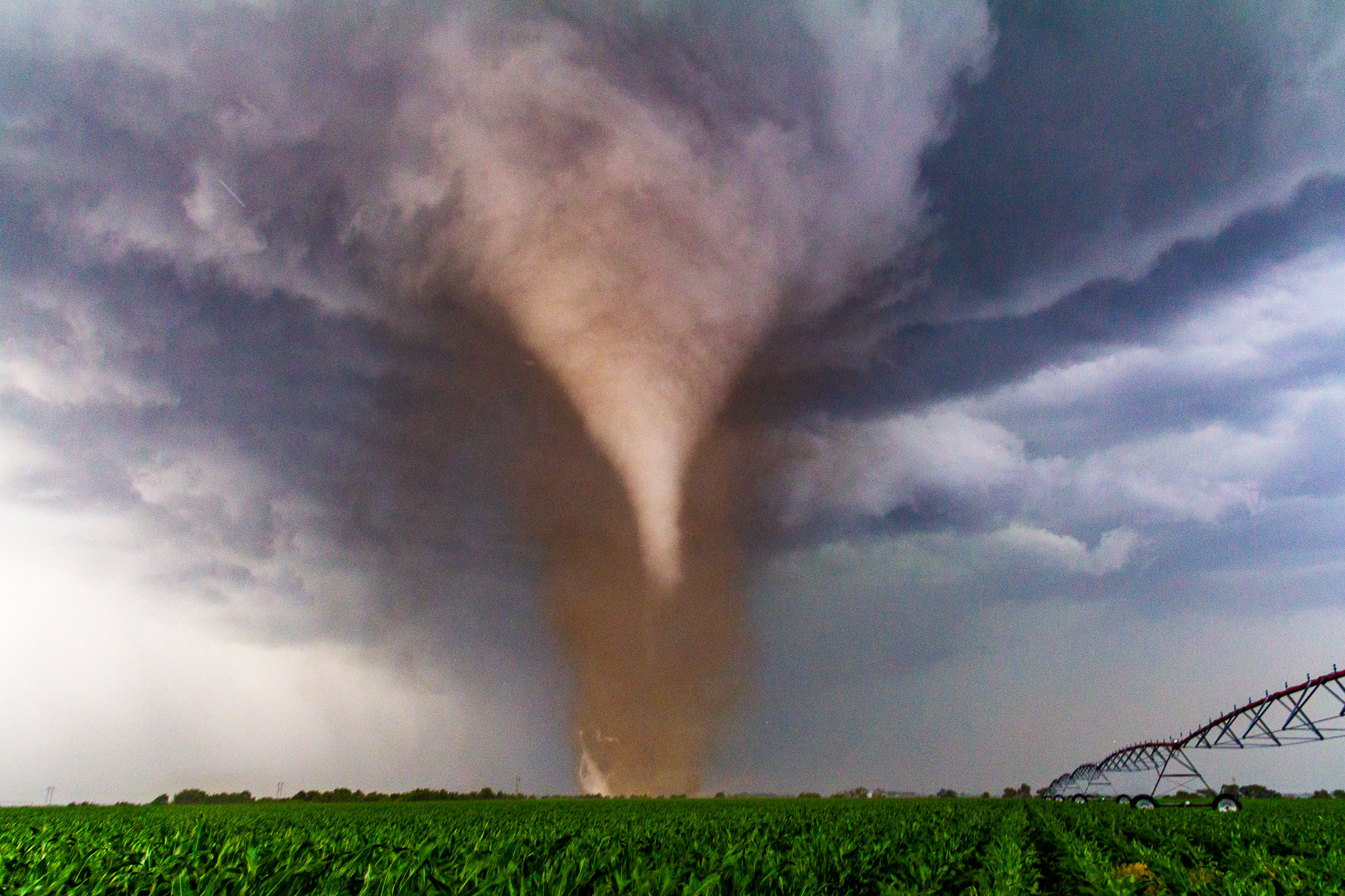
Shortly after that, the main Bradshaw Nebraska tornado formed and dropped to our south. We were in a perfect position to let it mature and come towards us. It ended up passing just 700 yards to our west before going north into the field next to us providing us an amazing white sunlit cone. I had just gotten my new camera the night before and I was taking some of my best photos the first full day I owned it!
Following the Tornado
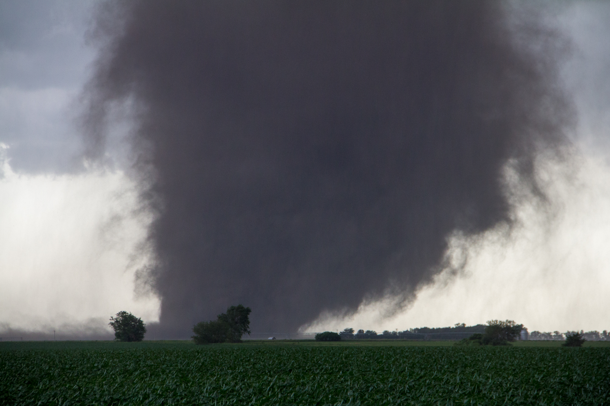
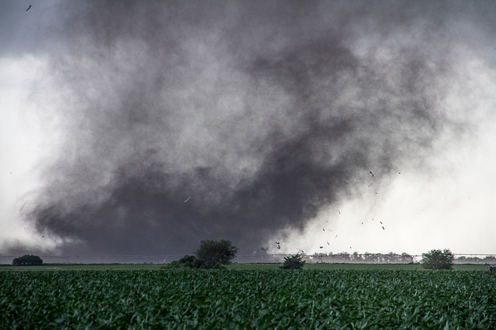
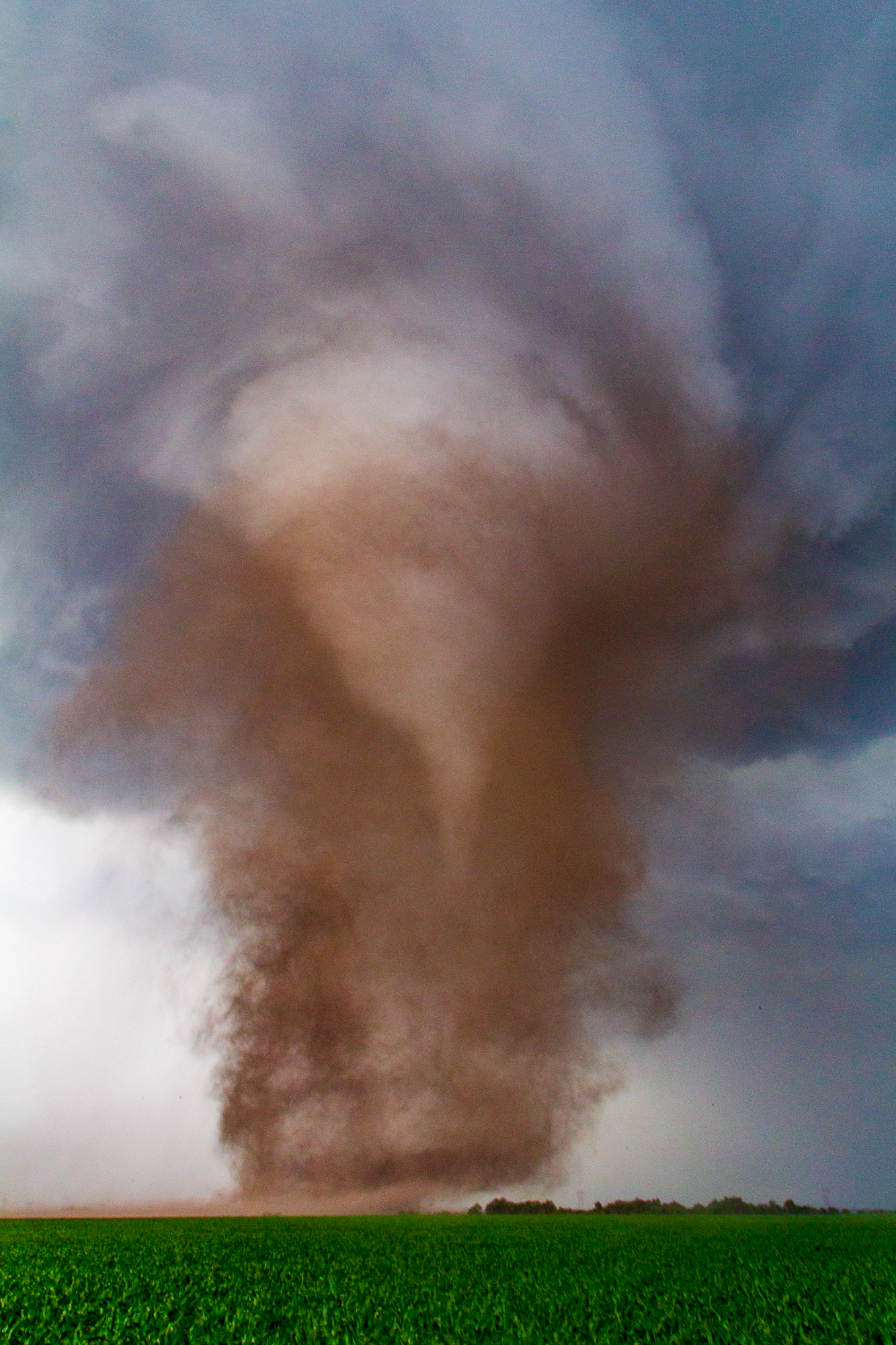
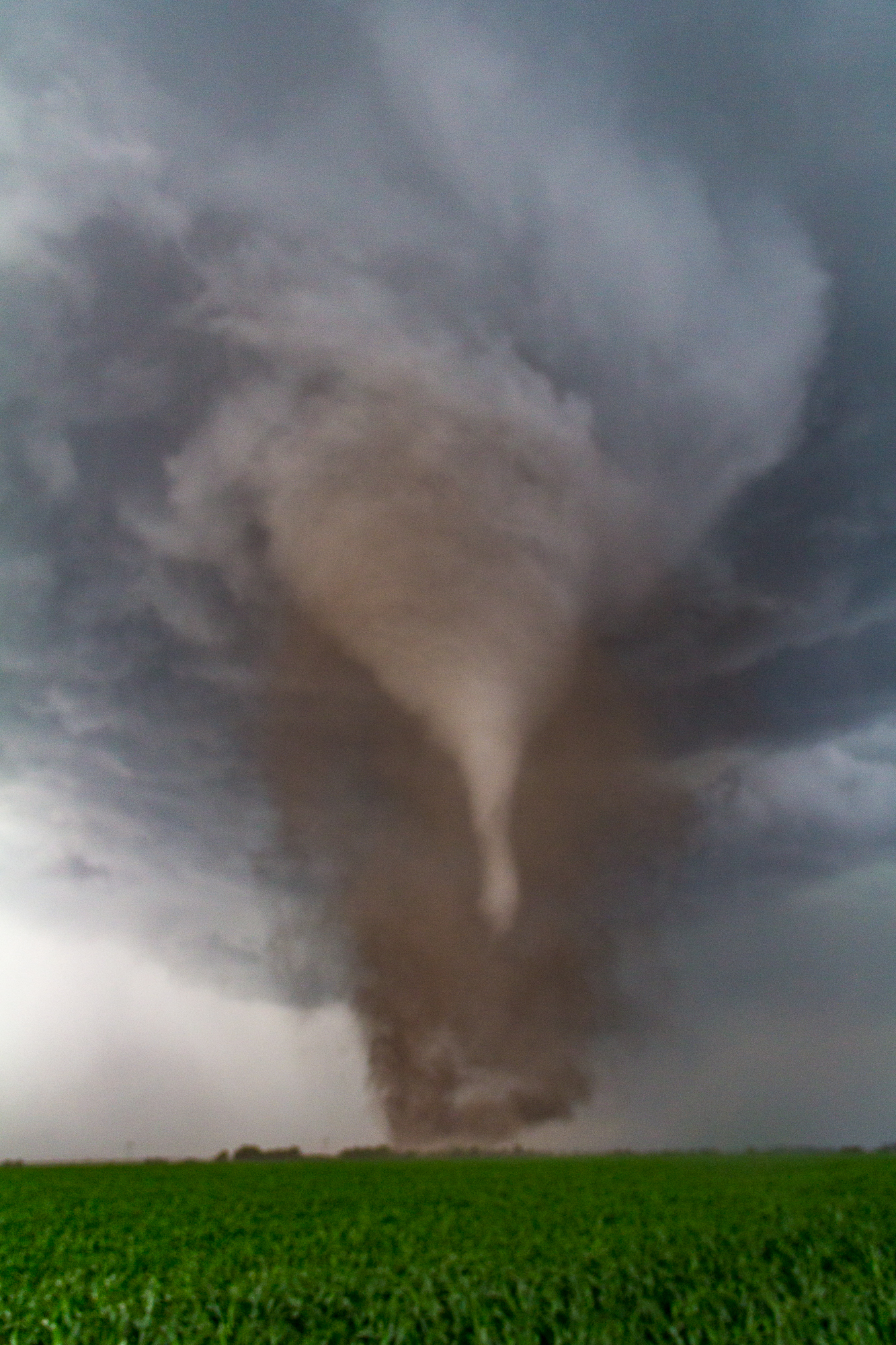
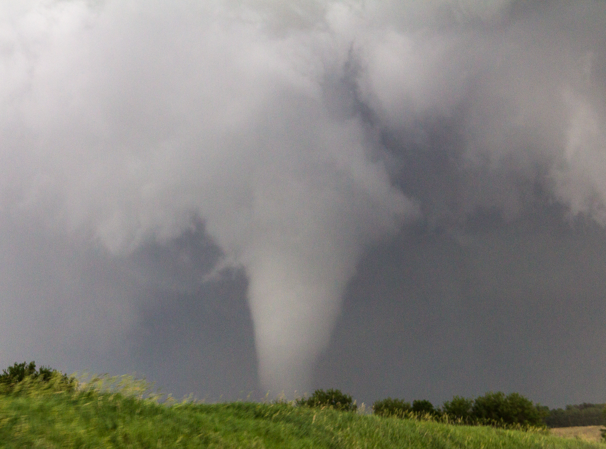
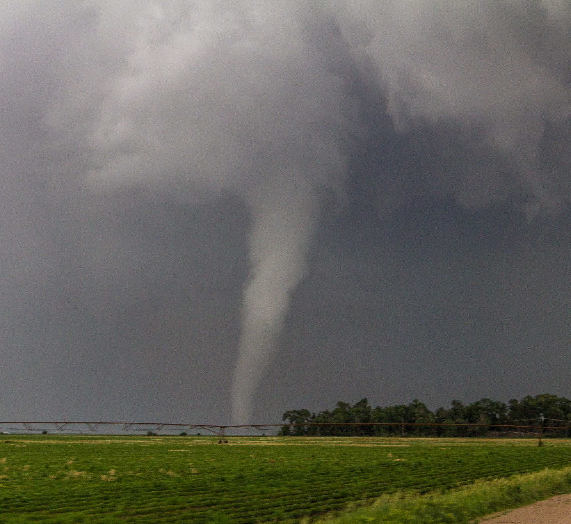
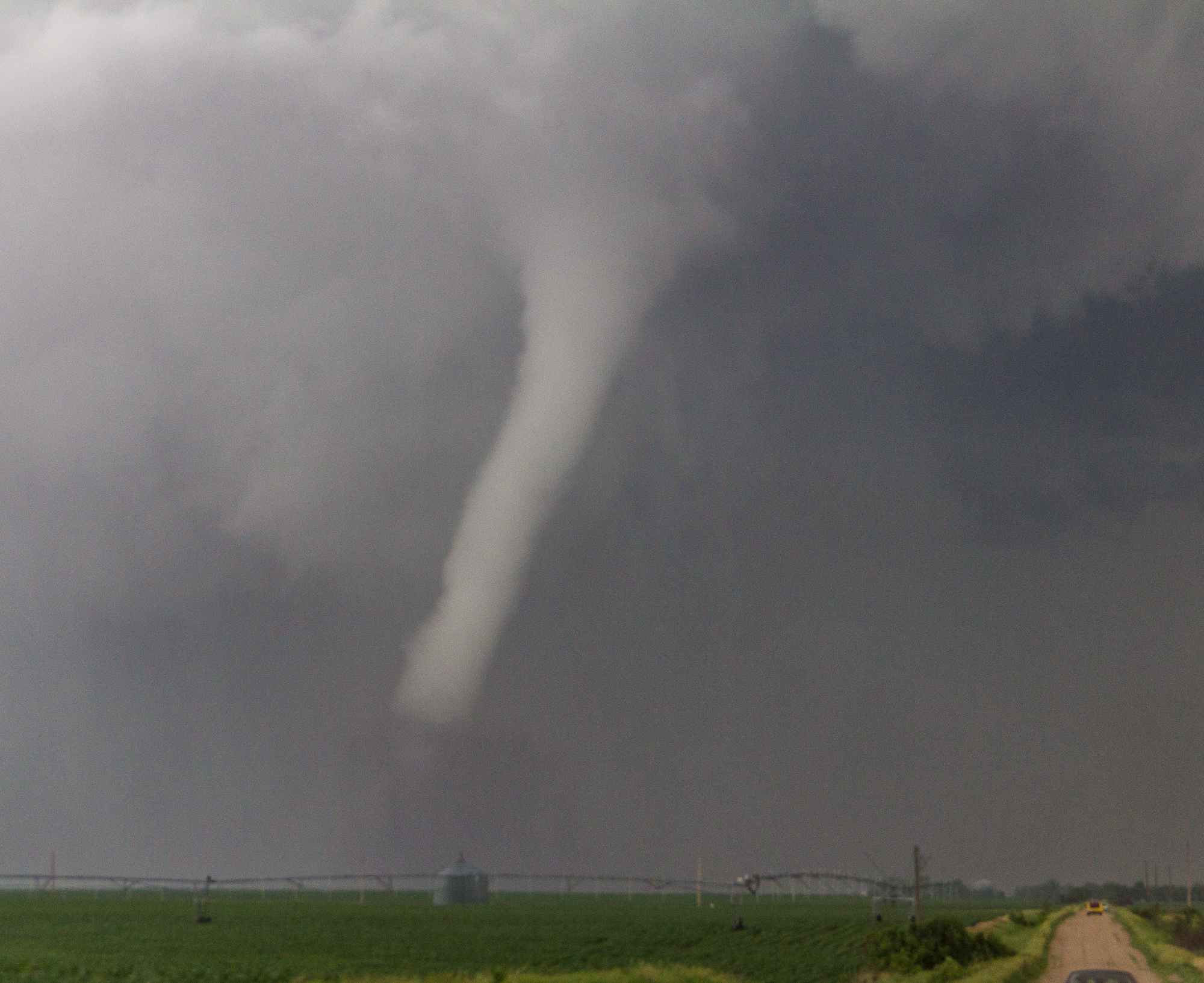
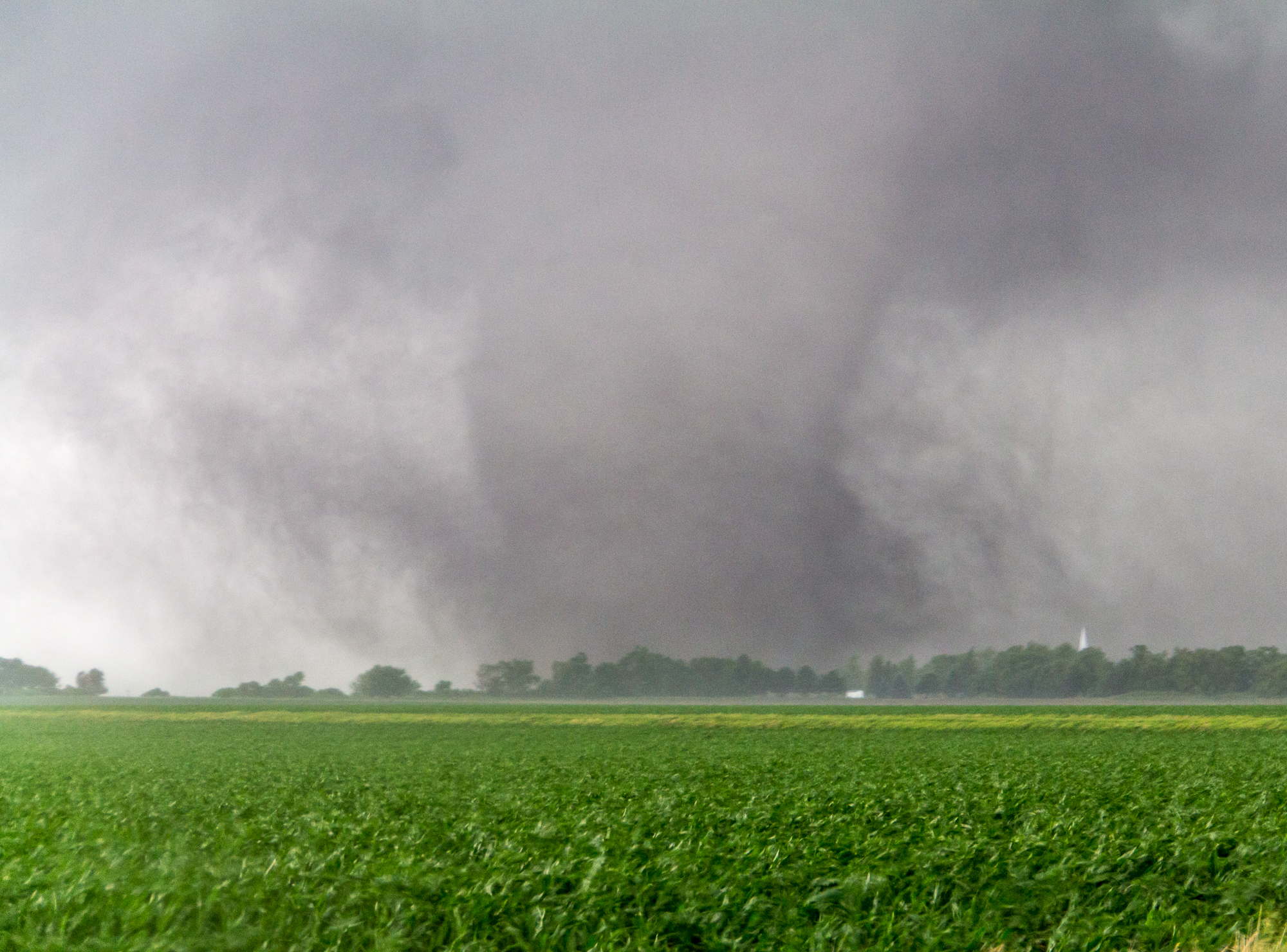
We stair stepped on the great gridded gravel roads for quite a few miles, staying east of the damage path and keeping up with the tornado. It was on the ground for probably 15-20 minutes before dissipating with an incredible rope out.
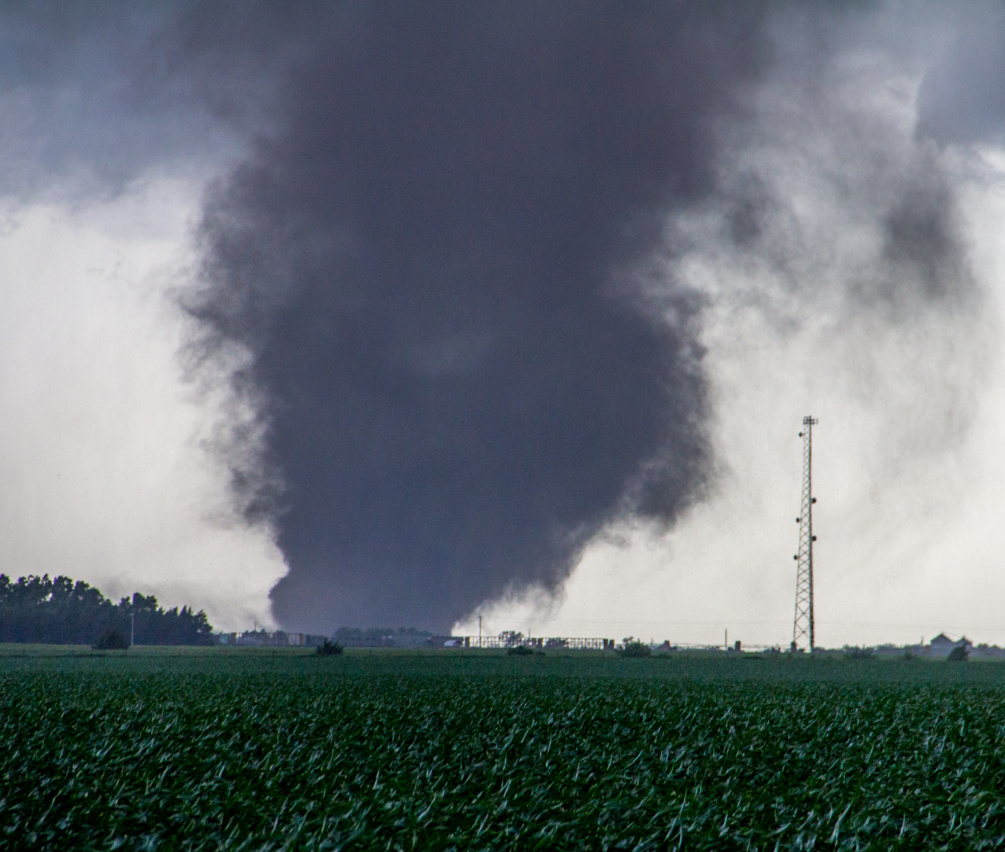
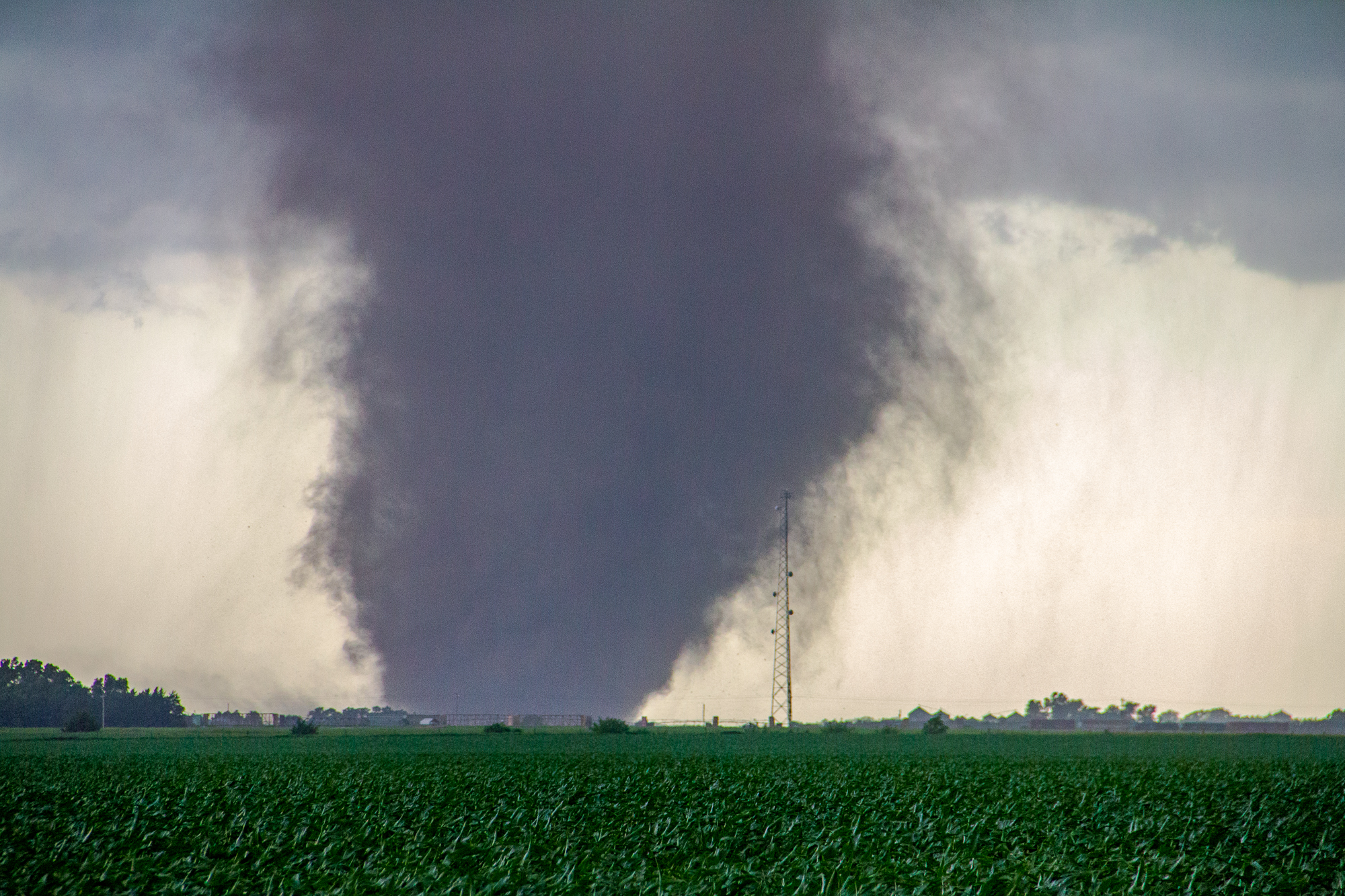
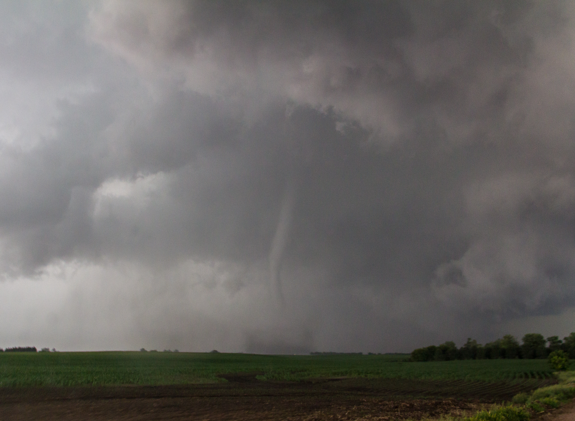
Osceola Tornado
Eventually the third tornado formed, and became a fat stovepipe. This was the Osceola Nebraska Tornado. Our view was not the best, however, we were able to get a decently close view as it crossed the road about a mile north of us.
Eventually getting across the river near Columbus, NE became an issue. We were running out of roads. The tornado had since roped out, so we kind of stood down. We rolled into Columbus and decided to meet Scott Bennett, Jesse Risley, and Steve Polley for steak dinners.
The drive back to OKC was long, and we got back around 4 am. The adrenaline kept running most of the night, keeping me and JR wide awake till our arrival home.
Links
- National Weather Service write up of the June 20, 2011 event
- My video of the Bradshaw, Nebraska Tornado
- My video of the Osceola Nebraska Tornado
- JR Hehnly’s Bradshaw Nebraska Tornado recap
- Jeff Duda’s Chase Recap from June 20, 2011
- James Hammett’s Recap of the Bradshaw Tornado
- Nick Nolte’s Recap fof the Stamford & Pleasanton Tornadoes
- Mike Hollingshead Recap of June 20, 2011
- Skip Talbot’s Recap


