Storm Chase Details
Miles Logged: 1468
States Chased: IL, MO, AR
Milestones: First high risk chase
Severe Risks: SPC Outlooks
Severe Reports: Storm Reports
Pre-departure
The SPC was calling for a high end weather event on Feb 5, starting as far out as the Day 5 outlook. By the time the 4th rolled around, the SPC had placed most of the Lower Mississippi River area under a day 2 moderate risk.
I made the call on Monday evening to head out early on Tuesday. The plan was to try the north end of the moderate risk in Southern Indiana. The outlook had wording with a strong emphasis on Strong, Long-tracked Tornadoes.
Heading out Tuesday Morning
The chase on Tuesday started at 7 am Eastern when Chad Rust (rip) and I loaded up my truck and headed out from Lansing. We hopped onto I-69 and took it down towards Indianapolis. The original idea was to get south to Indy by noon and make a decision on which direction to head. As it turns out, we were in Indy with a full tank of gas by 11am.
Morning SPC Outlook
The SPC issued a HIGH risk in Arkansas in the morning soon after we were underway. By 11 am we were passing through Indianapolis and southwest on I-70. With the late morning addition of parts of Southern Illinois and Missouri to the high risk, that became the target.
Charleston Missouri
We made one quick stop in Mount Vernon for gas and food before heading to Charleston, Missouri. We stopped in Charleston and enjoyed the warm, sunny weather. I didn’t want to get too much further away, as I had plans to go home that night.
After hanging out in Charleston for approximately an hour, a cell appeared on radar in Arkansas. It was heading towards Poplar Bluff, MO which was about an hour west of us. We took off after the cell, but didn’t end up catching it as it went into the Mark Twain National Forest.
As the sun was setting, I decided the only way we’d see a tornado was to get into Arkansas and see if we could see the storm coming from near Atkins. We stopped in Pocahontas, AR and topped off the gas tank, and headed west on US-62, then US-63 and US-412 up to about a mile east of Hardy, AR.
Big Trouble?
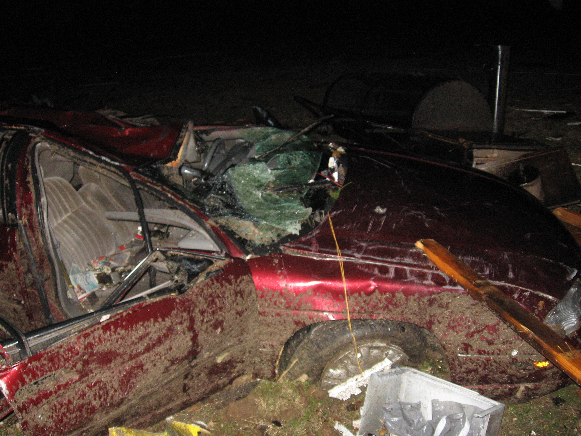
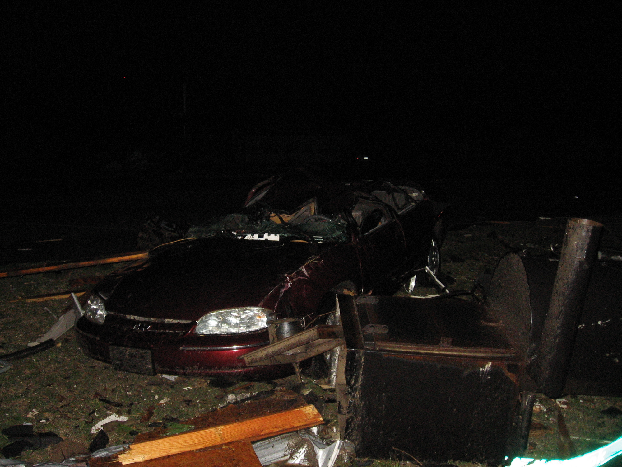
As we were unknowingly sitting in the path of the tornado, I did a phoner for local TV station KAIT 8 in Jonesboro. We had Little Rock radar up and noted that the rotation had significantly declined. Unfortunately we didn’t realize we were in a big radar hole.
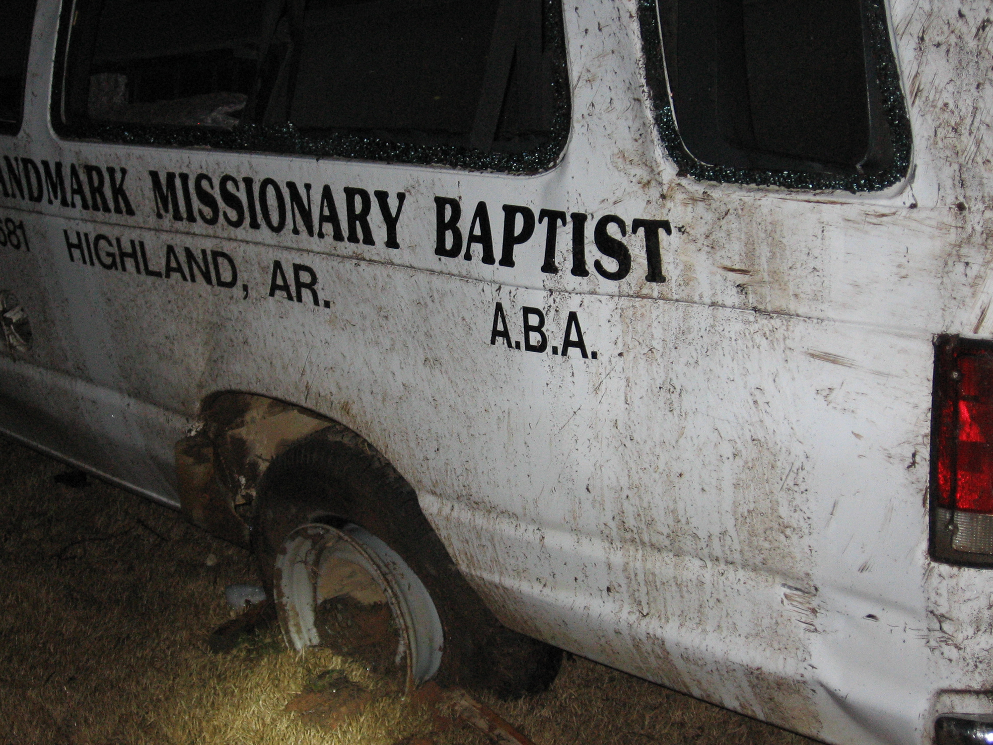
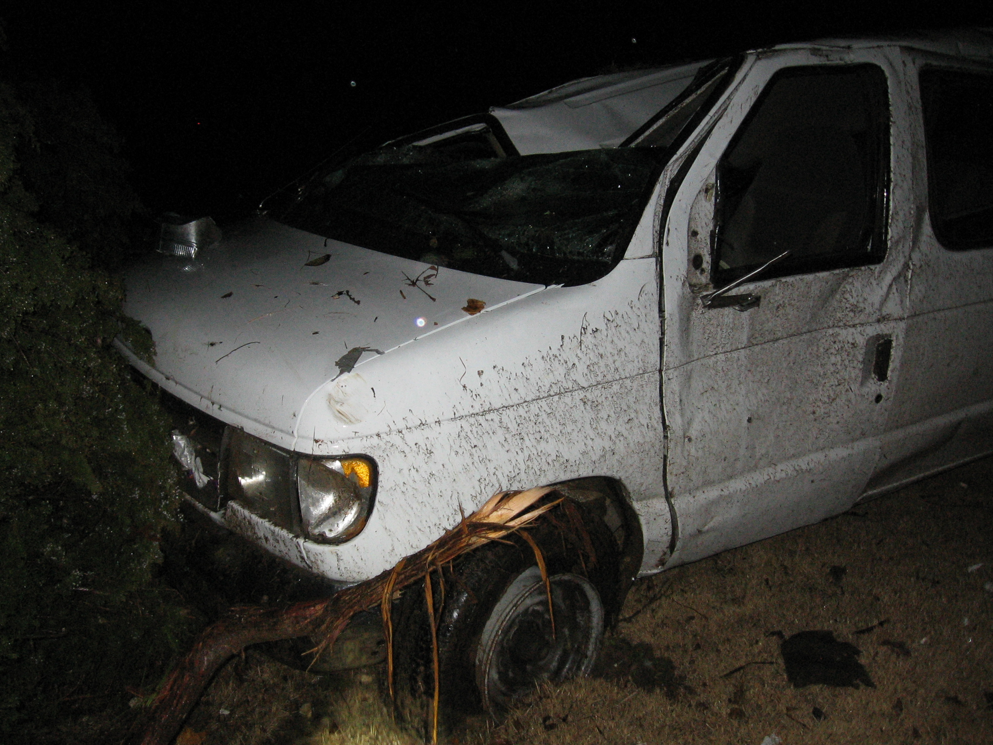
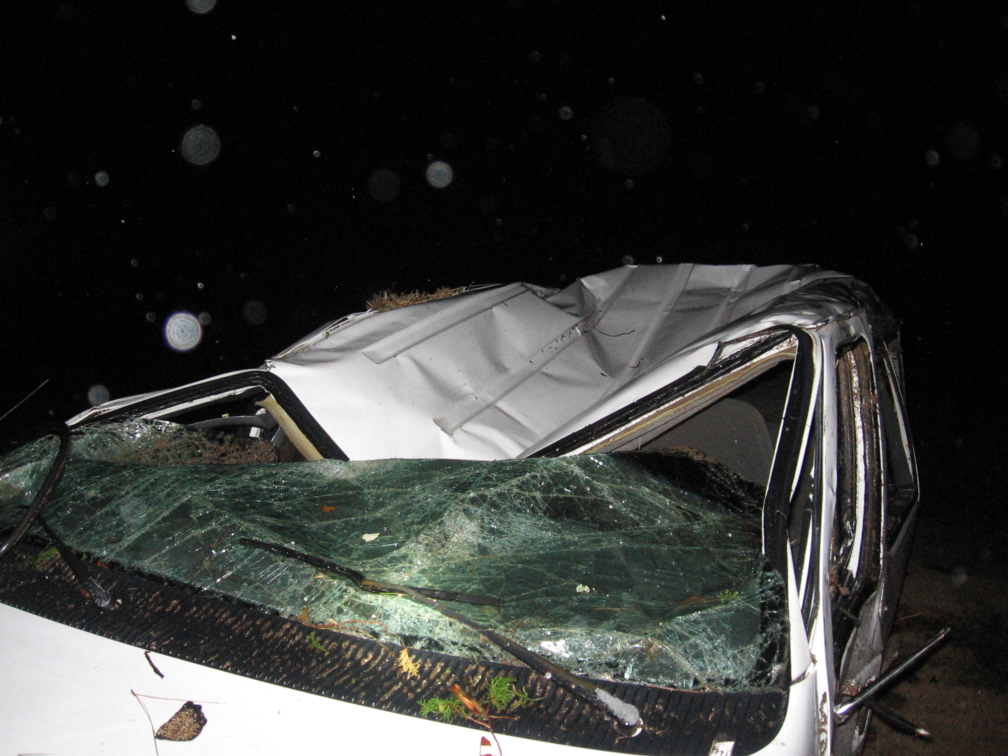
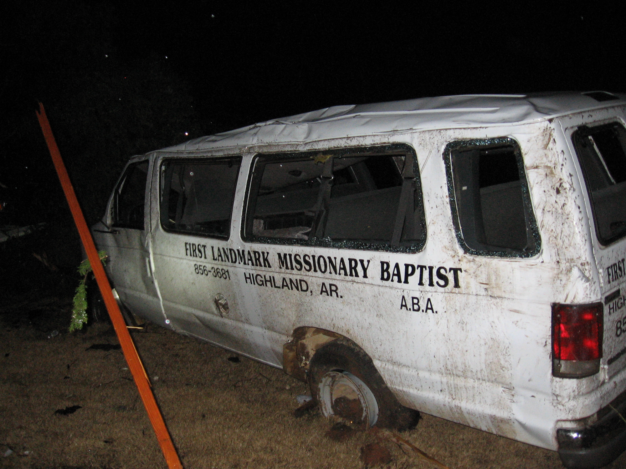
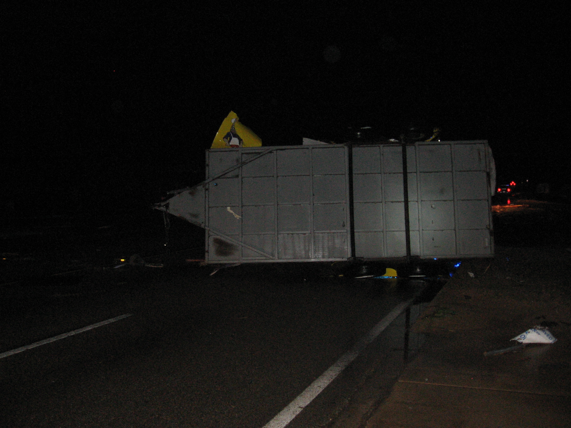
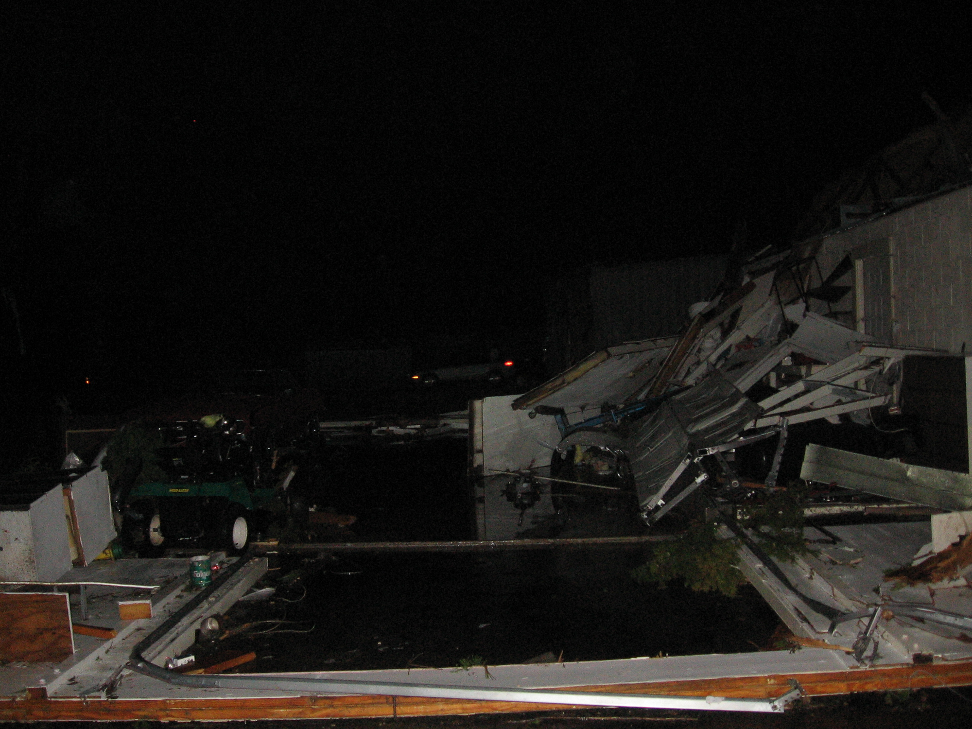
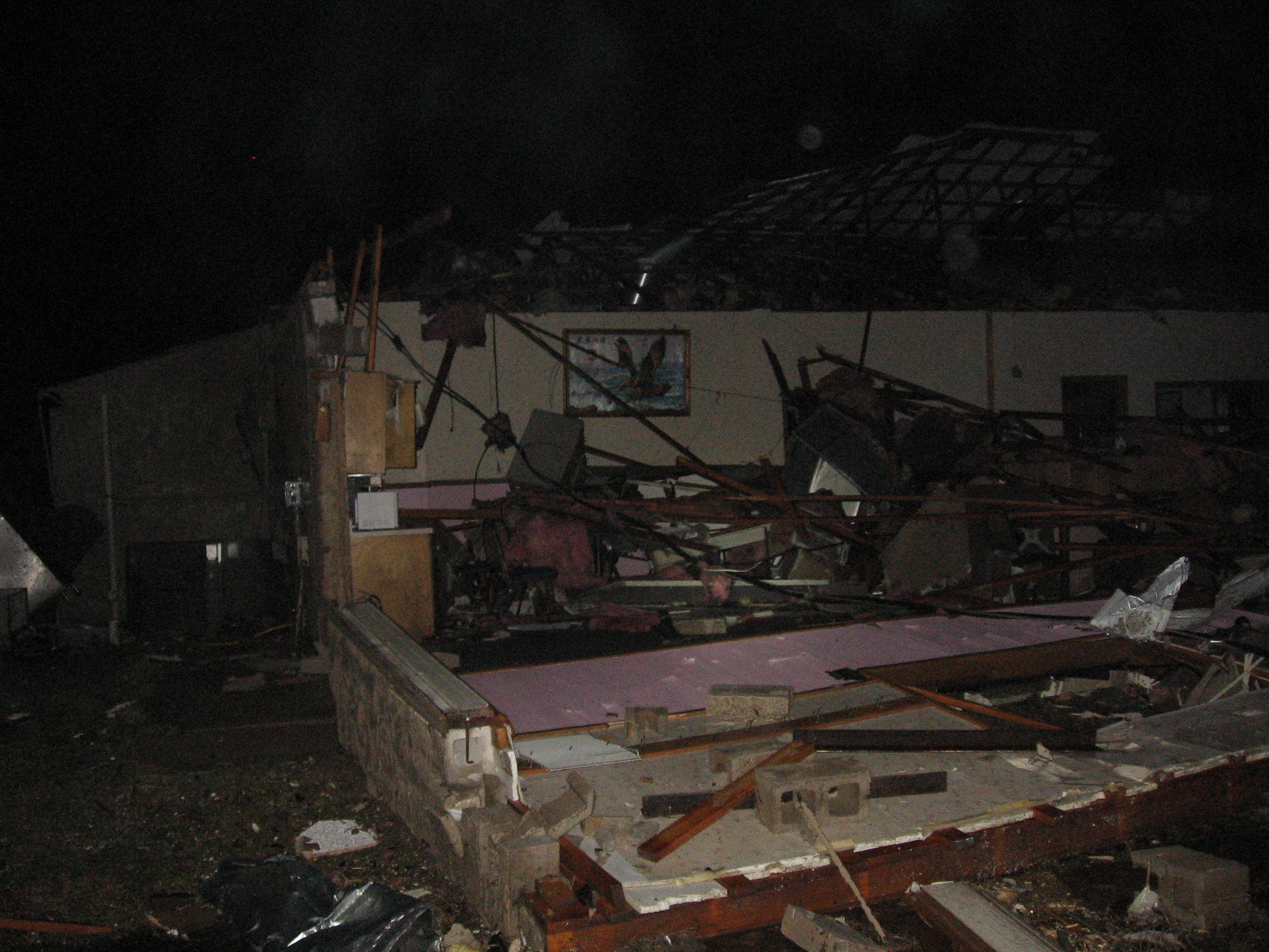
I got a call telling me to switch over to Memphis radar. Close call. The official track of the 122-mile long EF-4 tornado ended approximately a 1/2 mile from where I was sitting.
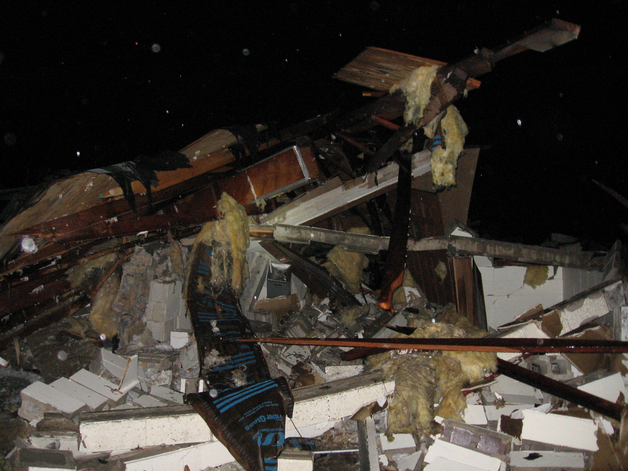
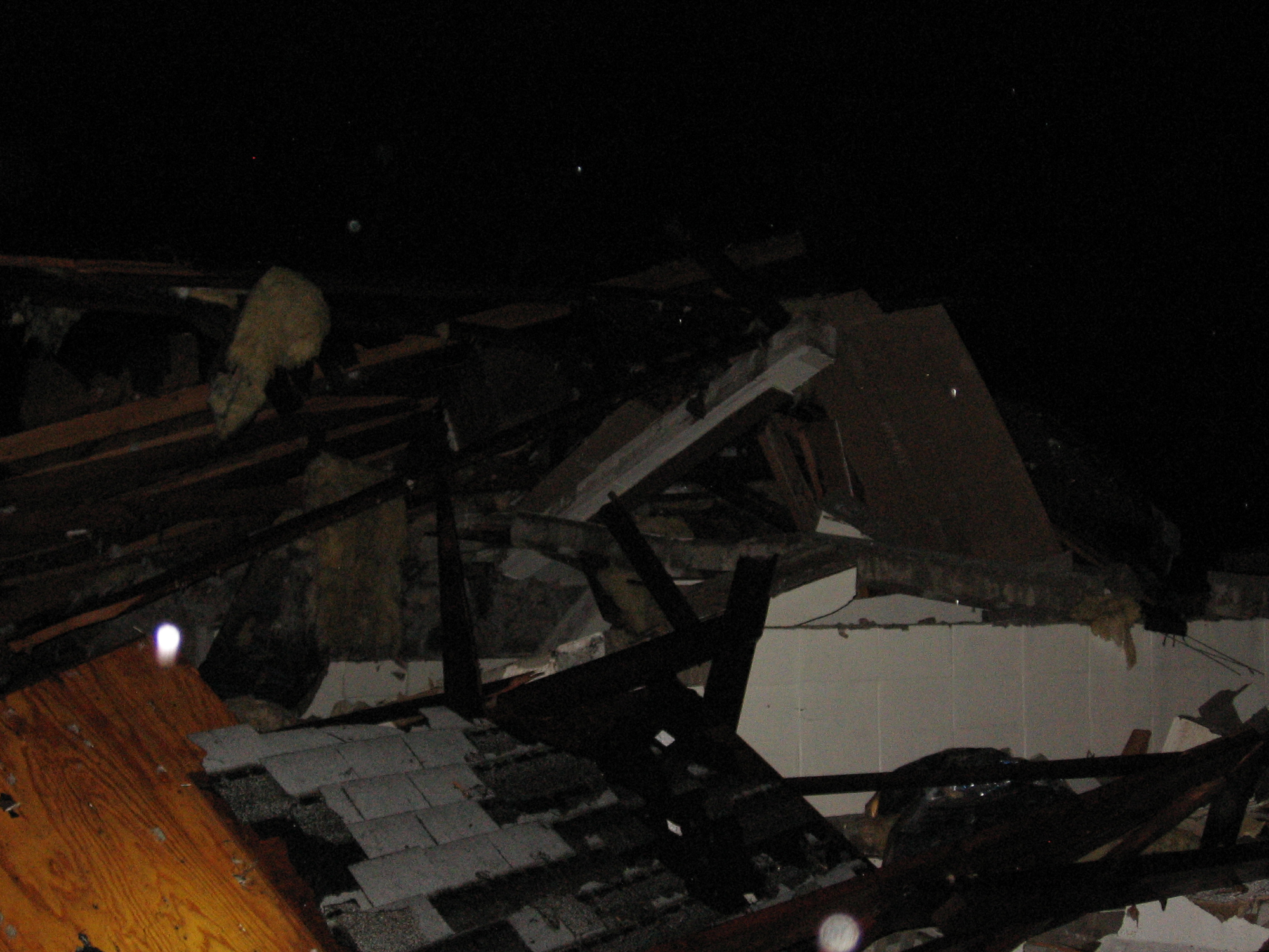
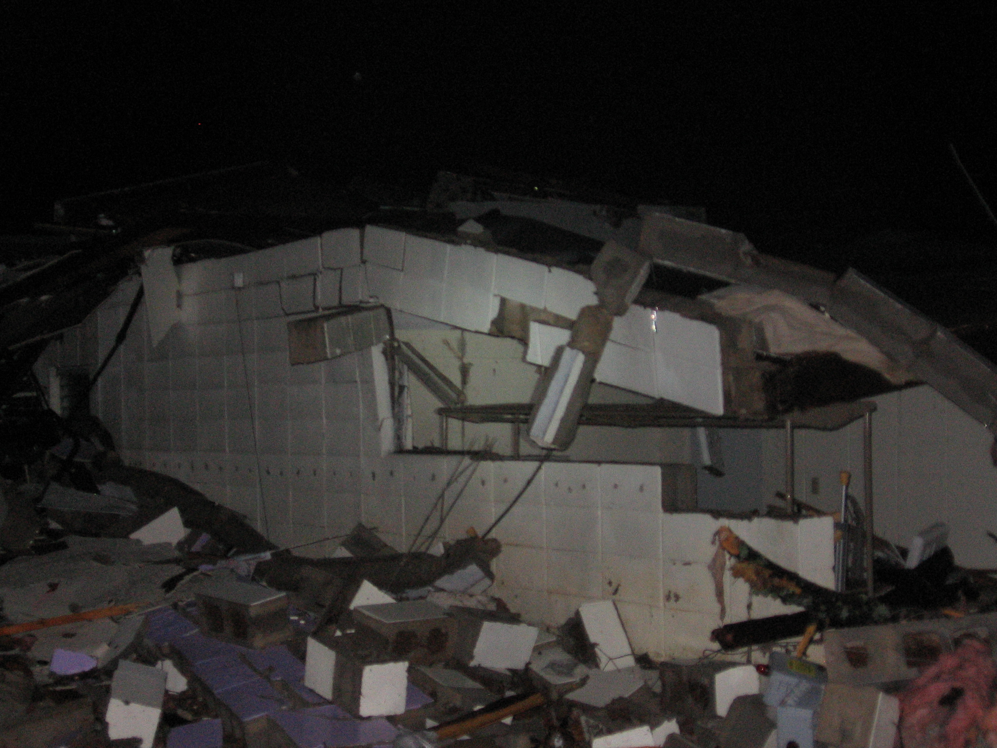
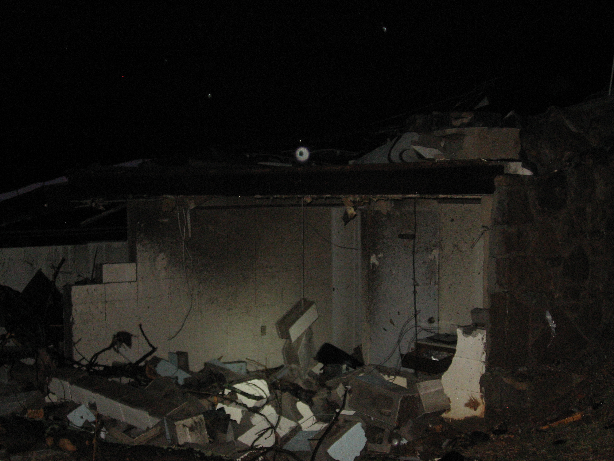
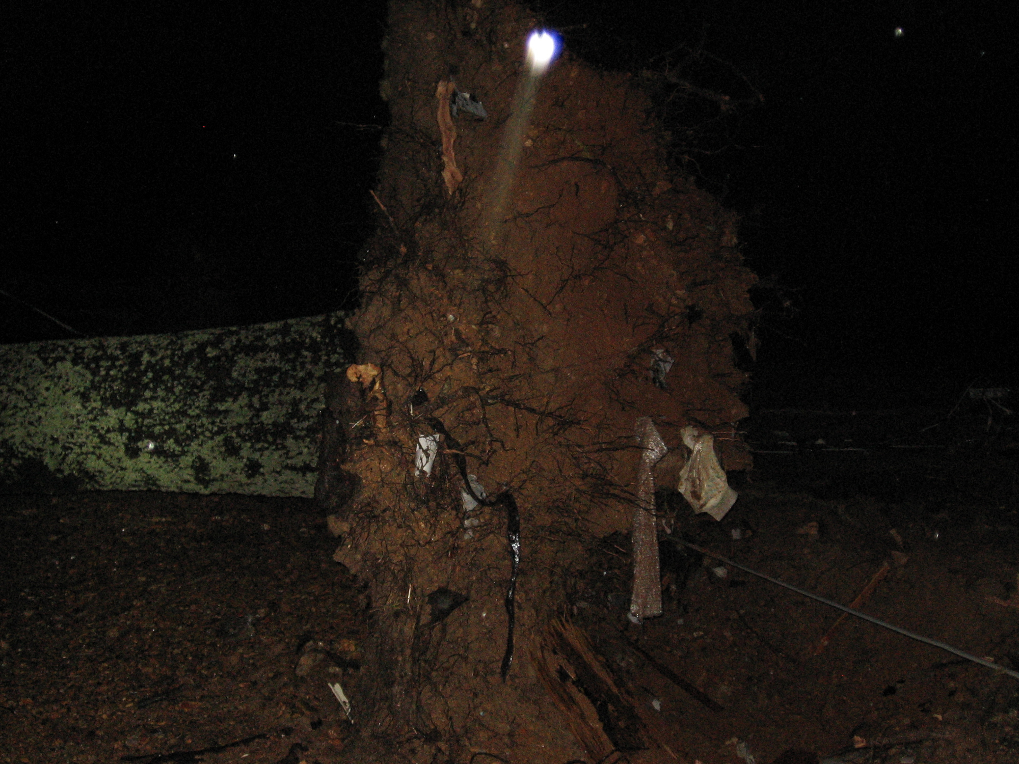
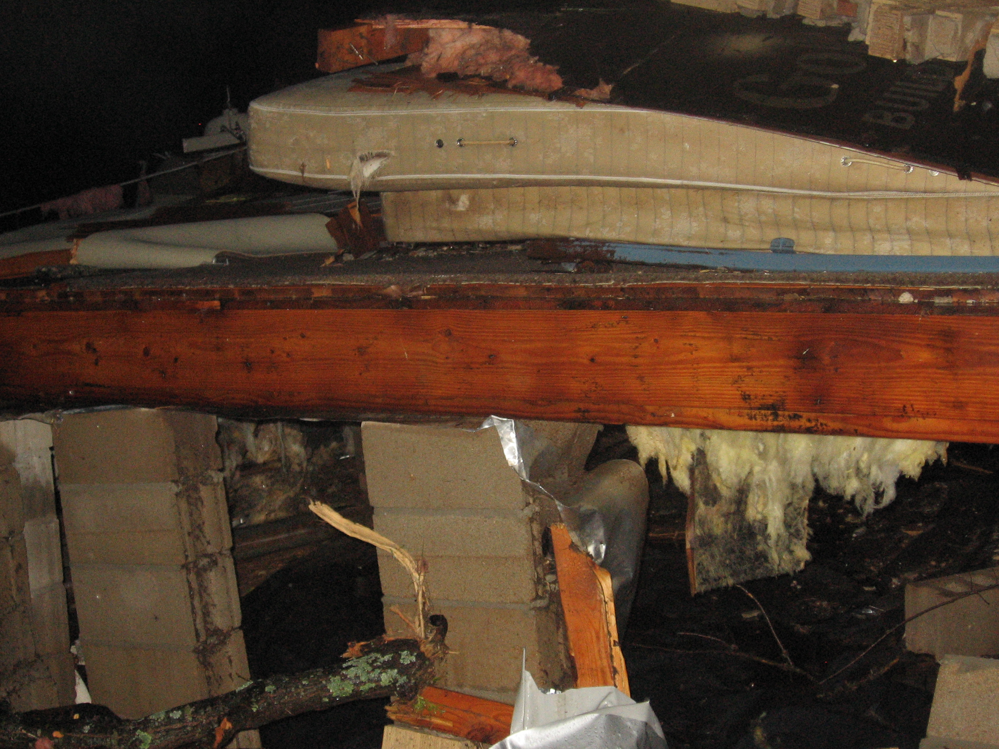
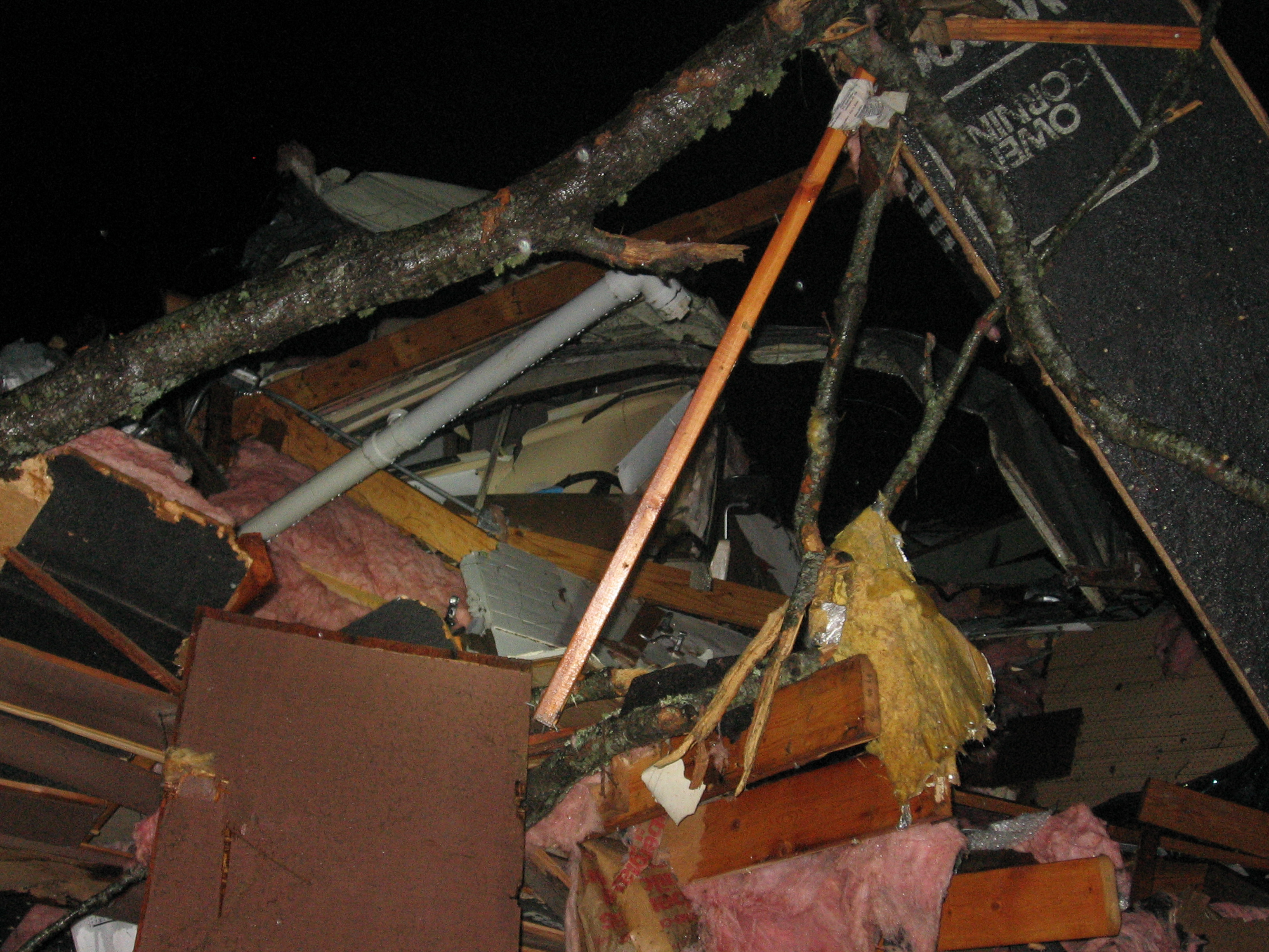
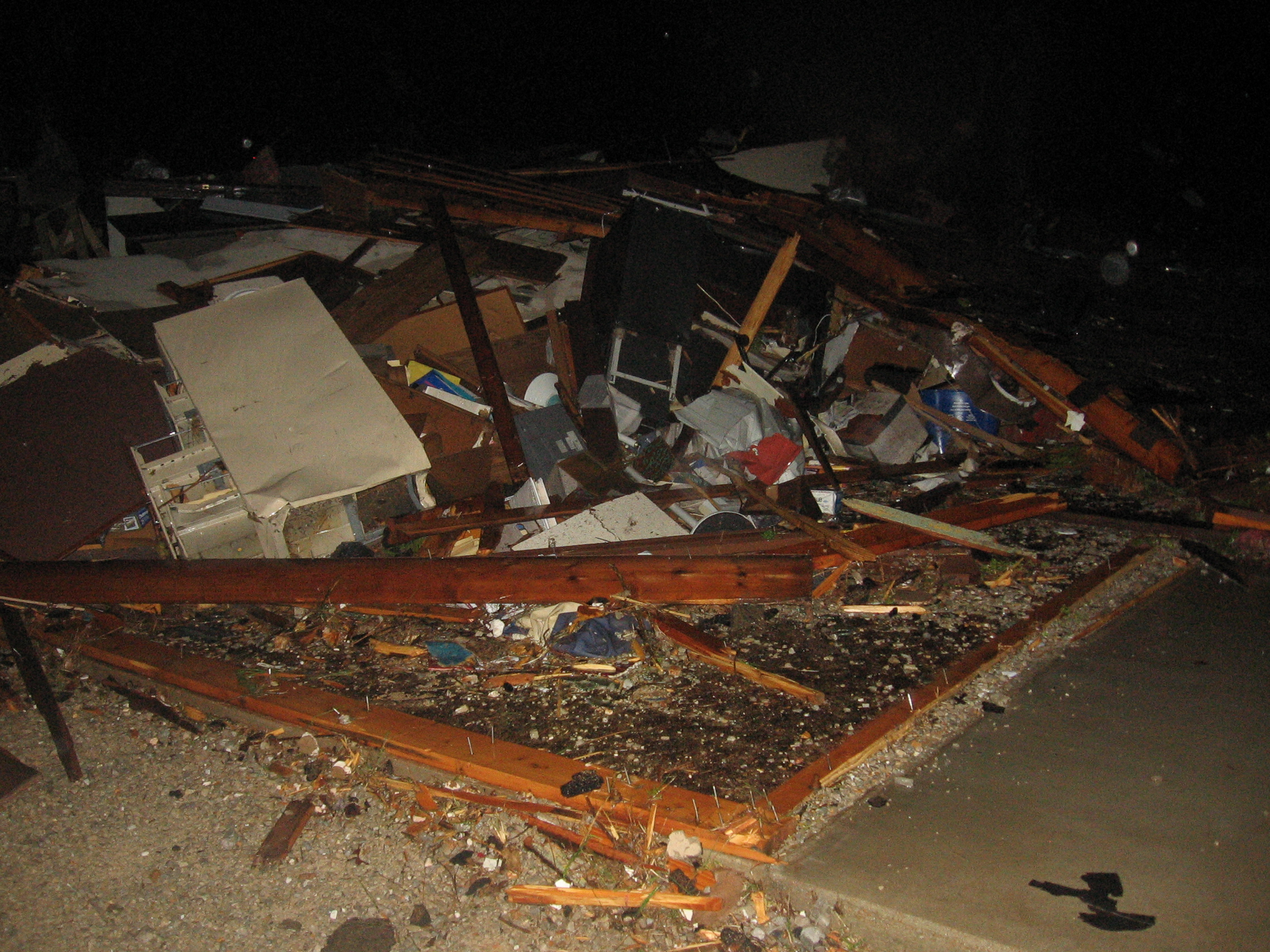
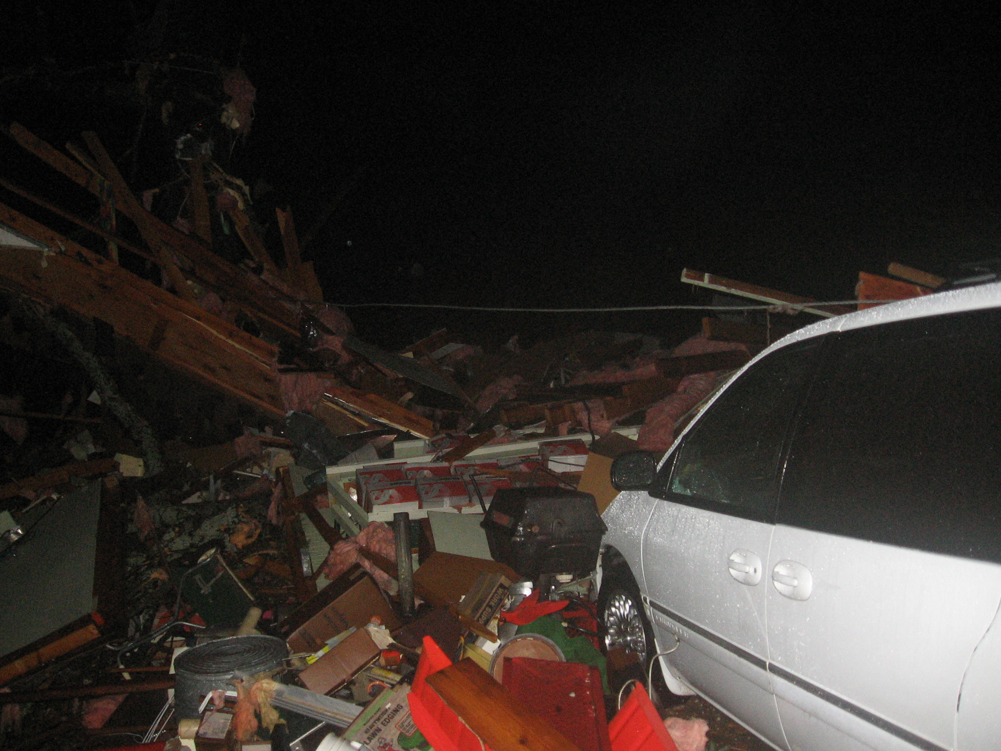
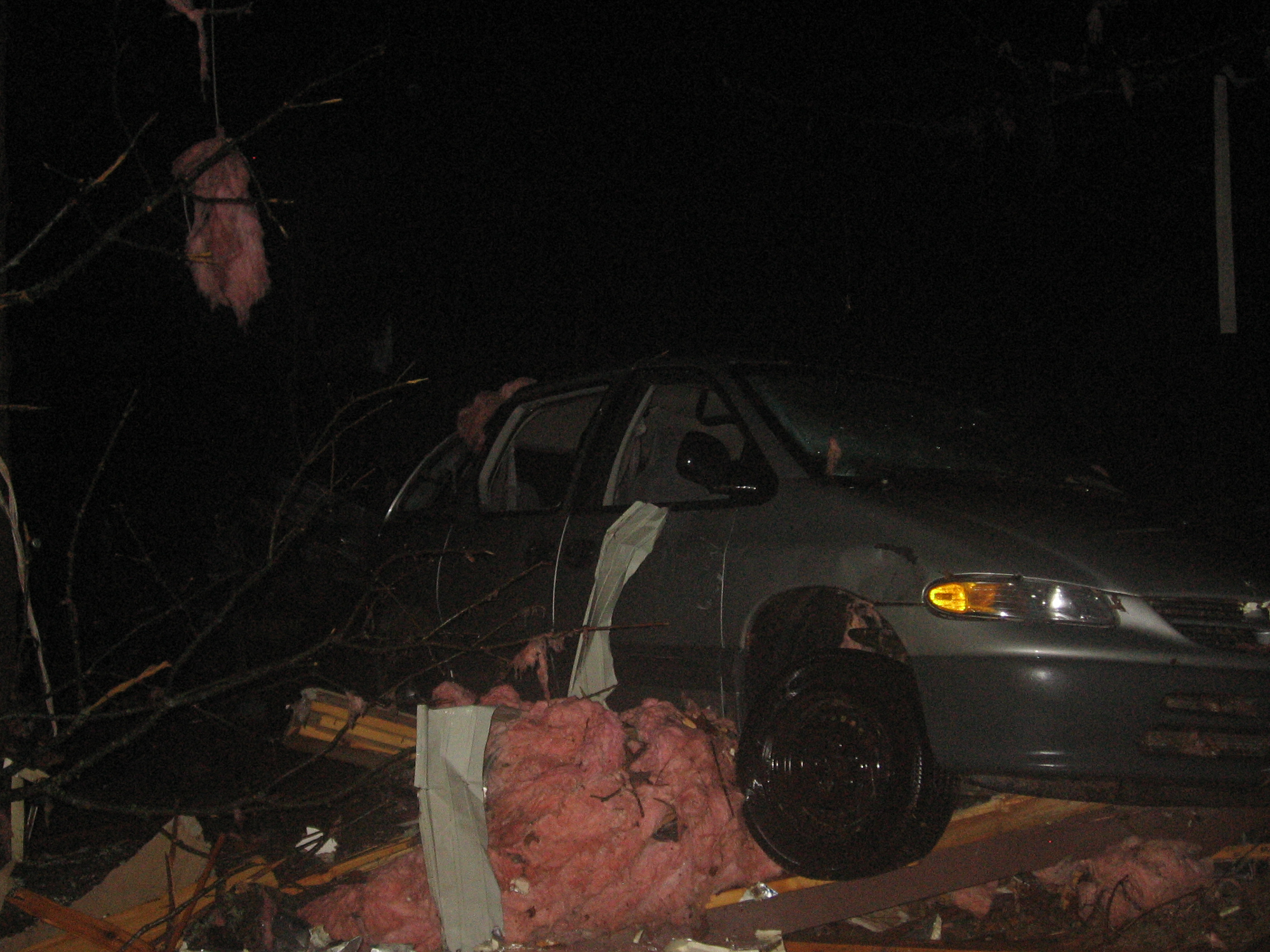
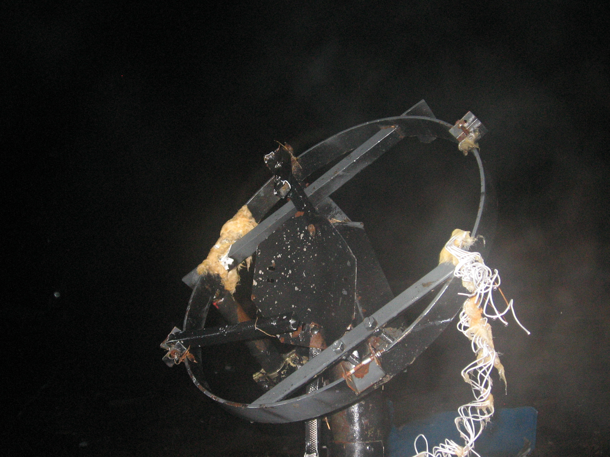
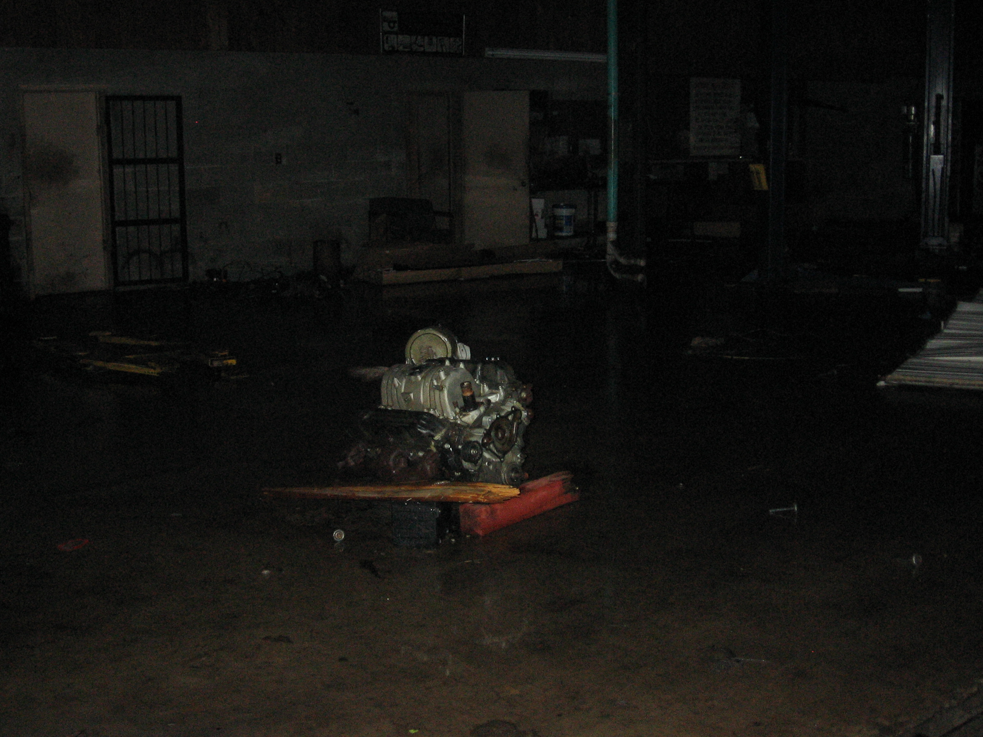
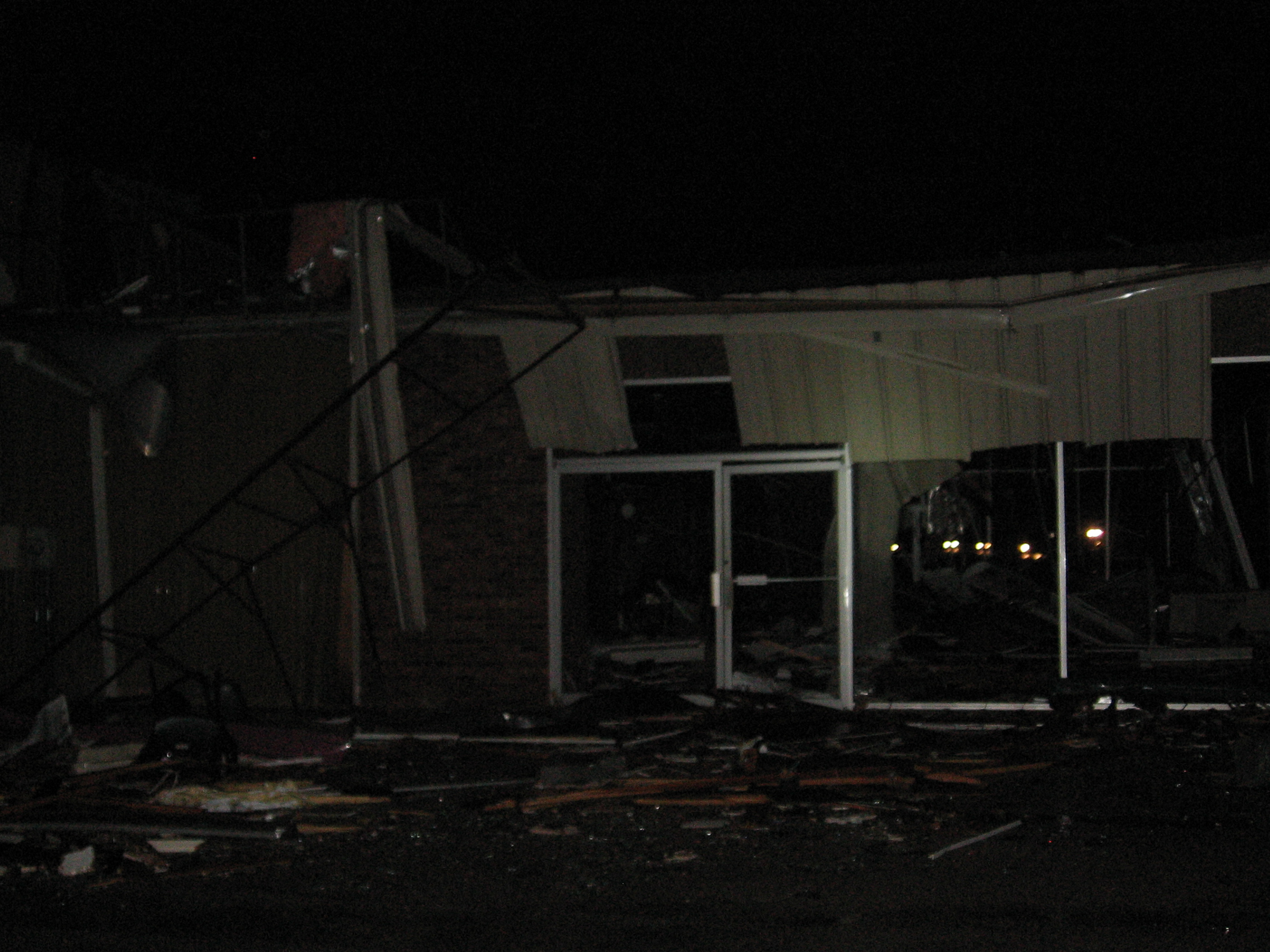
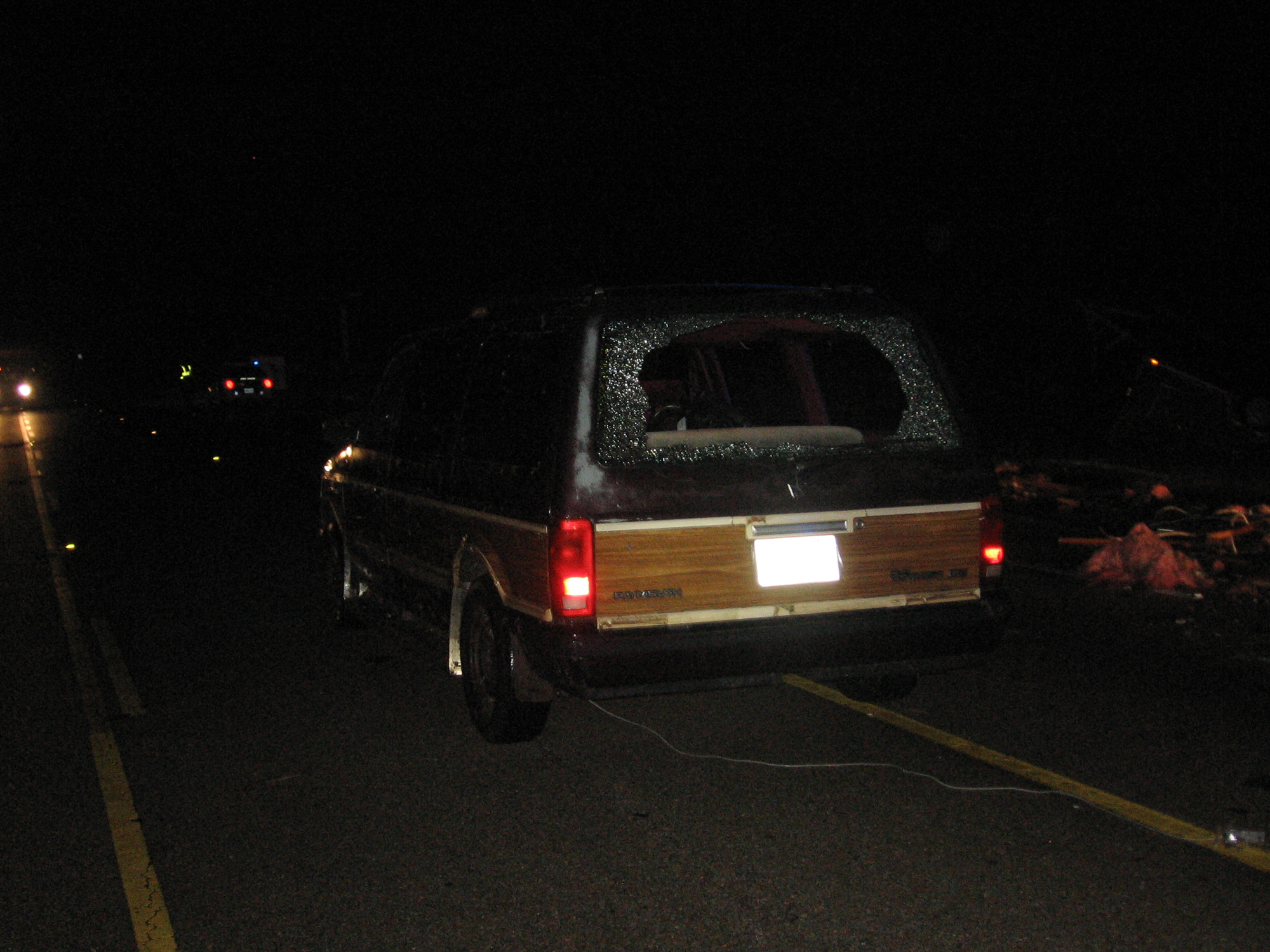
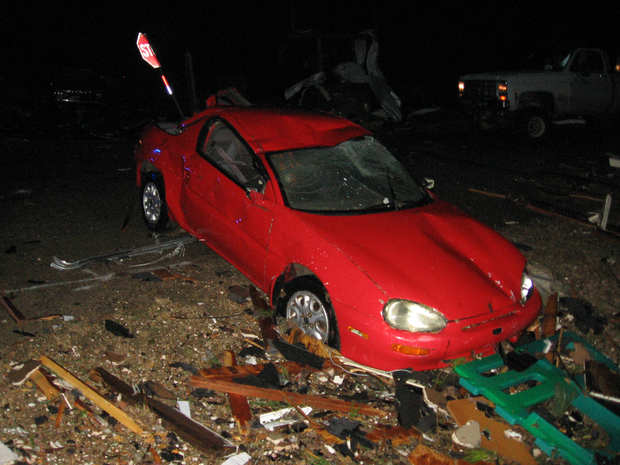
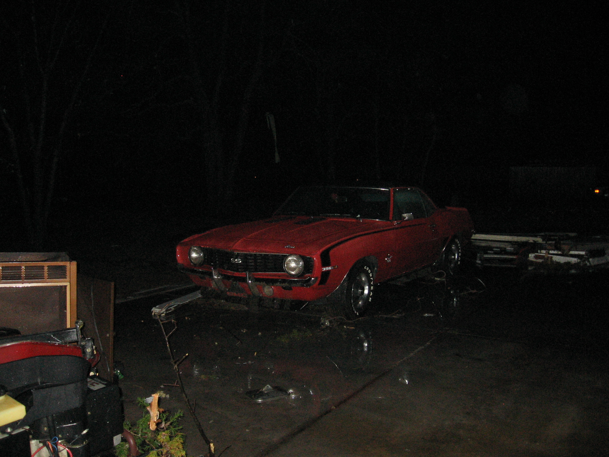
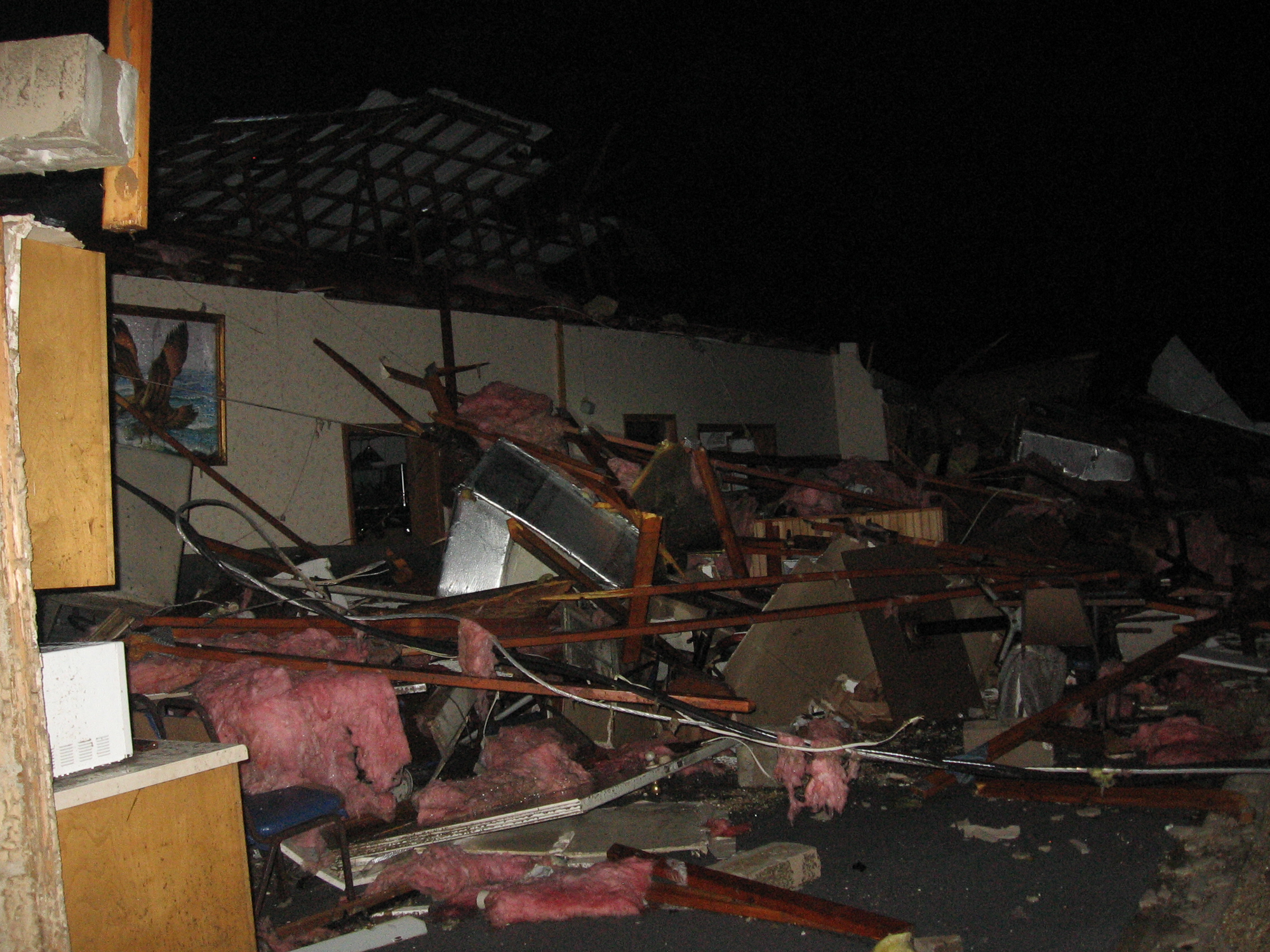
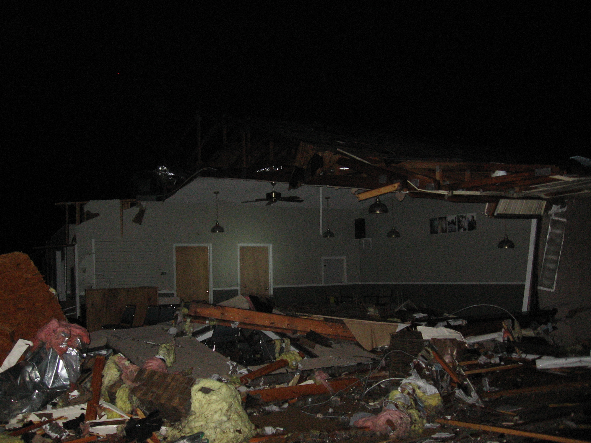
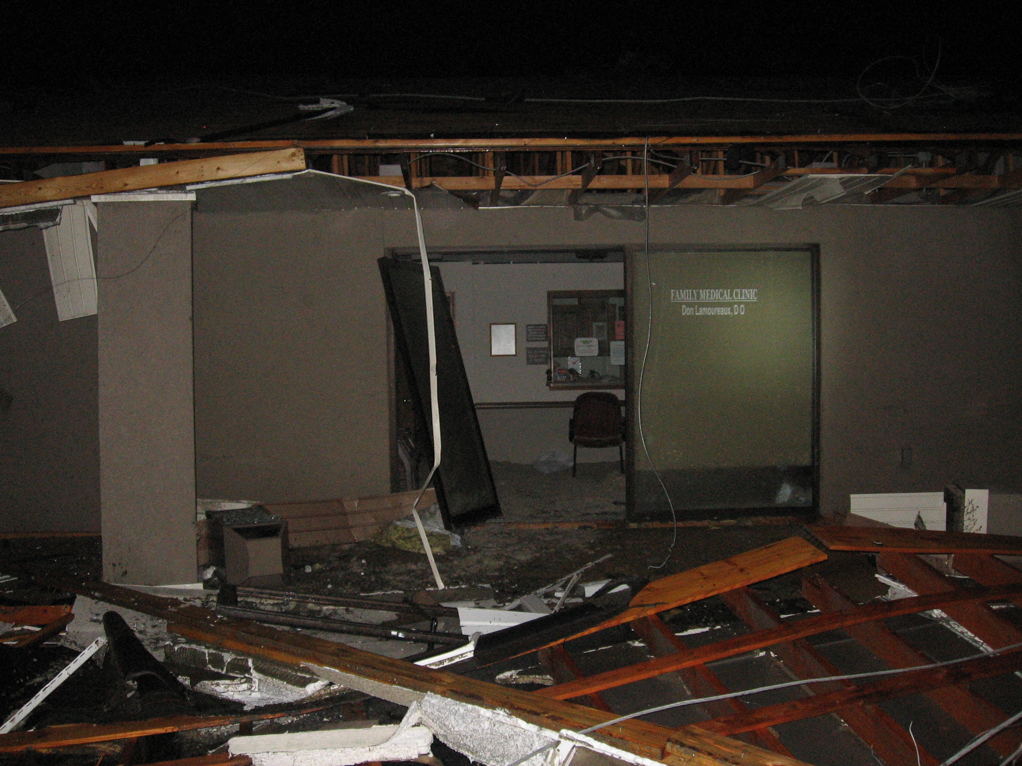
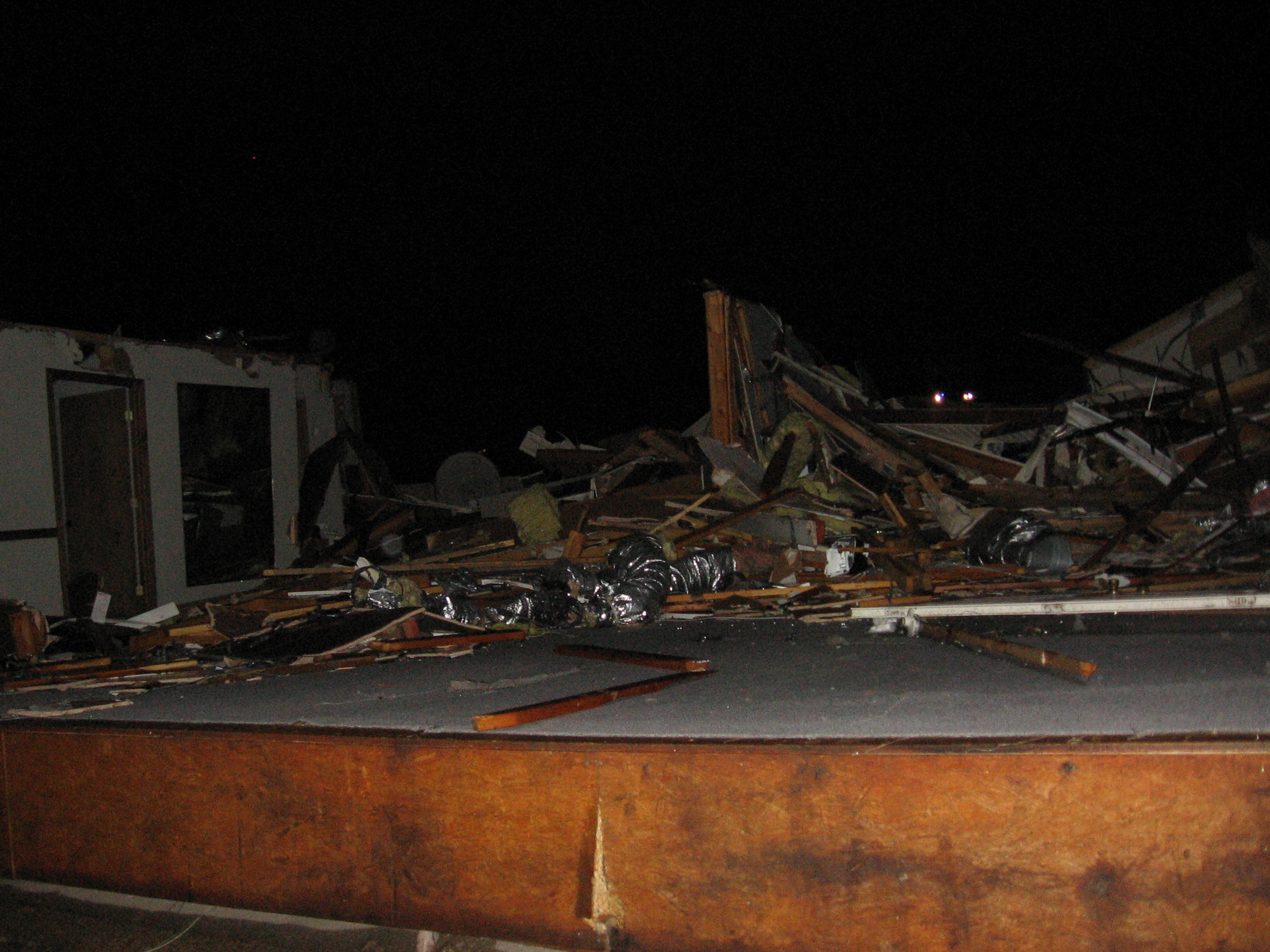
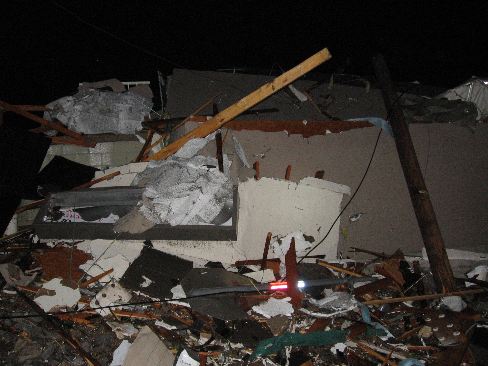
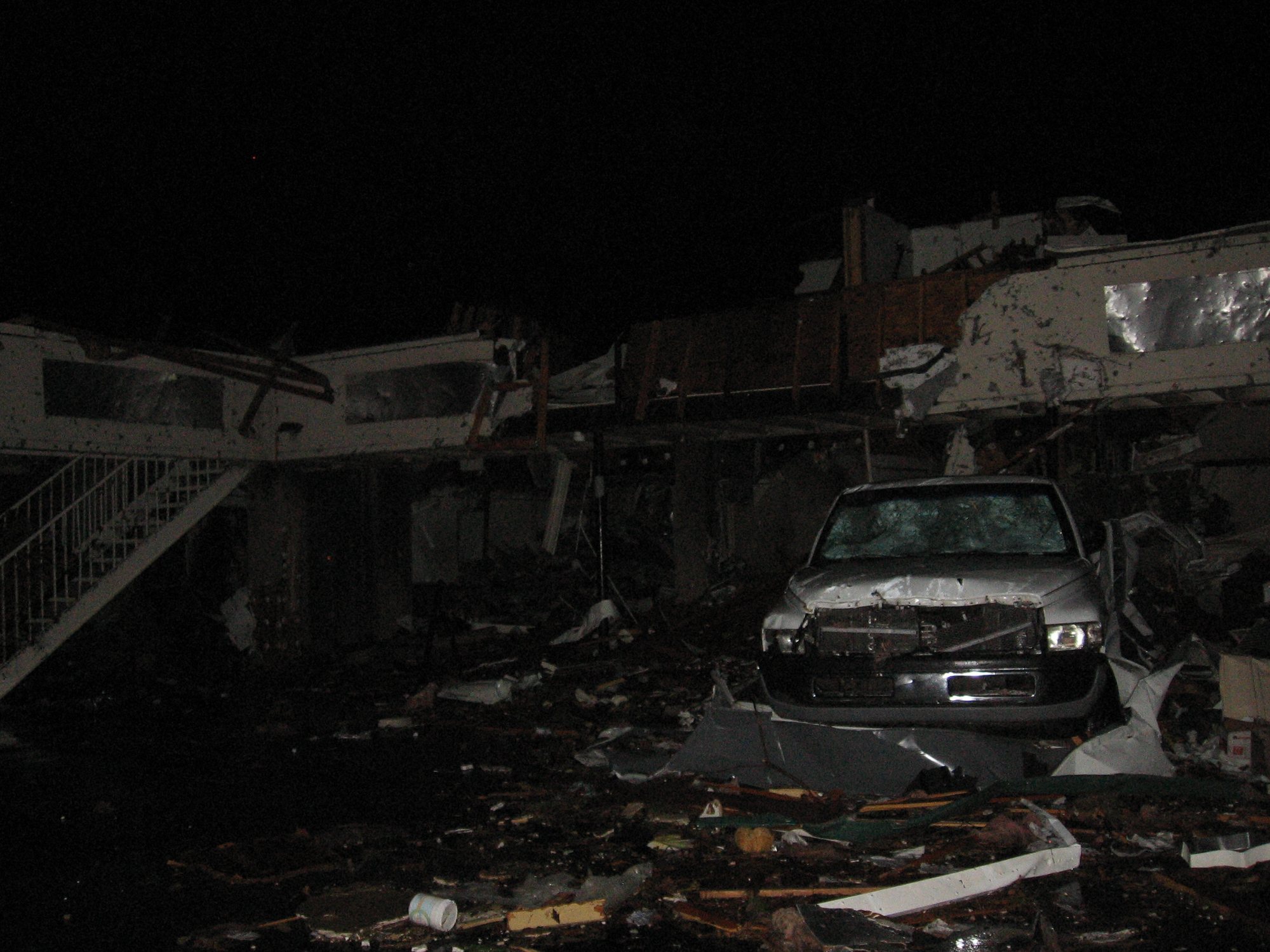
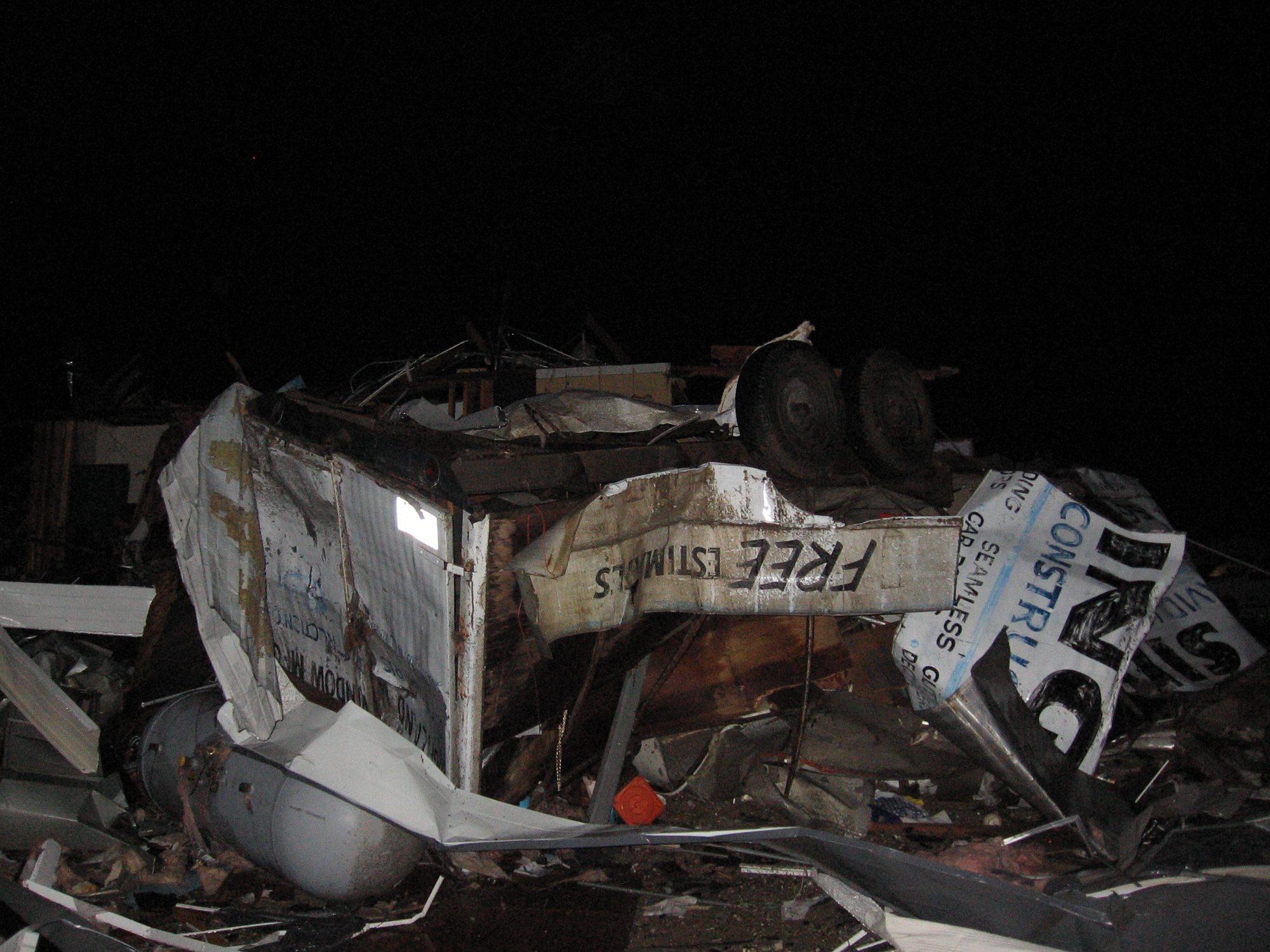
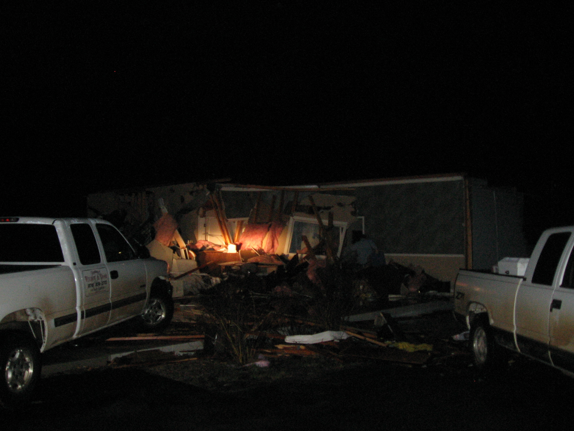
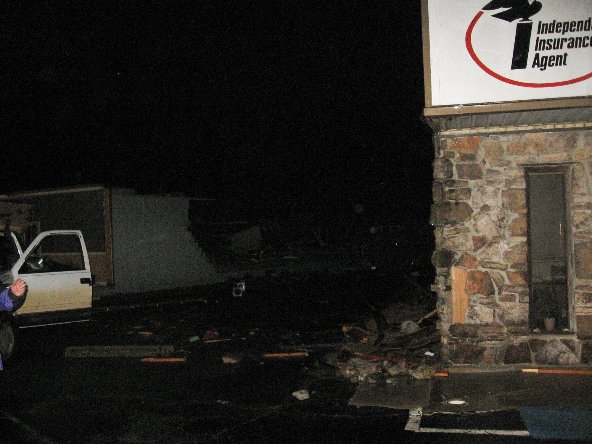
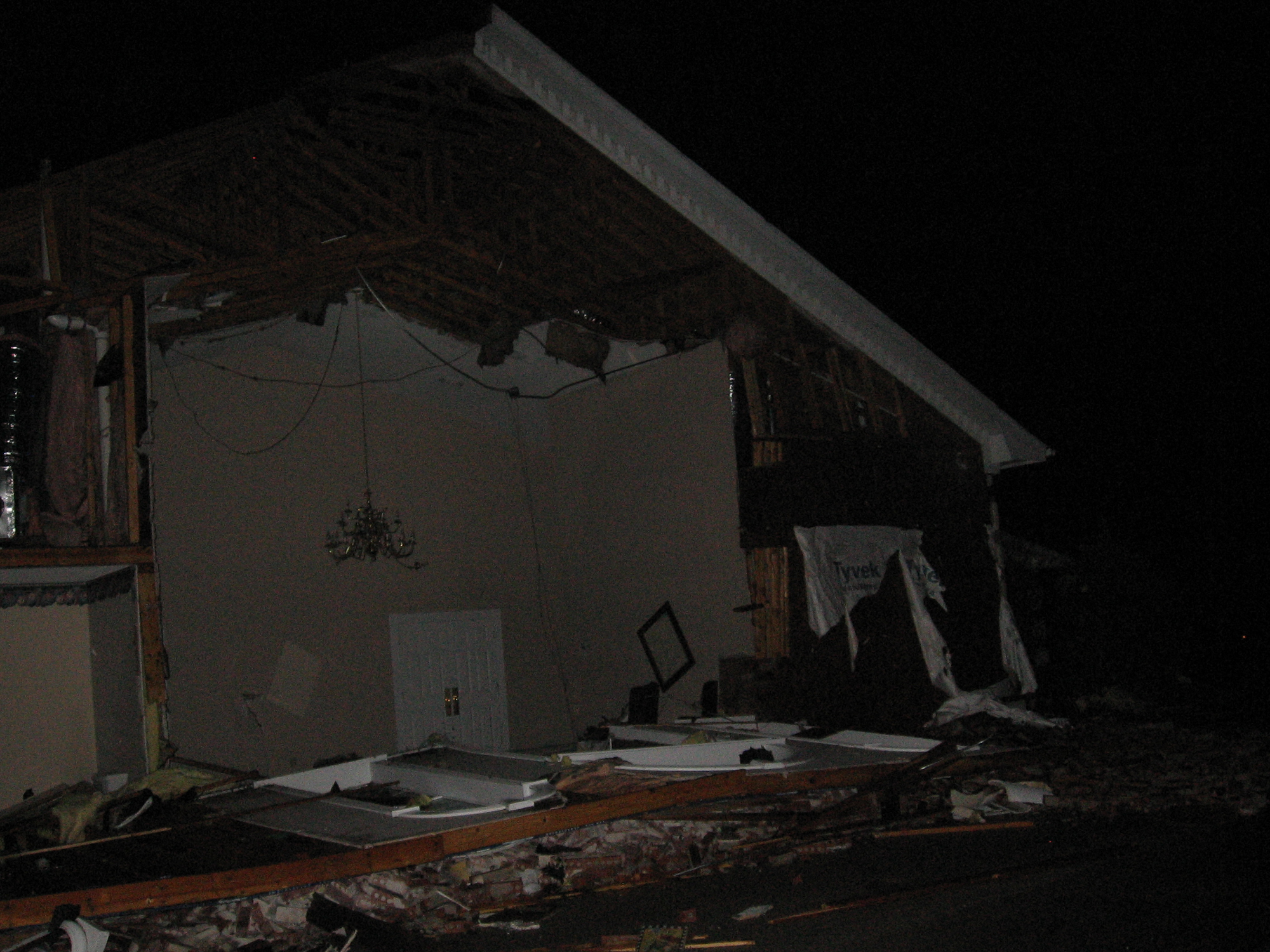
Damage in Highland Arkansas
After that, we went to the town of Highland, Arkansas and found total destruction. Chad and I hung out in Highland, AR for awhile. Chad went and got pictures and walked through town. After a couple hours, we headed north to Rolla, MO, where we stayed for the night.


Woke up to freezing cold
We awoke to quite the temperature contrast. Winter had returned, and snow had fallen in Rolla. We got on our way home to Michigan. On the way back I did a phoner for WLNS.
We stopped by Bainbridge, IN to survey the Tornado damage there. It wasn’t much damage, but interesting nonetheless. We also headed north to take a drive through Nappanee, IN which was affected by tornadoes back in October. The town still has a 50 yard wide path cut through it. It was very interesting to see 4 months later.


