Storm Chase Details
Miles Logged: 174
States Chased: MI
Spotter Network Reports: 1
Severe Risks: SPC Outlooks
Severe Reports: Storm Reports
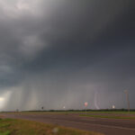
Not a lot to say about Wednesday July 16. CAPE values in excess of 3500-4000 J/KG and little Cap led to some storms firing in Lower Michigan, including a bow echo over in Wisconsin that came across the lake. I left work early and shot up US-127 to the Shepherd, MI area. Indications of 3.5 inch hail were most likely over exaggerated, however, I expected to at least find some hail. By the time I made it up there, most of what was severe previously had gone. I chased through some torrential downpours and a lot of cloud to ground lightning.
I did observe an elevated mesocyclone just a mile or two west of Alma, MI. I also saw some interesting updraft areas, however, I’m not sure I’d call any of them a wall cloud.
I met up with Dan Burkhart in Ithaca and had some healthy McDonalds. We eventually decided to head out and head back south. Nothing in the area was very impressive. On the way down, more cells popped near St. Johns and in Clinton County. VIL’s were pretty respectable, but I found no hail. Dan reported an estimated gust of 40MPH.
I took Dewitt Rd. south from St. Johns to Dewitt and then headed home. I ended up going south of home and down south of Holt and drove around for a bit. By this time the sun had set and things were quickly dying out. It provided me a good light show, but not a lot else.


