Storm Chase Details
Miles Logged: 960
States Chased: AR
Tornadoes Witnessed: 1
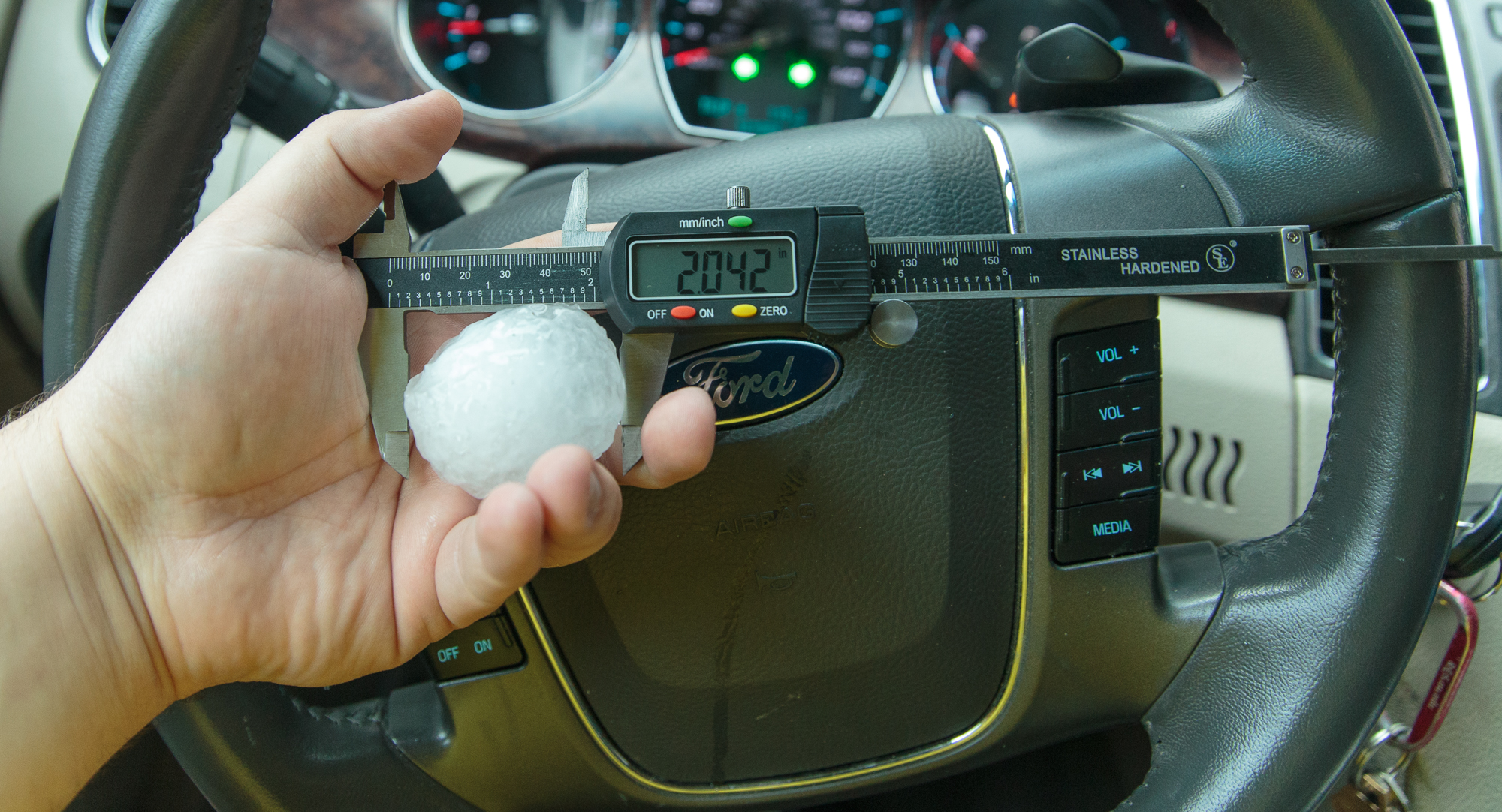
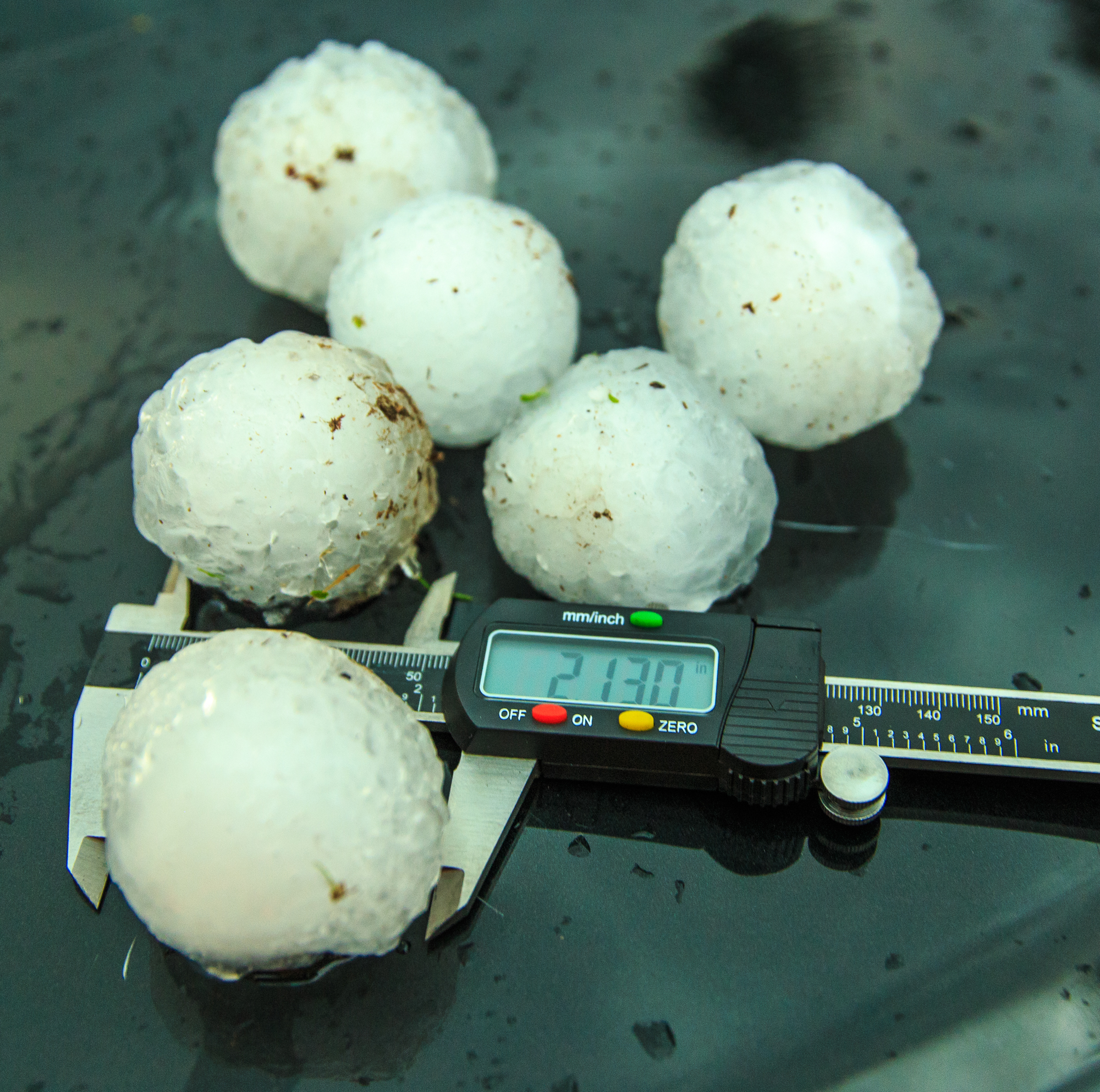
Largest Hail Encountered: 2.00 in.
Severe Risks: SPC Outlooks
Severe Reports: Storm Reports
Wasn’t really expecting to be chasing this early in the season, but a compact and potent shortwave ejected out of the rockies and across Oklahoma the 13th and over a warm sector in Arkansas. Moisture quality was OK, but not great with dewpoints in the upper 50s and mixing ratios around 10 per observed soundings.

Shear was a big question mark in my mind, with 850mb winds not really backing to the south like we needed to keep storms discrete and spinning. I feel like the 850 winds not being backed contributed to the coverage of storms by way of splitting, and we had less tornado producers because of it. It seemed a lot of storms went up in the first place, and instead of congealing into lone supercells, the updrafts kept splitting, and the rain from each was pissing in the updraft of nearby storms.
Nonetheless, I left Norman around 9 am on Sunday morning and headed down I-40 towards Little Rock with a target in mind near Little Rock. I ended up adjusting that to Hot Springs and found myself in the city of Hot Springs with storms blowing up to the west. I had to get my national park passport stamp to keep up my little battle with JR Hehnly, then I headed west on US270 towards the storm near Norman/Mt Ida, AR.
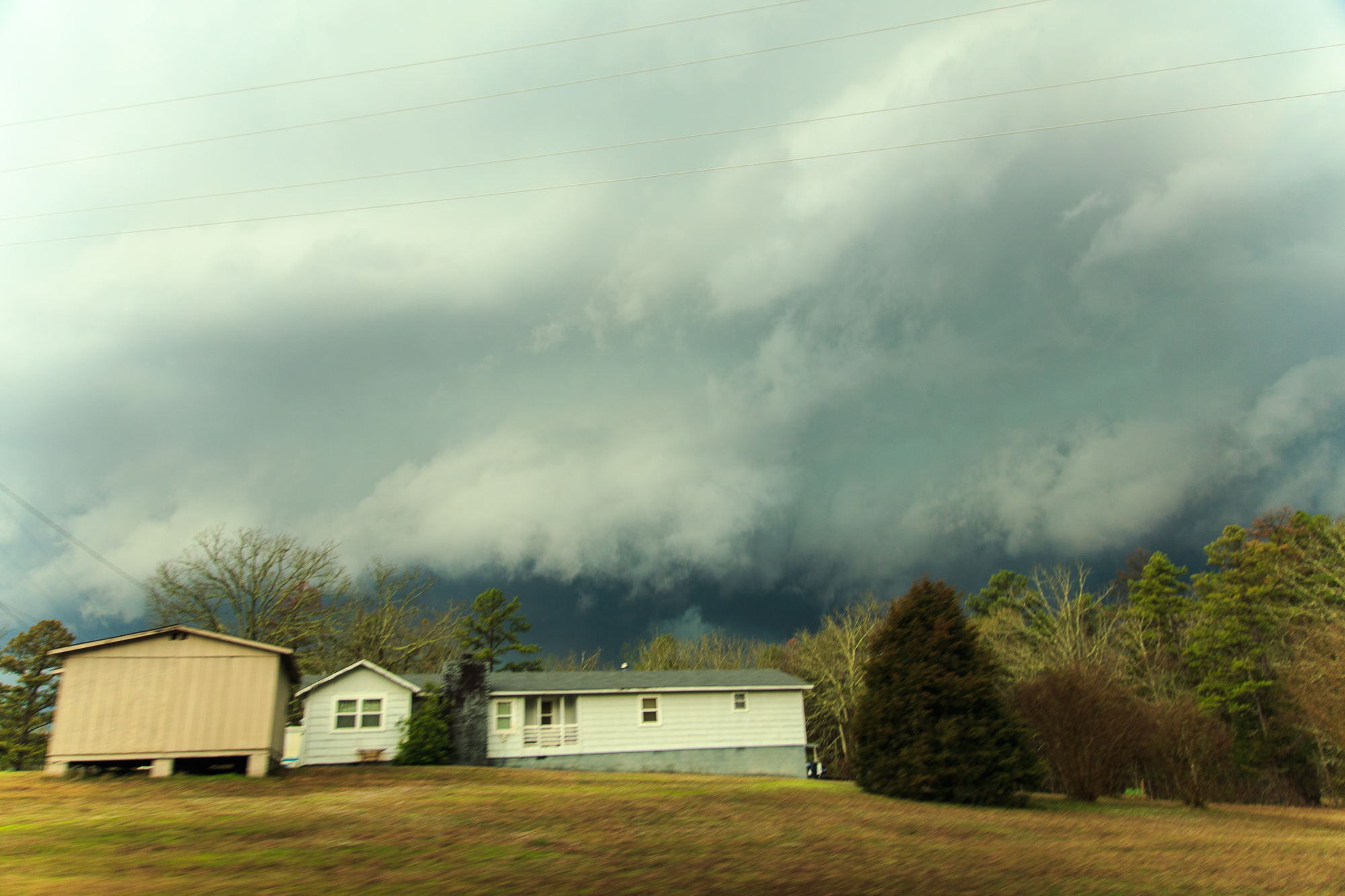
As I approached the storm, it was quite HP in nature, and terrain was awful as to be expected. The first intercept was intense with ramping up RFD it seemed. I was able to stop on an overpass where 270 crossed a little fork of Lake Ouachita, and it afforded me a little view. A tree snapped in half in front of me and fell over as inflow jets from the south raced to the lake. The NWS later confirmed an EF-1 tornado just northeast of that location, so it must have been a tornado or the beginnings of a tornado.
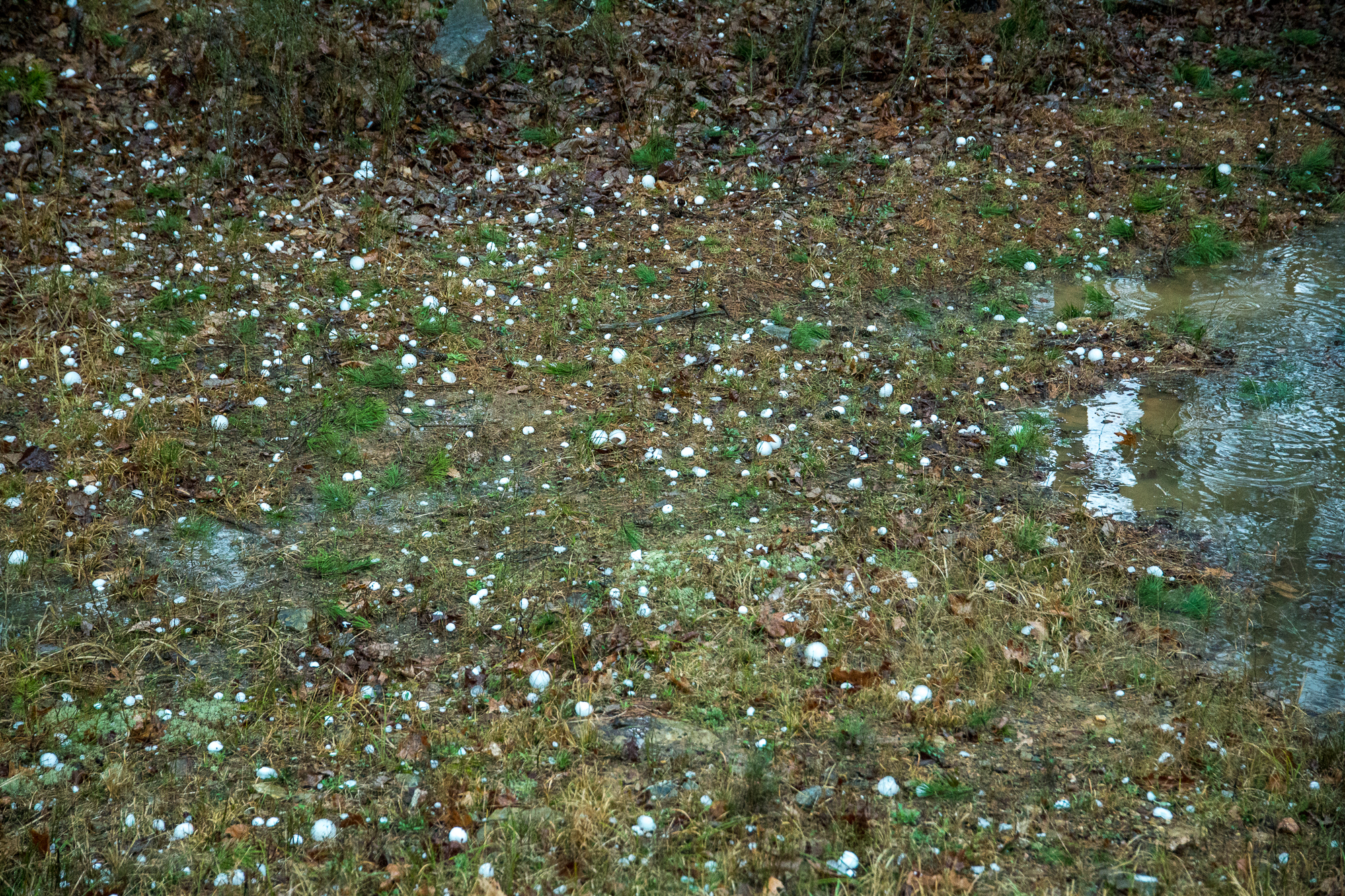
Jessieville Arkansas Hail
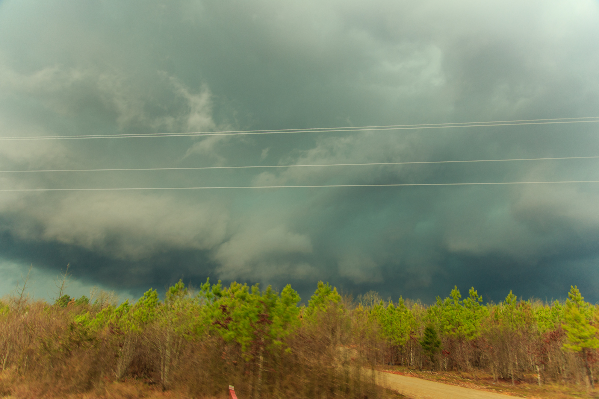
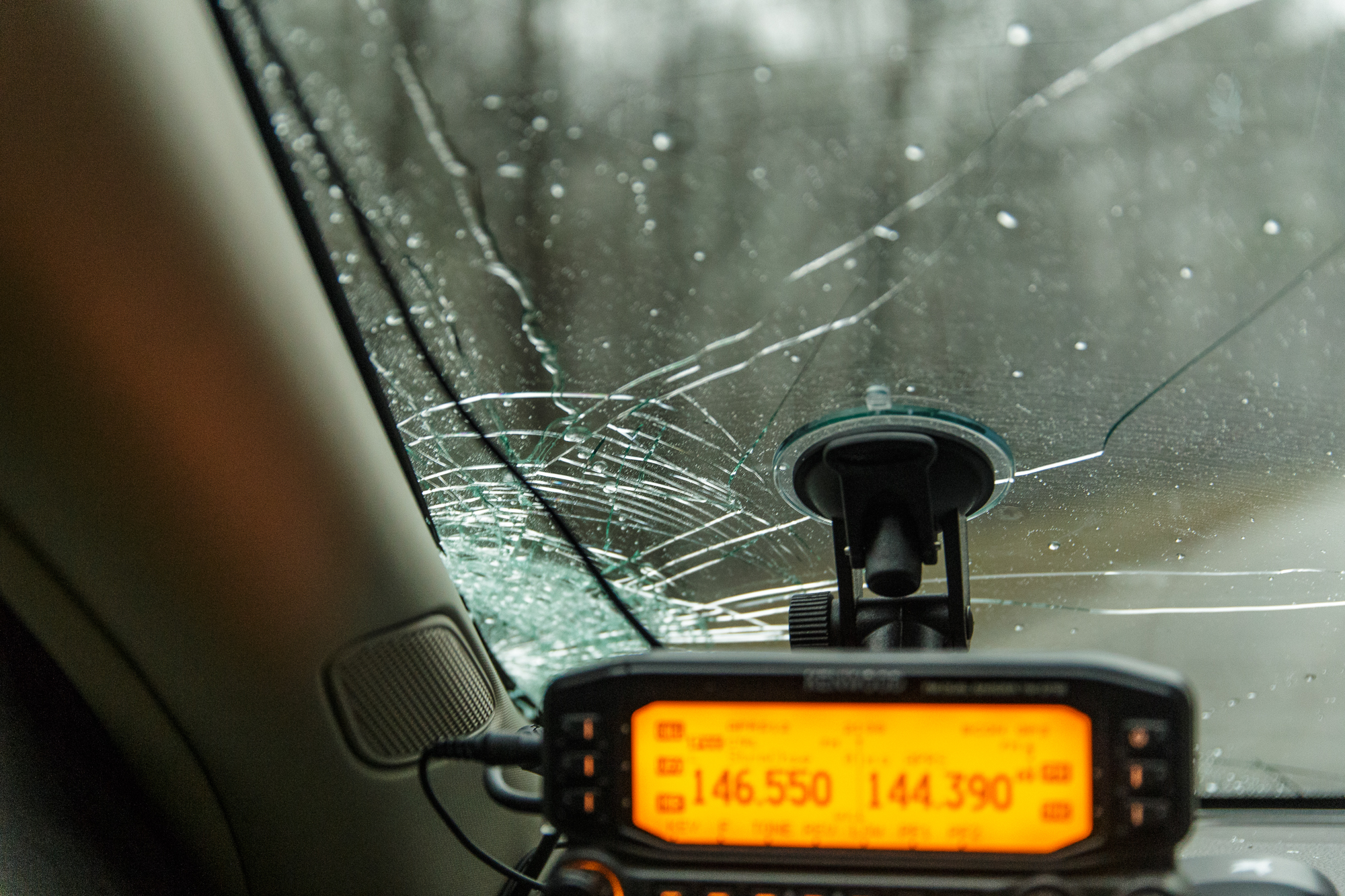
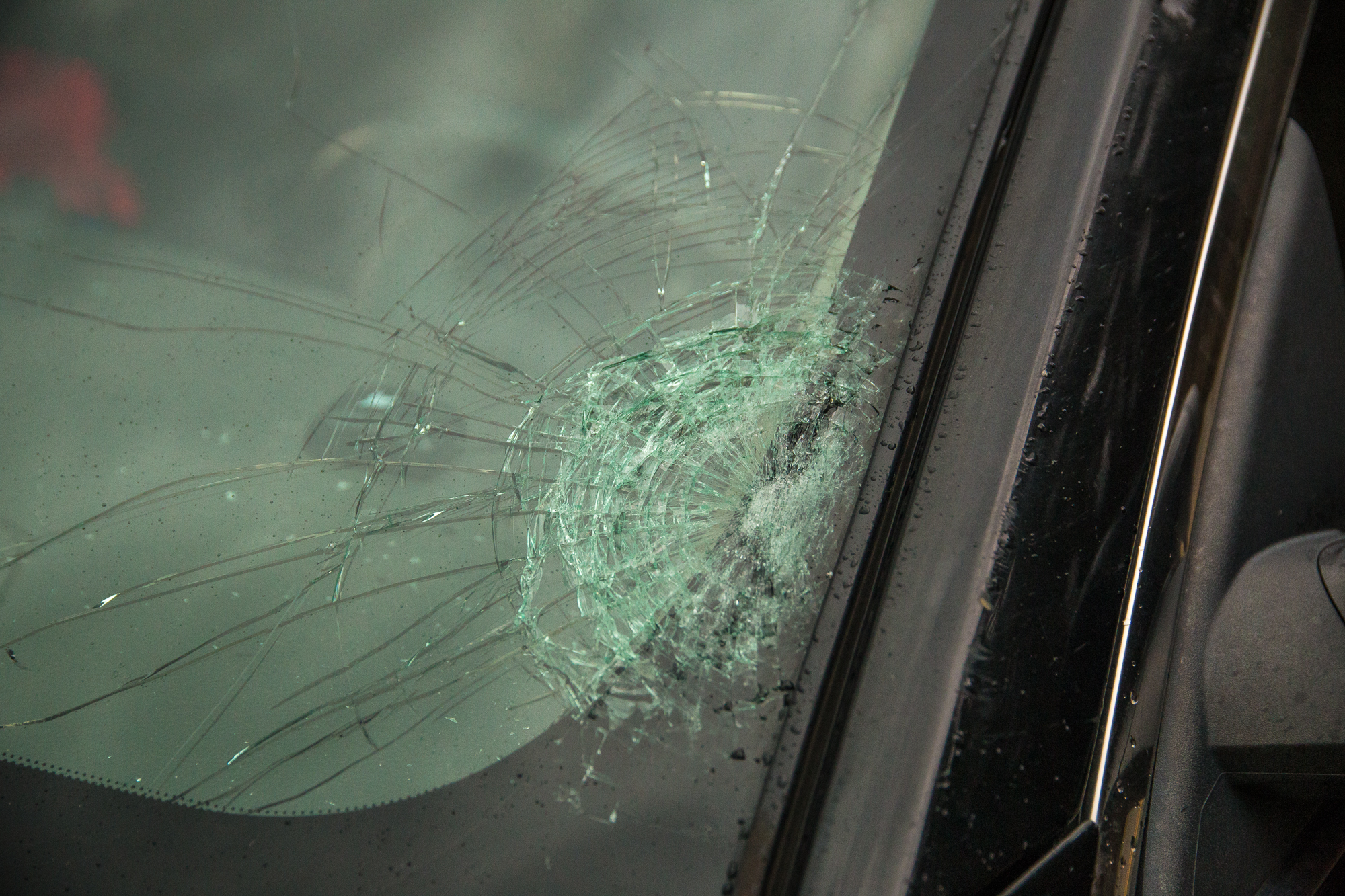
Roads were terrible and I spent the next 45 minutes navigating around the lake and up to Highway 7 near Jessieville which is where I’d intercept again. A confirmed tornado report came in, and I thought perhaps I could see something to my west but again, terrain sucked. I ended up smashing out my windshield on some bigger (2.5″) hail north of Jessieville.
I was incredibly screwed by roads and spent the next 30-45 minutes again catching up to the storm near Conway before waiting thru about 20 stoplights to get through town and towards Vilonia on US64. Supposedly there was tornado reports coming in, but I never was able to see anything and gave up at 167 before turning around and heading back to Norman.
I arrived back in Norman a little after 1am. As JR texted me after this chase, “Perhaps the terrain will be better next time”


