Storm Chase Details
Miles Logged: 438
States Chased: OK, TX
Severe Risks: SPC Outlooks
Severe Reports: Storm Reports
Forecast
Shear looked to be subtle but adequate from a few days out until about 24 hours before this event. As the event neared, it became worrisome that we wouldn’t have enough shear for supercells. However, I was still pretty confident in convective initiation and supercell mode to start with. So I headed west on I-40 with Taylor to the Texas Panhandle.
Chasing
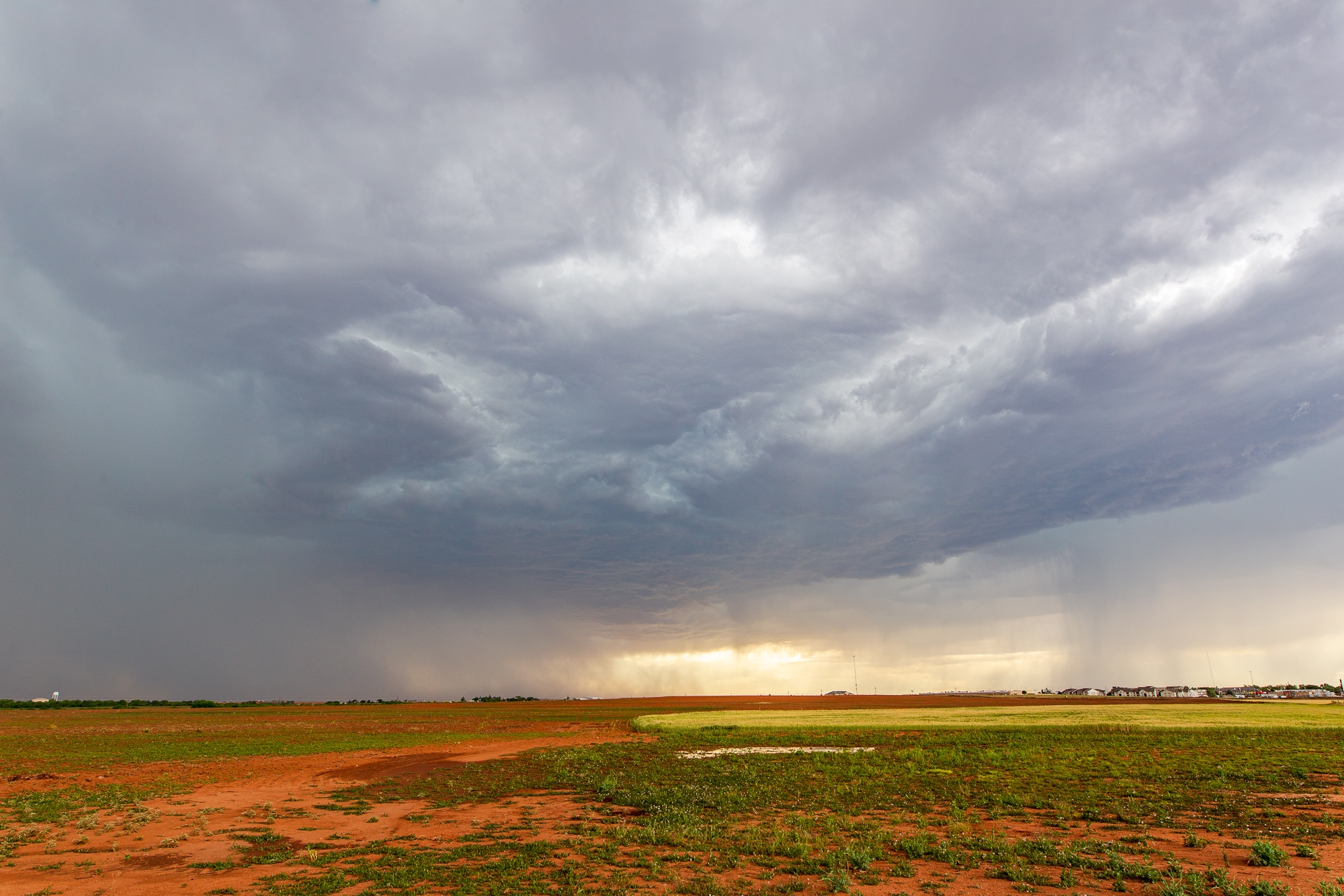
As we neared Shamrock, I pulled over and waited as storms battled it out. It became apparent that the southern storm to my southwest was probably the best shot, so we headed towards it. By the time I got near the base, vertical velocities had gone to about zero. No upward motion. The cap was winning.
Decisions
I was kind of hungry and decided that the best chance of any storms was with the complex coming out of the Lubbock area. So I made a decision to head to Childress for food, gas, bathroom and figure it out from there. I ran into Tim Marshall after getting some food. Great to catch up with a legend.
Eventually the pretty high-based storms from the southwest showed up. The most intensification went on right in and north of Childress. We headed back up 83 to 62 and headed back into Oklahoma.
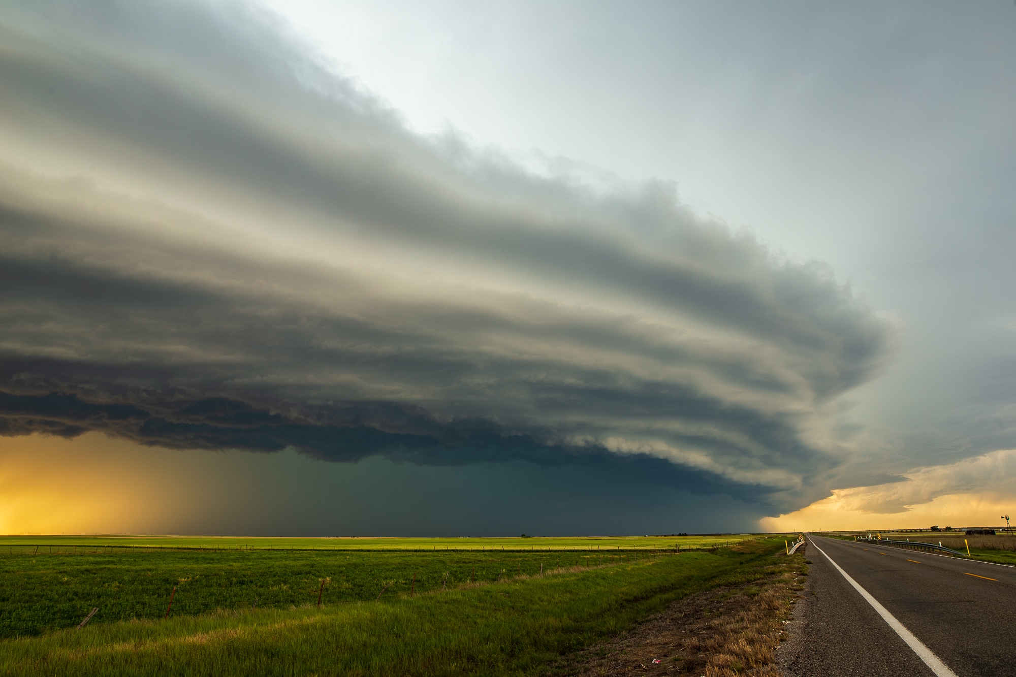
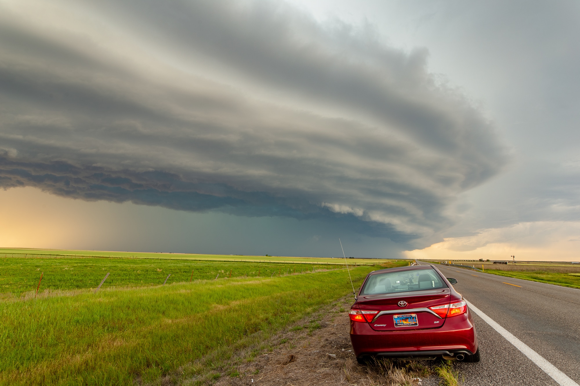
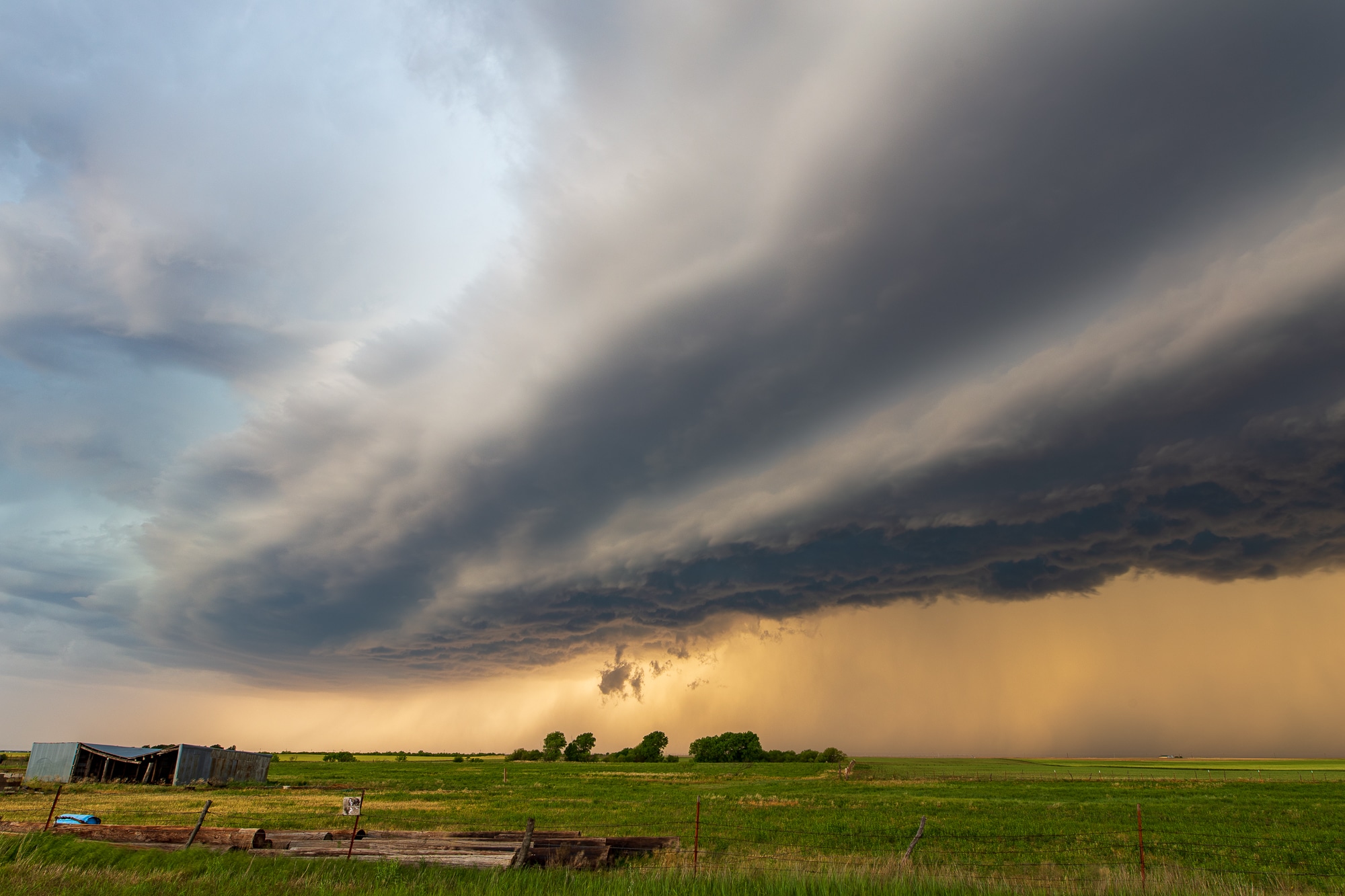
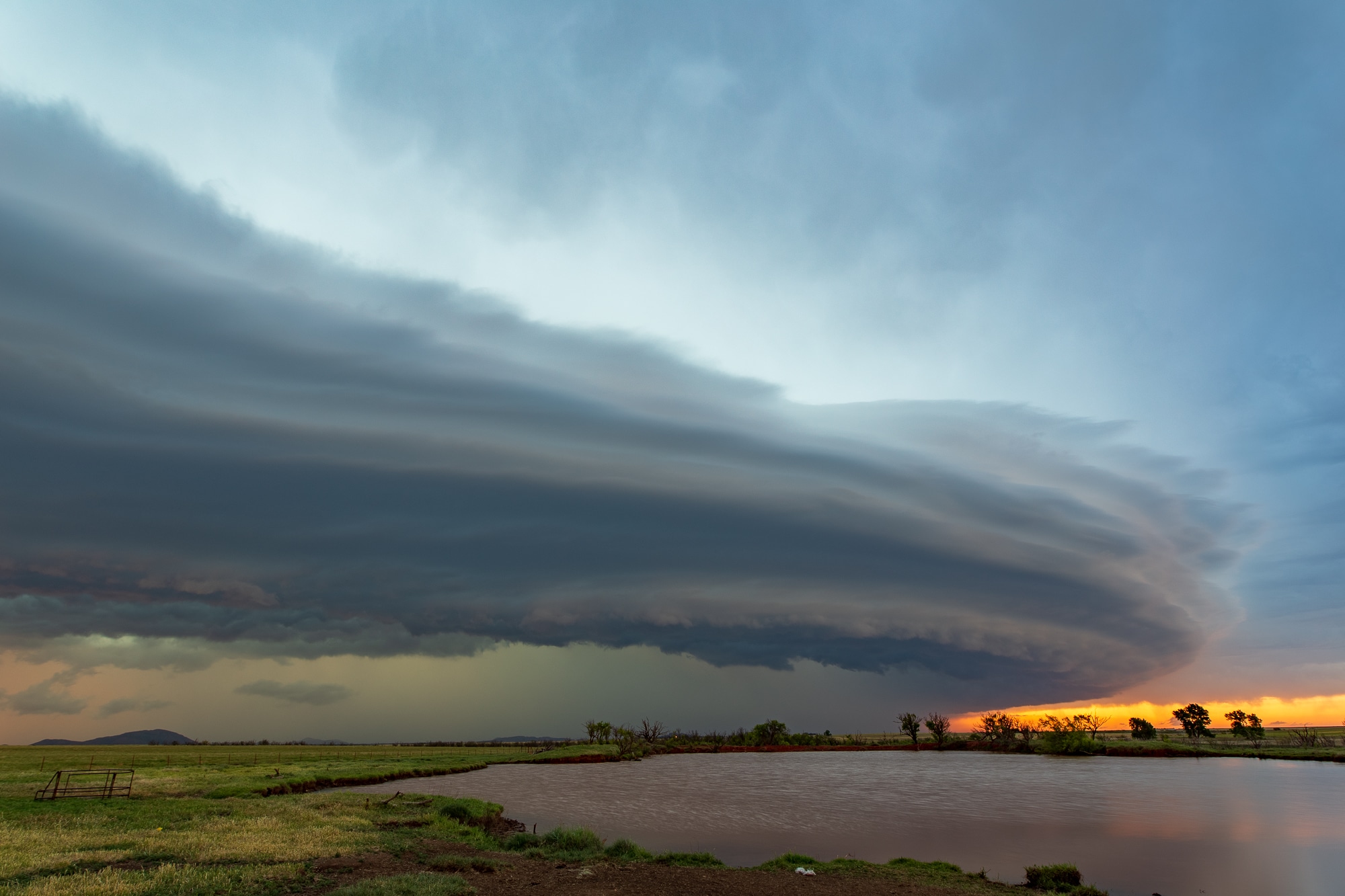
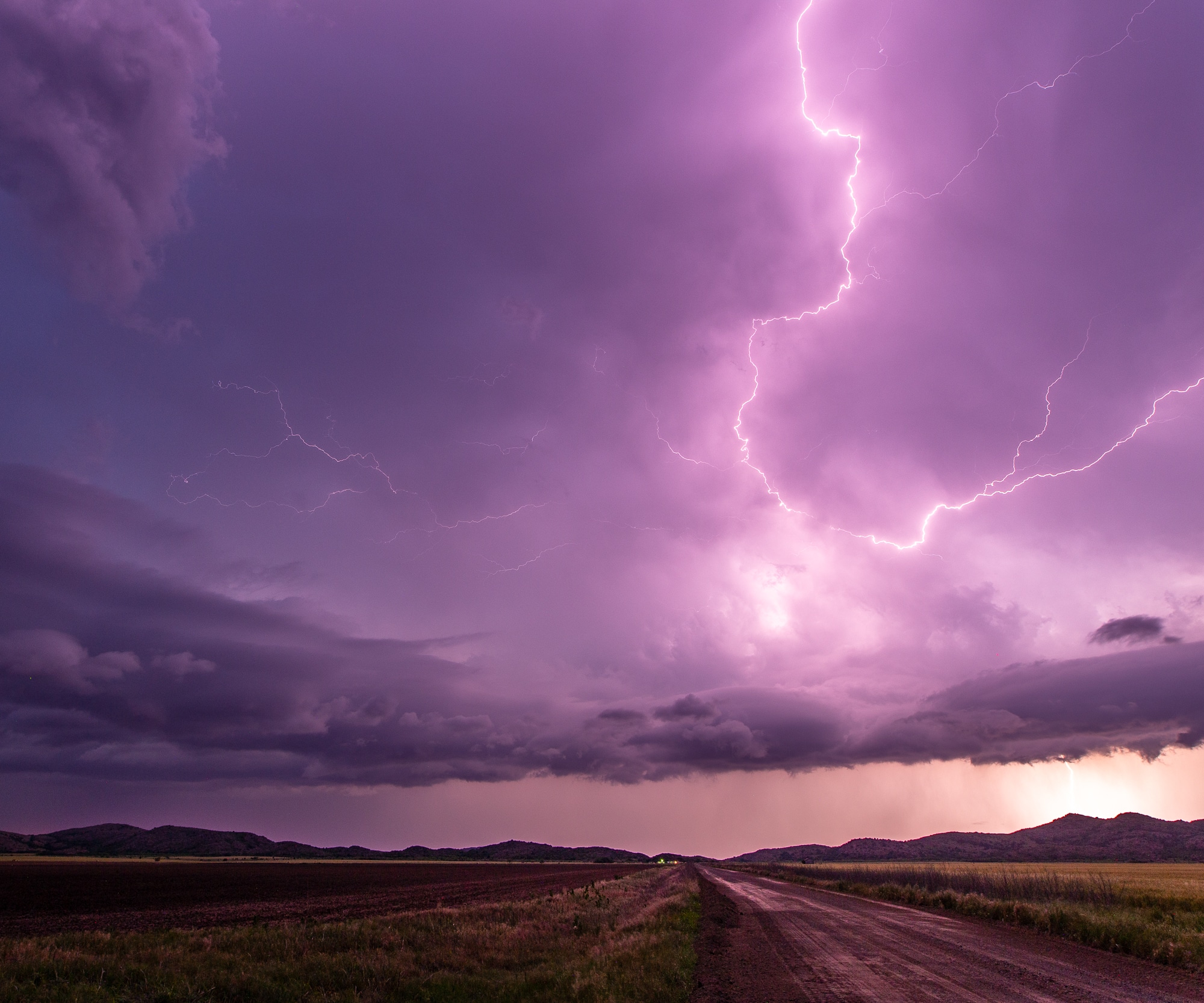
Structure
I could tell the structure was really good, so I raced ahead through Hollis and Gould and to the west side of Duke before setting up for the first photos. We snaked around the back roads through Southwest Oklahoma eventually ending up in Roosevelt near dark. Some beautiful photos!