Storm Chase Details
Miles Logged: 546
States Chased: OK, TX
Tornadoes Witnessed: 3
Largest Hail Encountered: 1.50 in.

Highest Wind Encountered: 70 MPH
Spotter Network Reports: 3
- Tornado 11 miles SSE of ACRES, KS
- Funnel Cloud 7 miles NNE of ROSSTON, OK
- Tornado 5 miles N of FOLLETT, TX
Severe Reports: Storm Reports
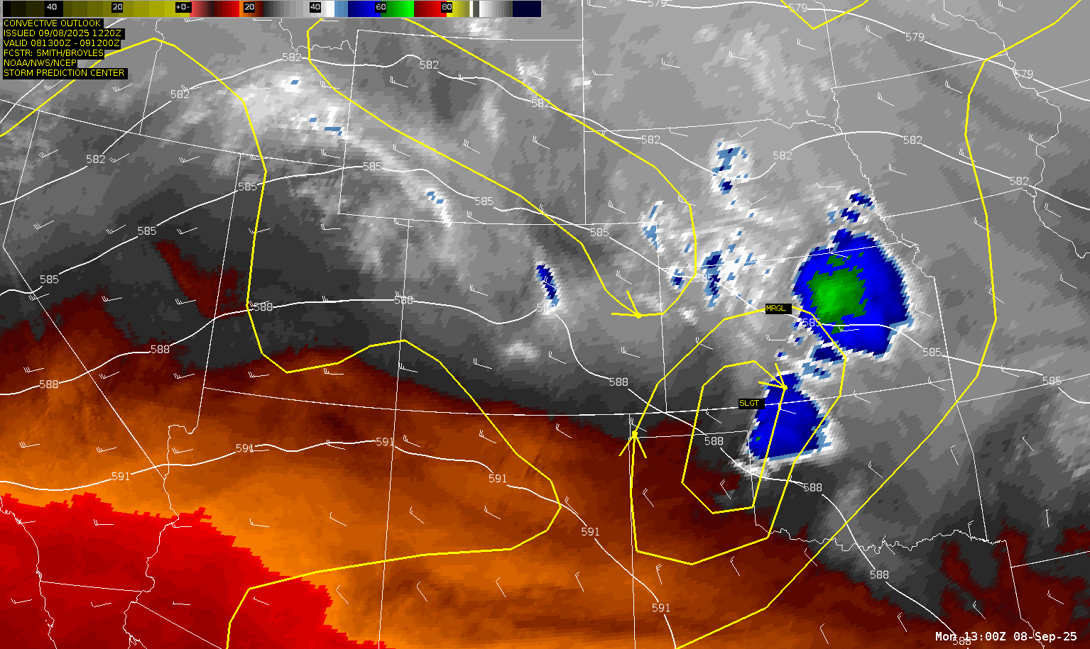
A marginal supercell day in early September after a disappointing weekend.
Forecast
I really had not been paying much attention to the weather with the Michigan game and a couple Staind concerts. Nevertheless, saw the slight risk from the SPC and started digging into weather on Monday morning. The first step was to check in on the RAP.
13Z RAP Forecast Hour 9
I checked on the 13Z RAP between work meetings and liked what I saw northwest of Woodward.


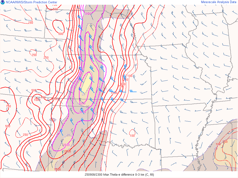
A narrow corridor of moisture had settled across Western Oklahoma/Eastern Texas Panhandle and up into western Kansas. Theta E values were reasonably high and point soundings showed pretty good turning and thermals.

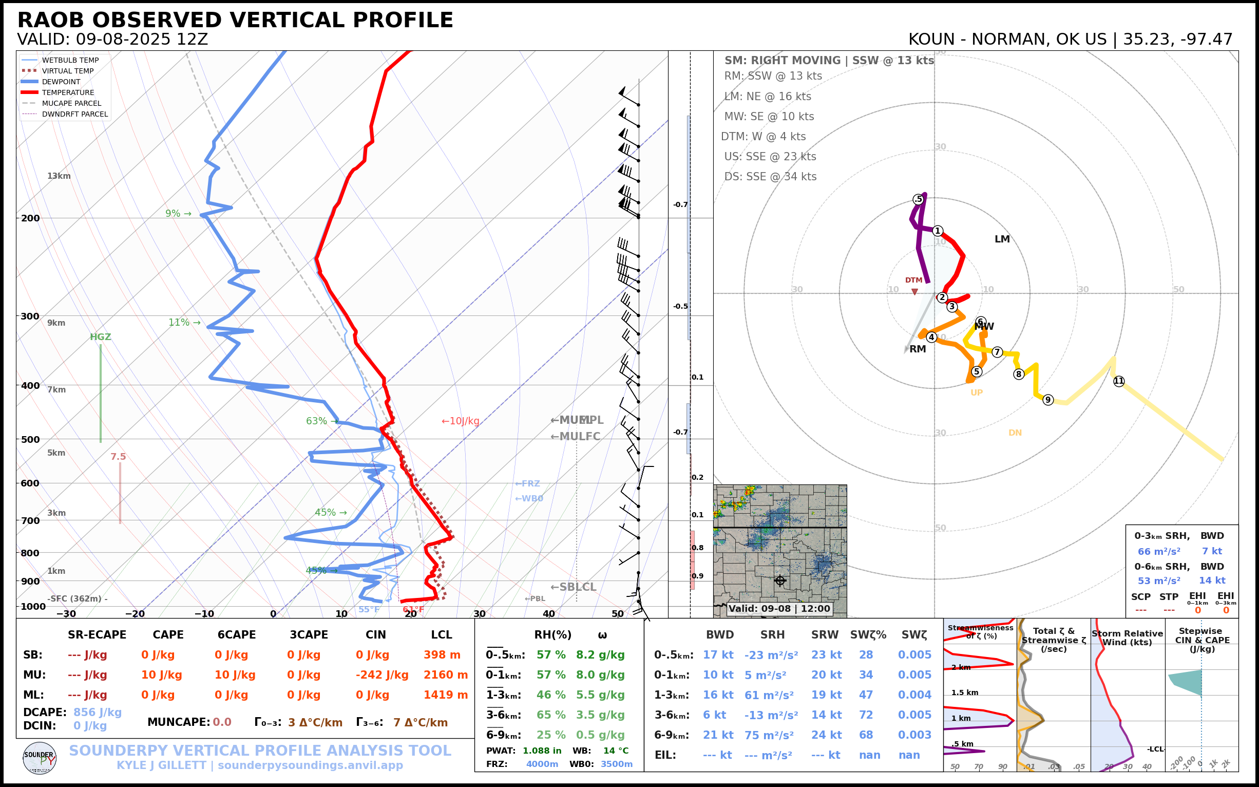
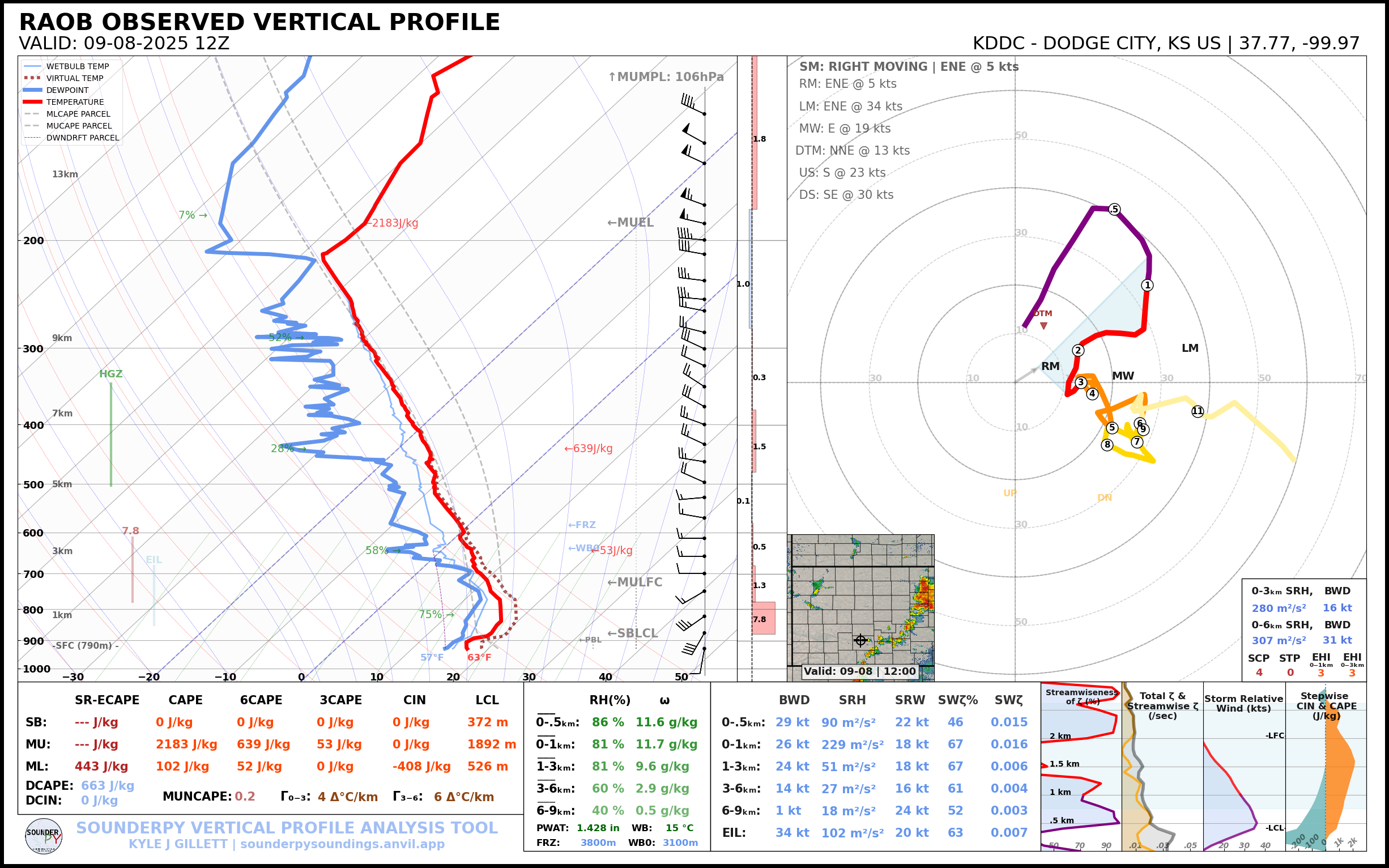
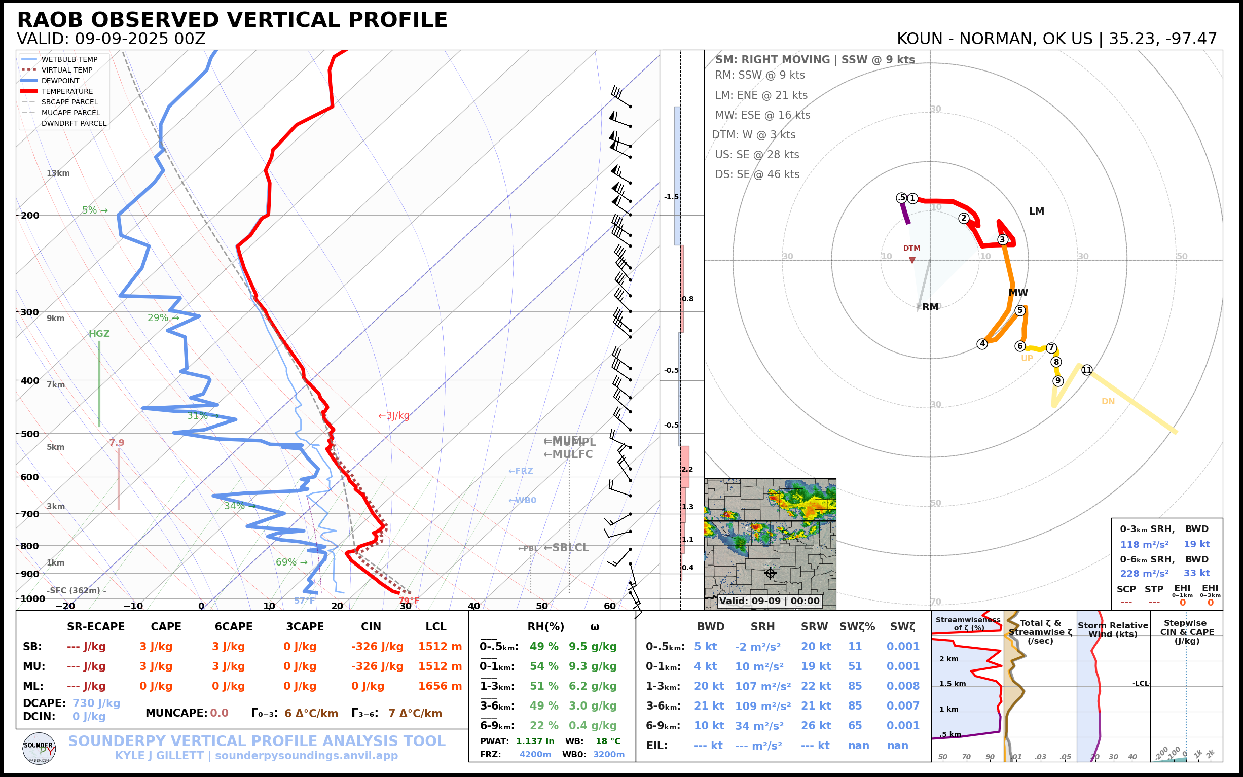
12Z Observed Soundings
Nadocast
The nadocast was also pretty bullish on the area

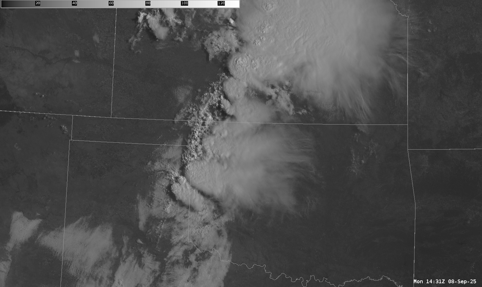
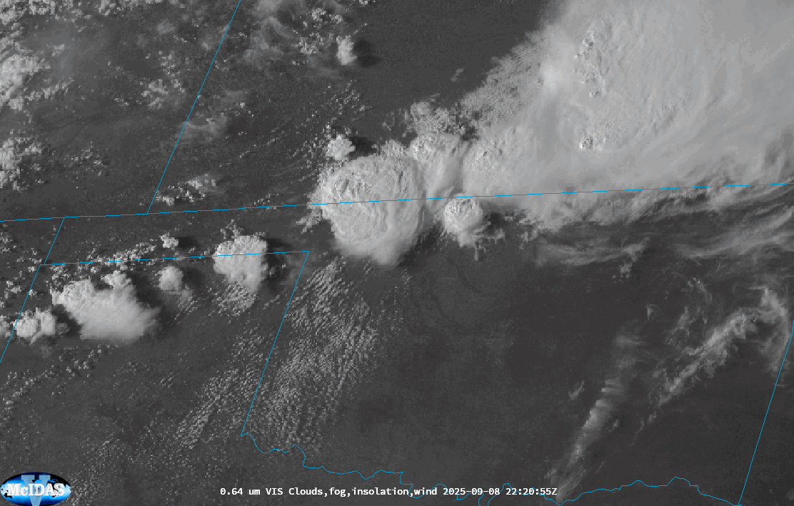
10:30 am Satellite Loops
As can be observed in these loops, some storms were ongoing early/mid morning just to the east of the target area. Storms were firing off a retreating boundary and moving to the southeast. This activity would slowly peter out as we moved into afternoon, leaving a good differential heating boundary up in Northwest Oklahoma.
Water Vapor
Visible Satellite
Norman Departure
After wrapping up my work for the day, I headed out the door with an initial target of Woodard. The drive was uneventful, making it to Woodward just before 4pm.
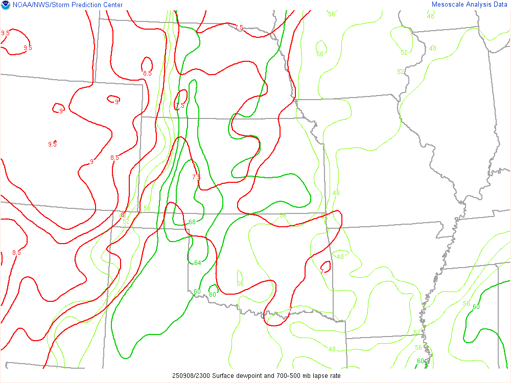
3:45 pm CDT Dewpoint and Theta-E
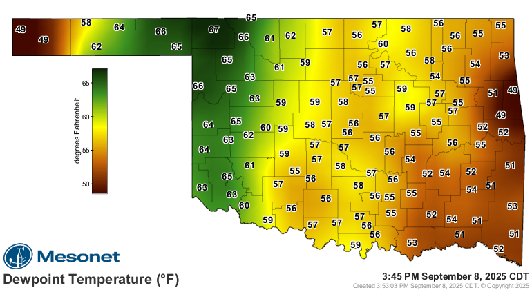
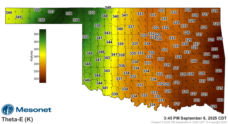
I ended up heading west on US 412 towards Fort Supply and Slapout, eventually stopping on a side road just west of Slapout. With limited radar coverage in this part of Oklahoma, I kept my eyes on the visible and infared satellite.
Multiple storms were firing across the panhandles and into Kansas. The strongest updraft on visible satellite appeared to be near Ashland Kansas, so I started to head towards Buffalo. The original plan was to go up 183 into Kansas, but it became obvious really quickly that might be too far east. It turned out the storm was moving a little west of south, a very anomalous movement.
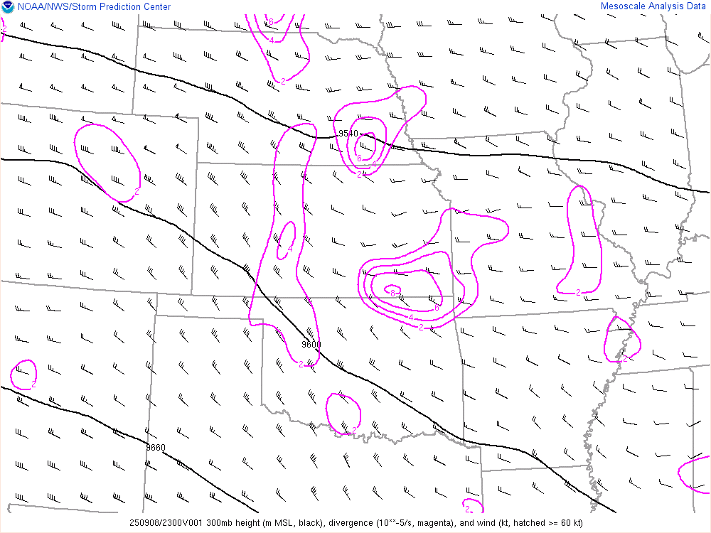
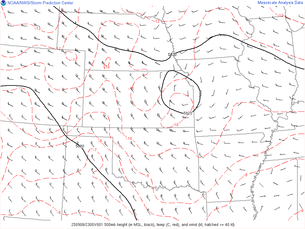
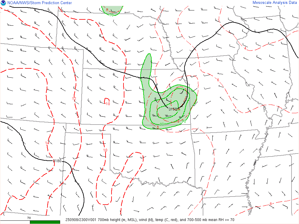
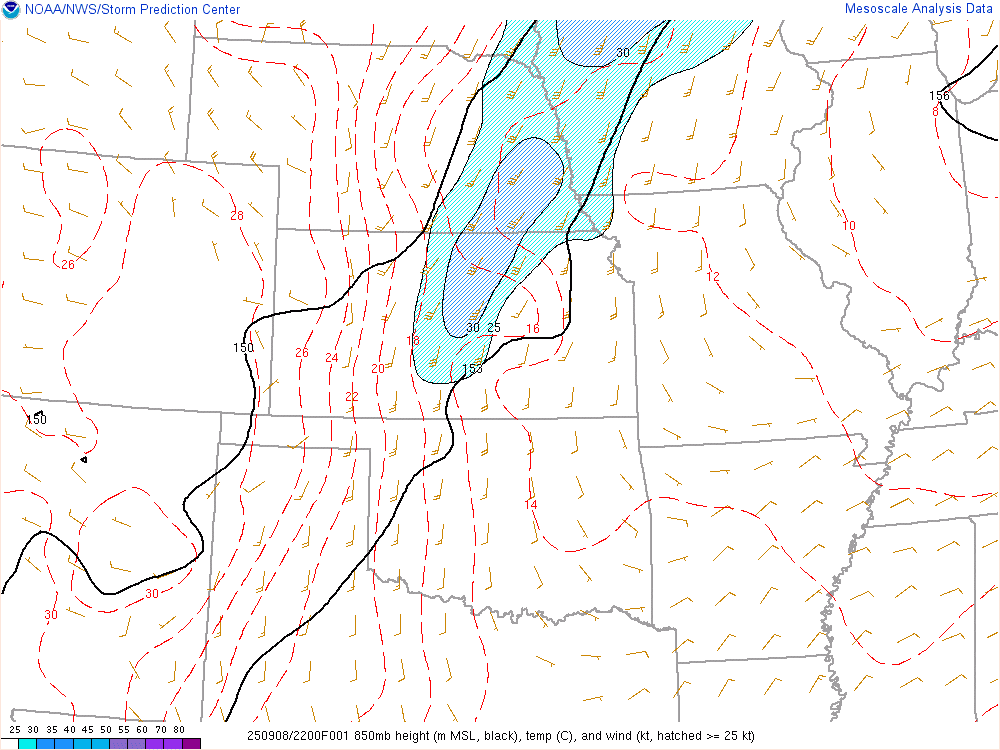
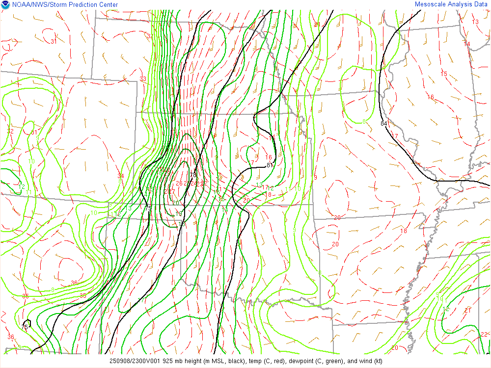
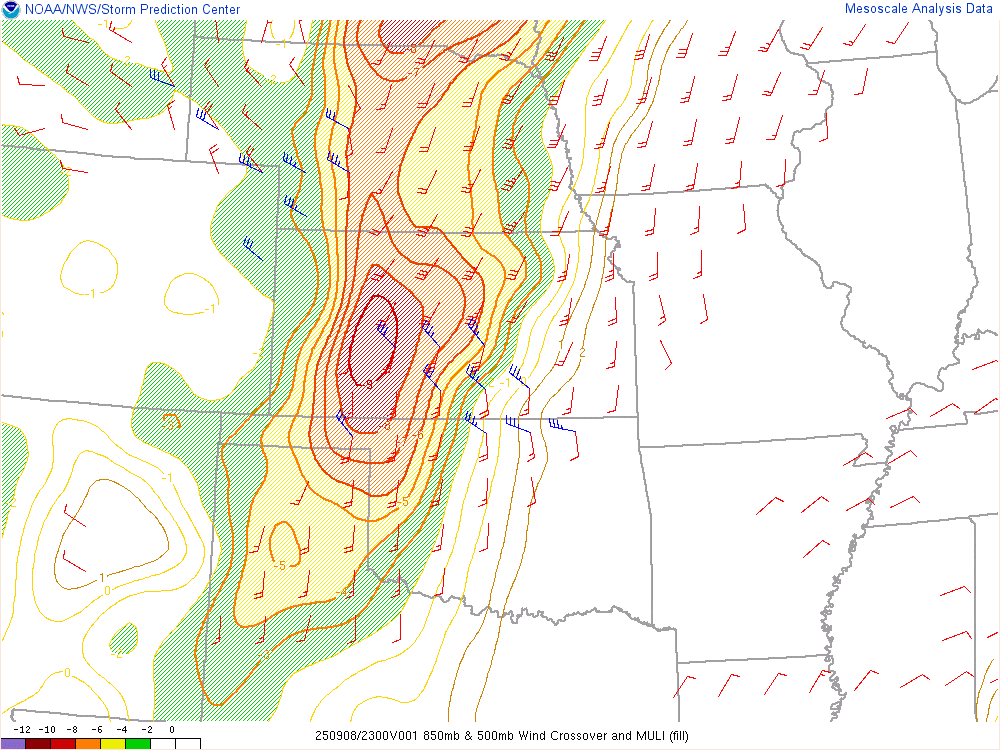
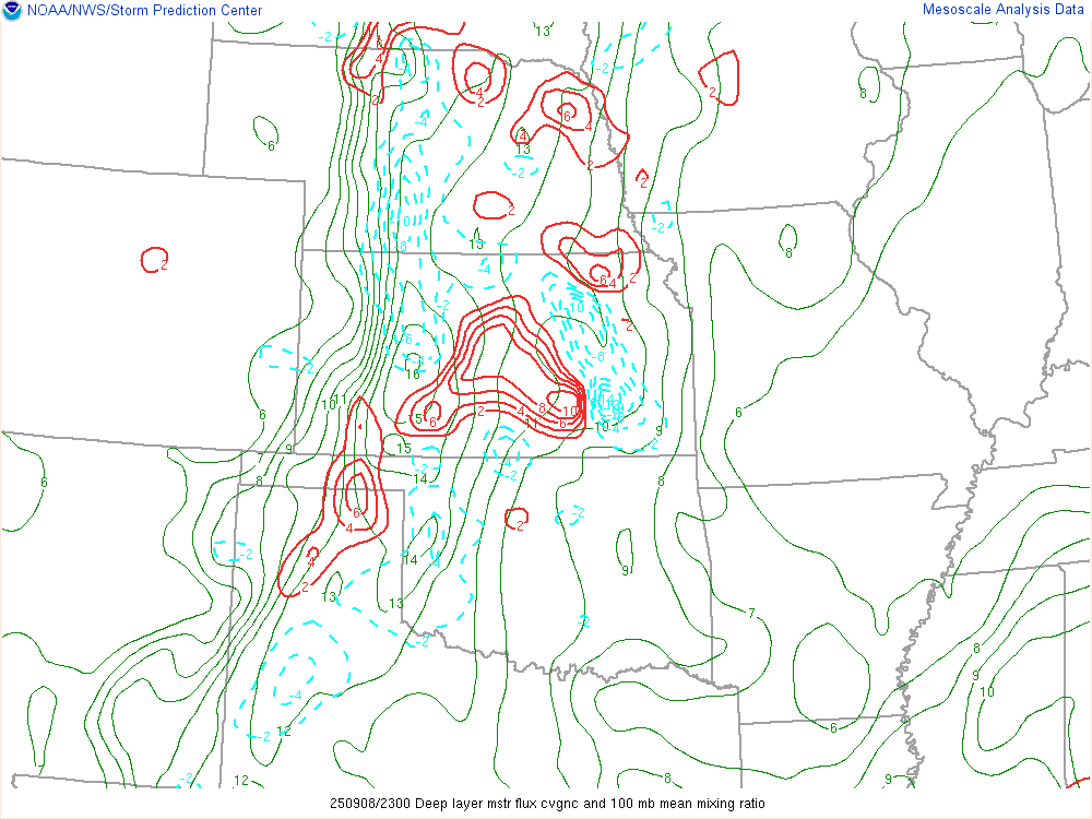
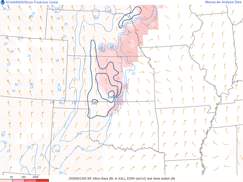
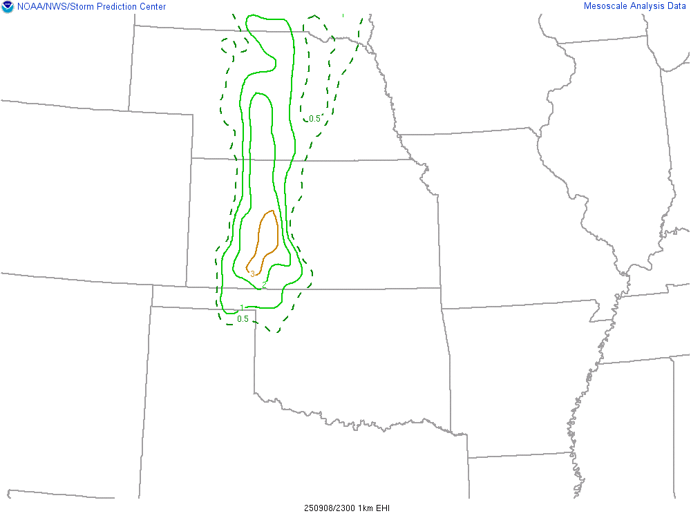
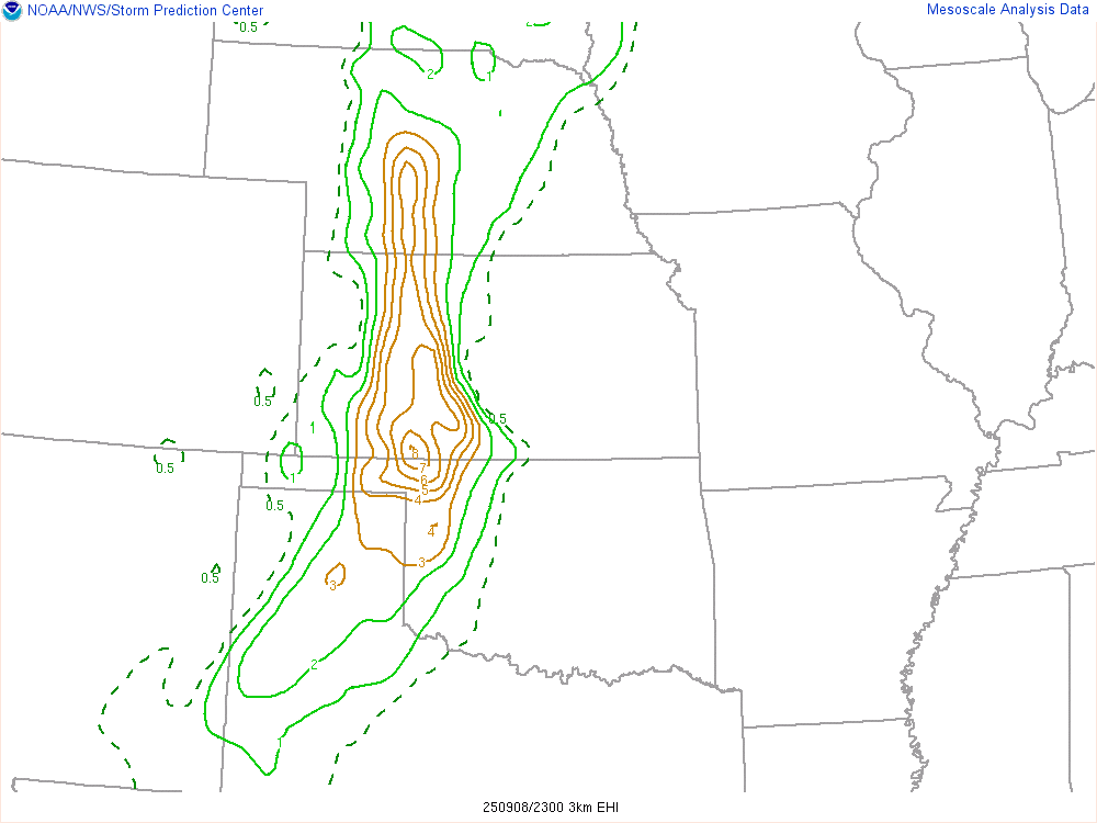
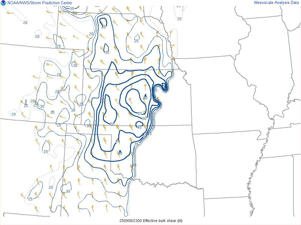
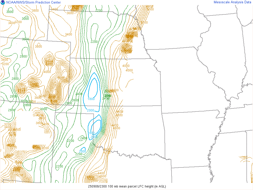
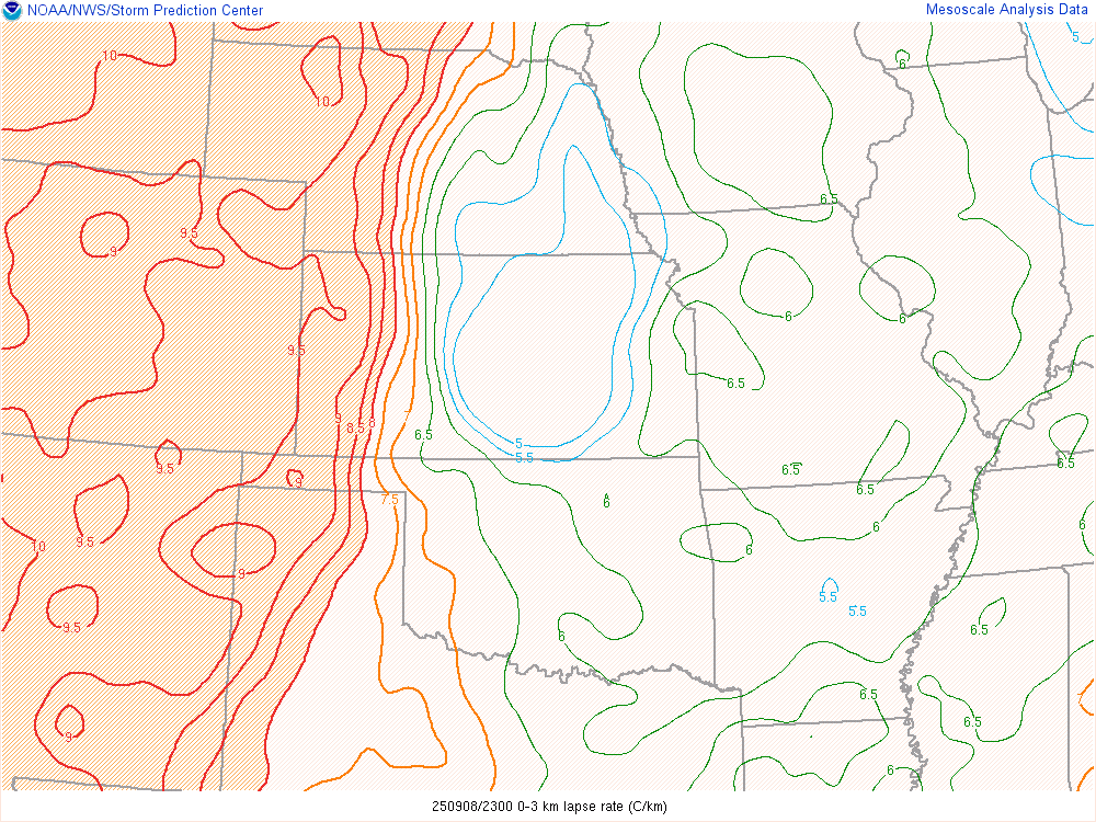
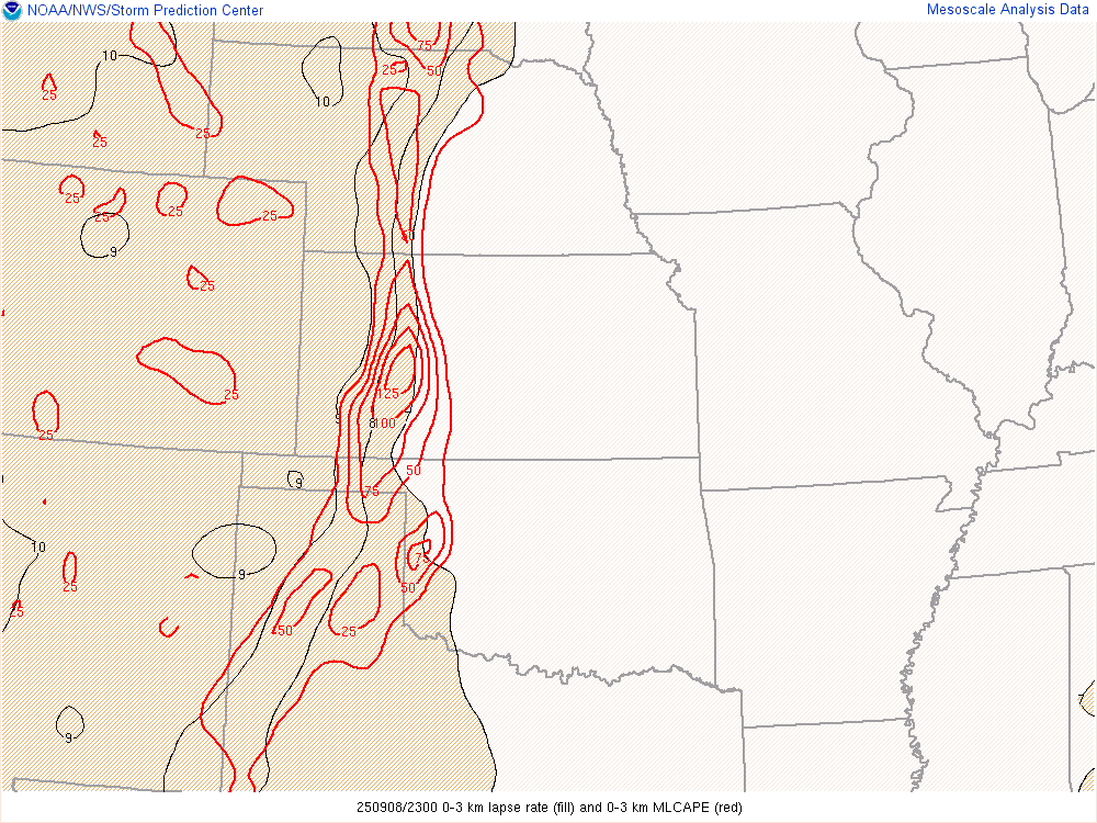
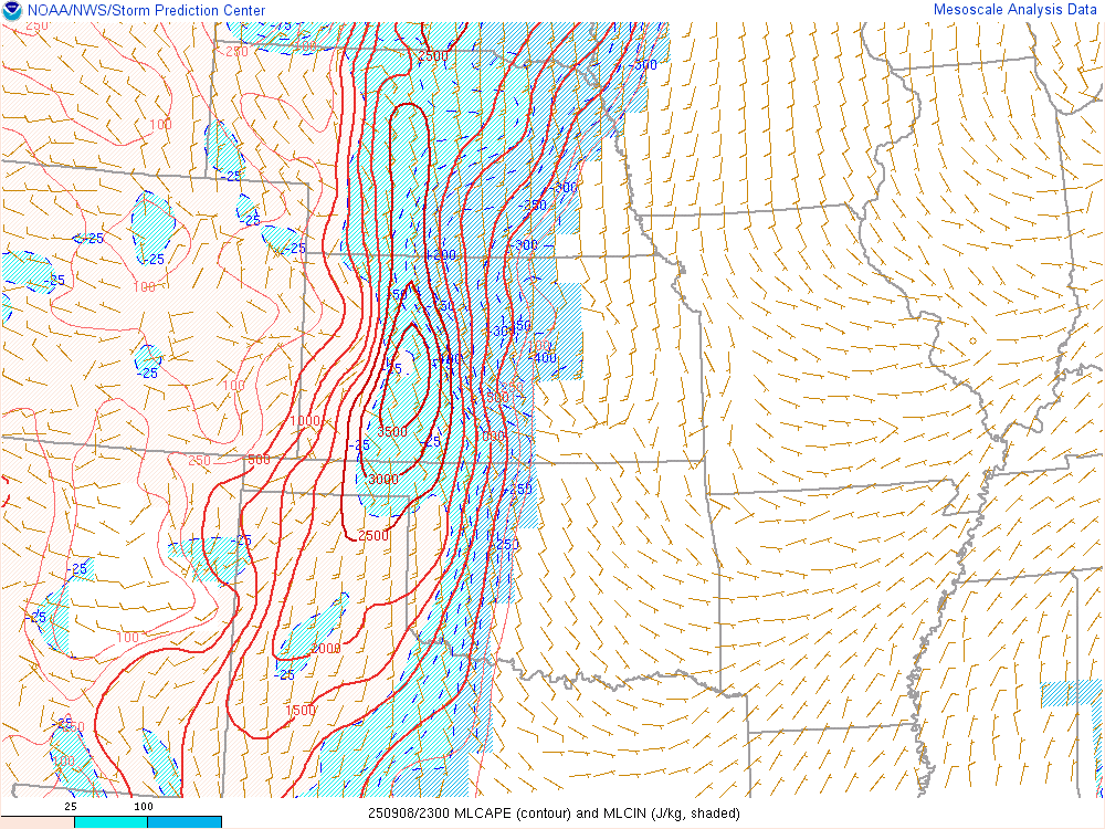
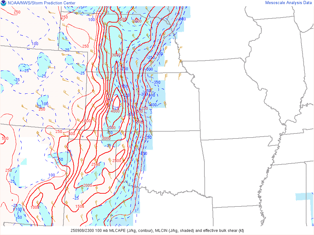
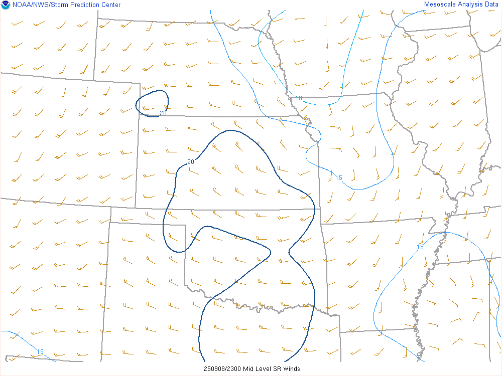
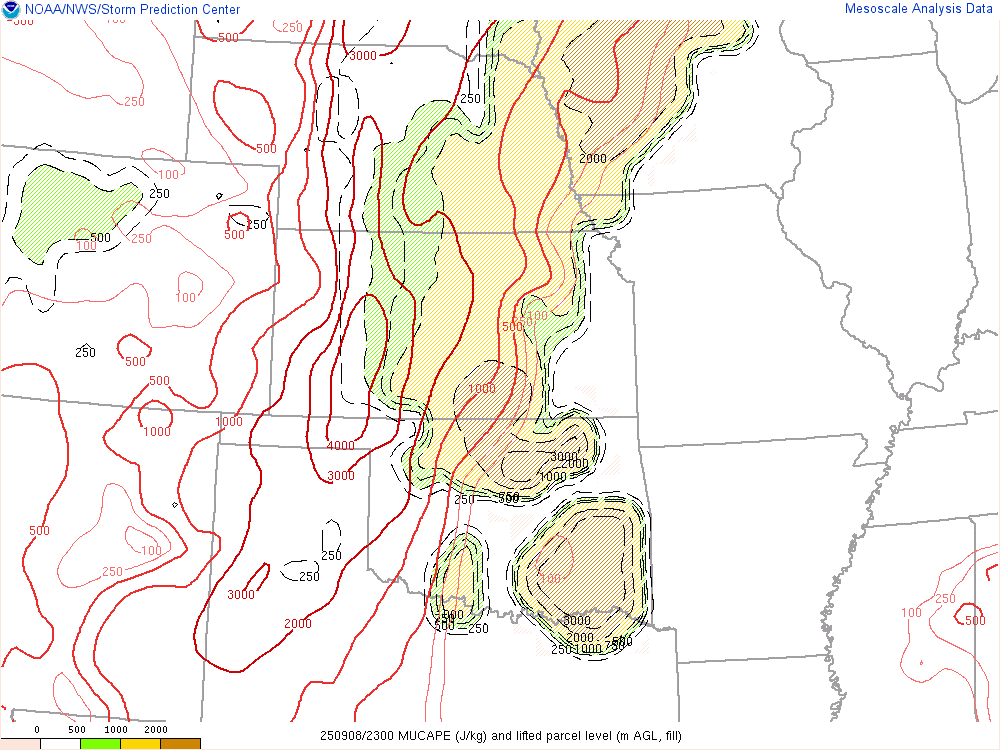
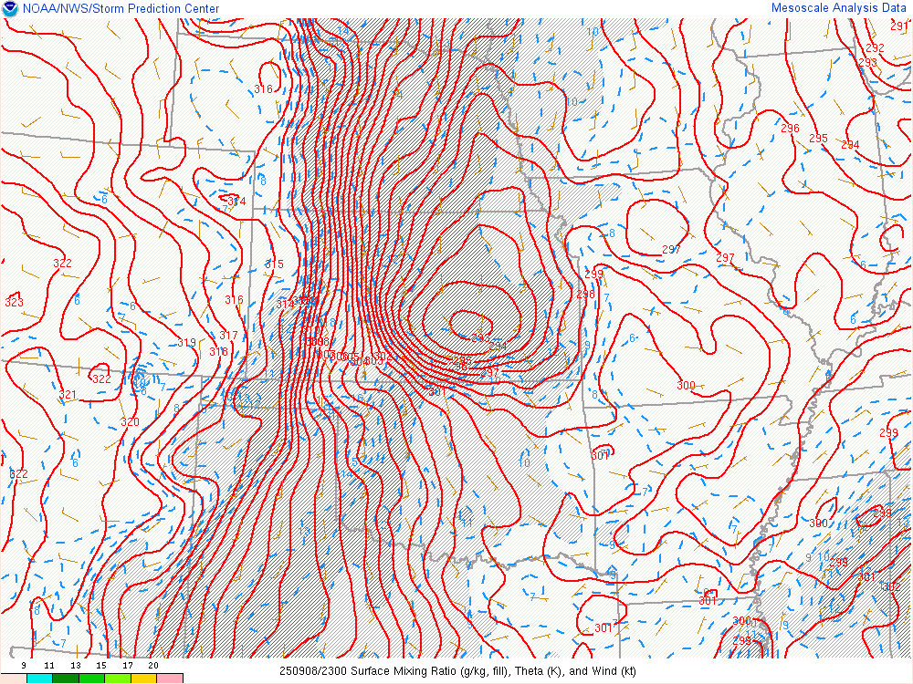
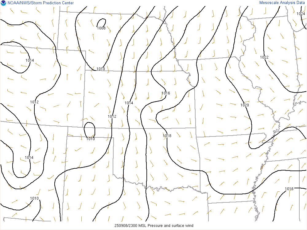
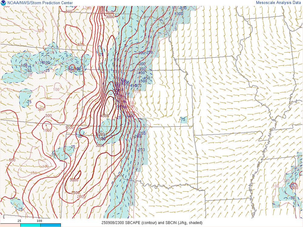
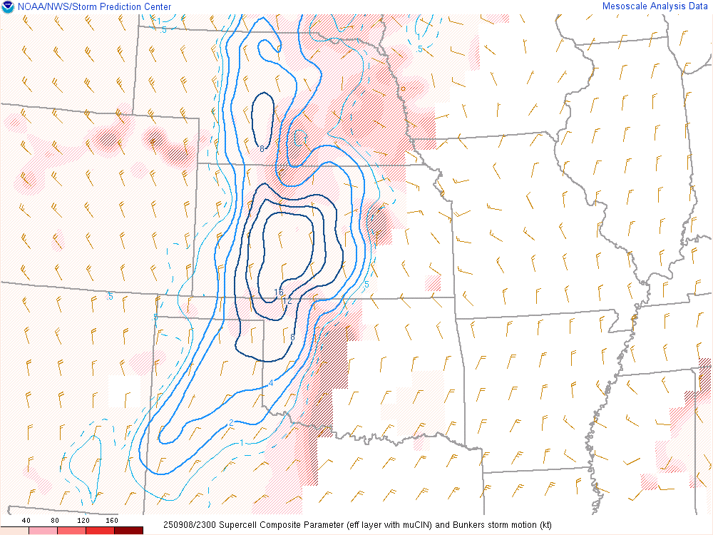
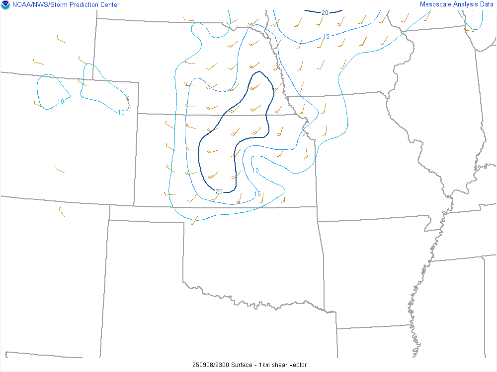
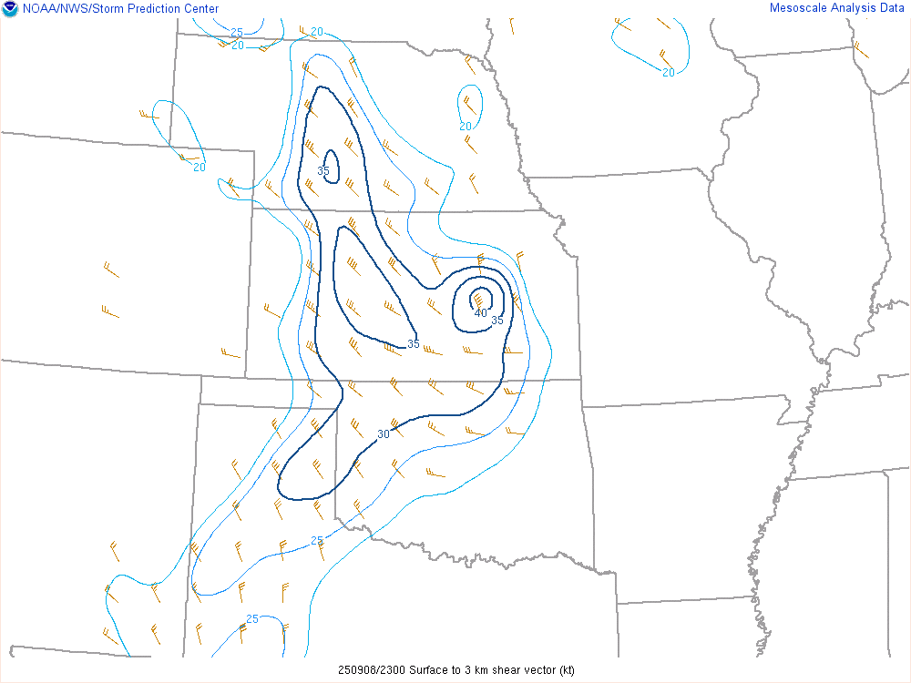
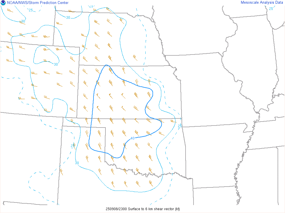
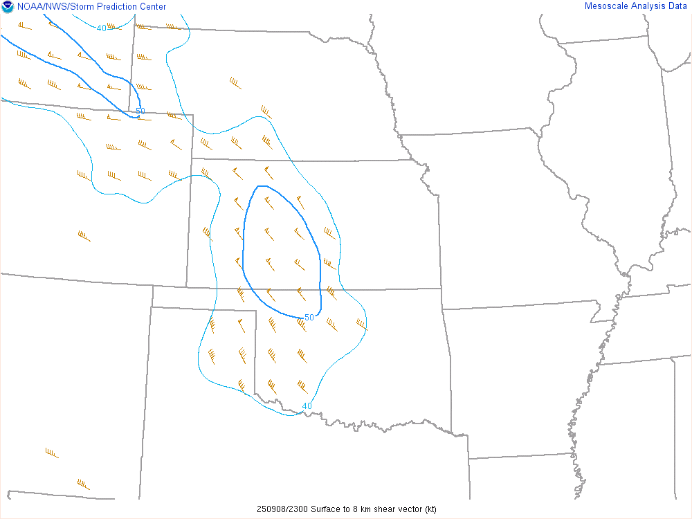
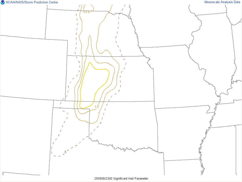
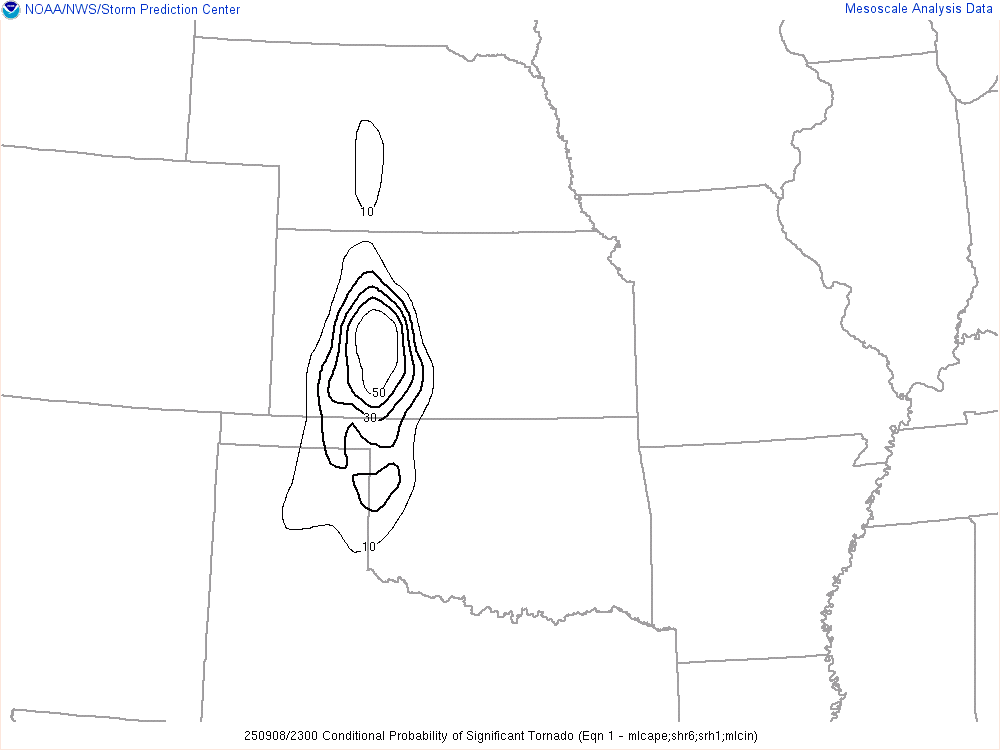
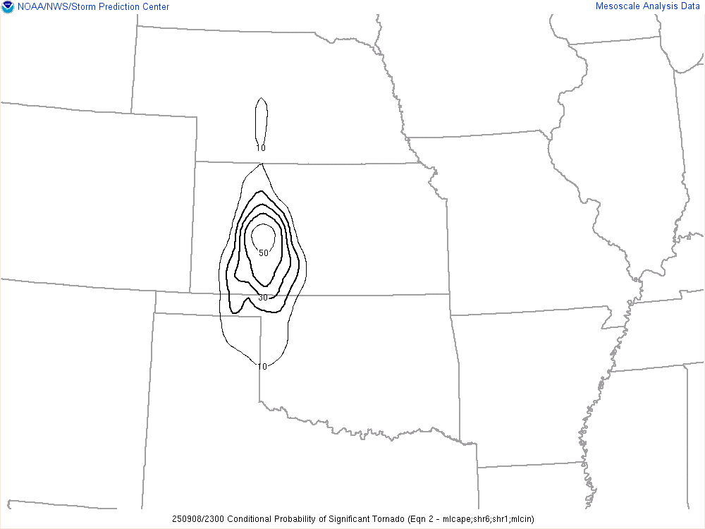
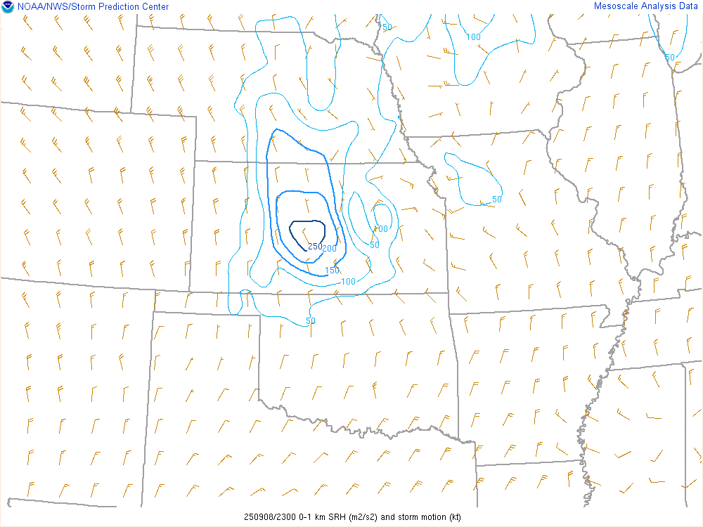
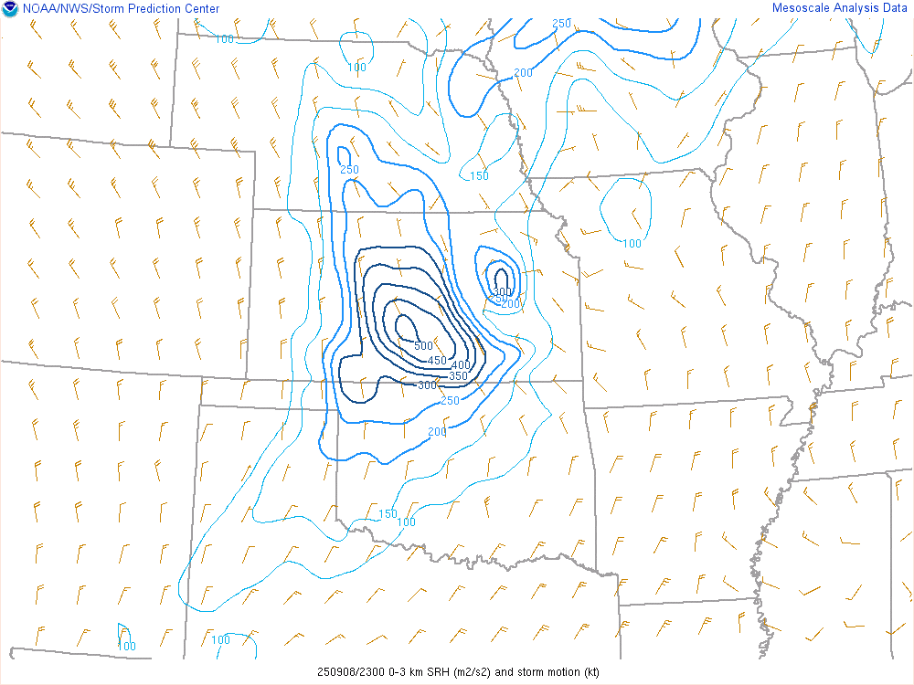
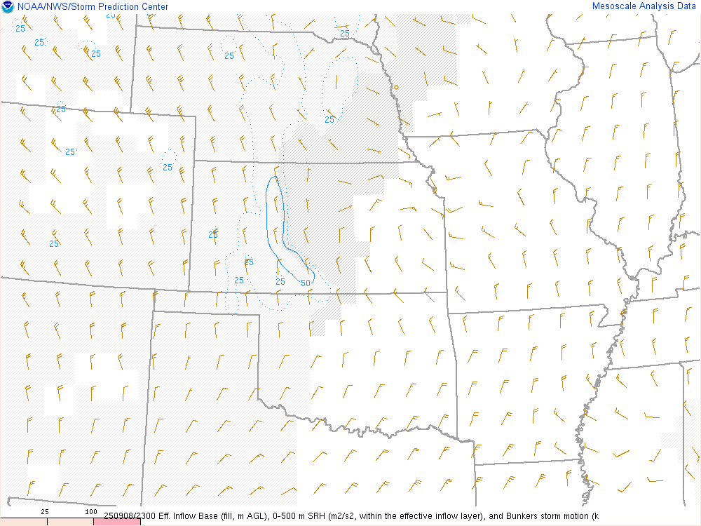
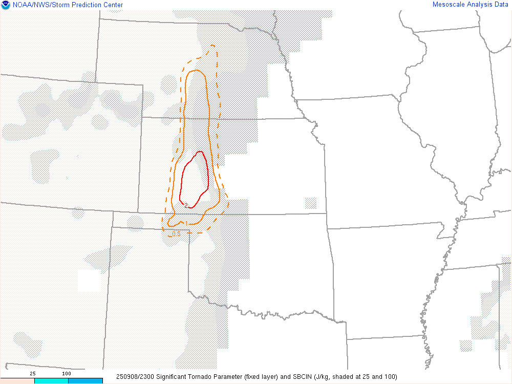
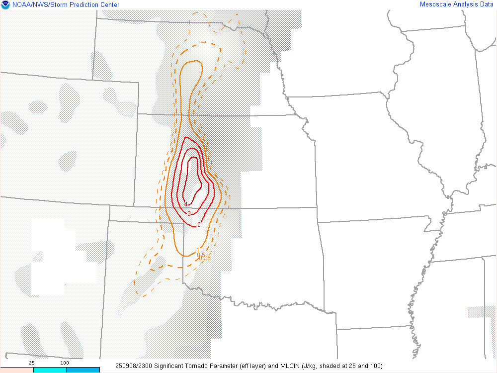
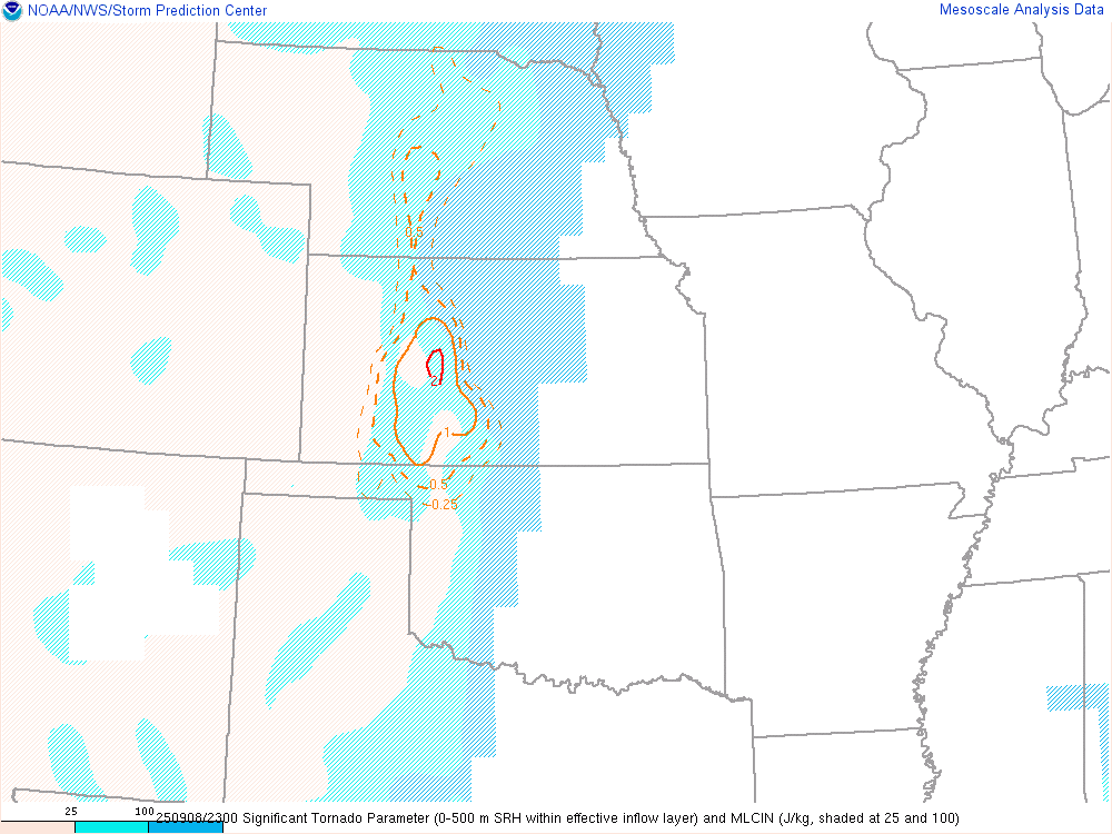
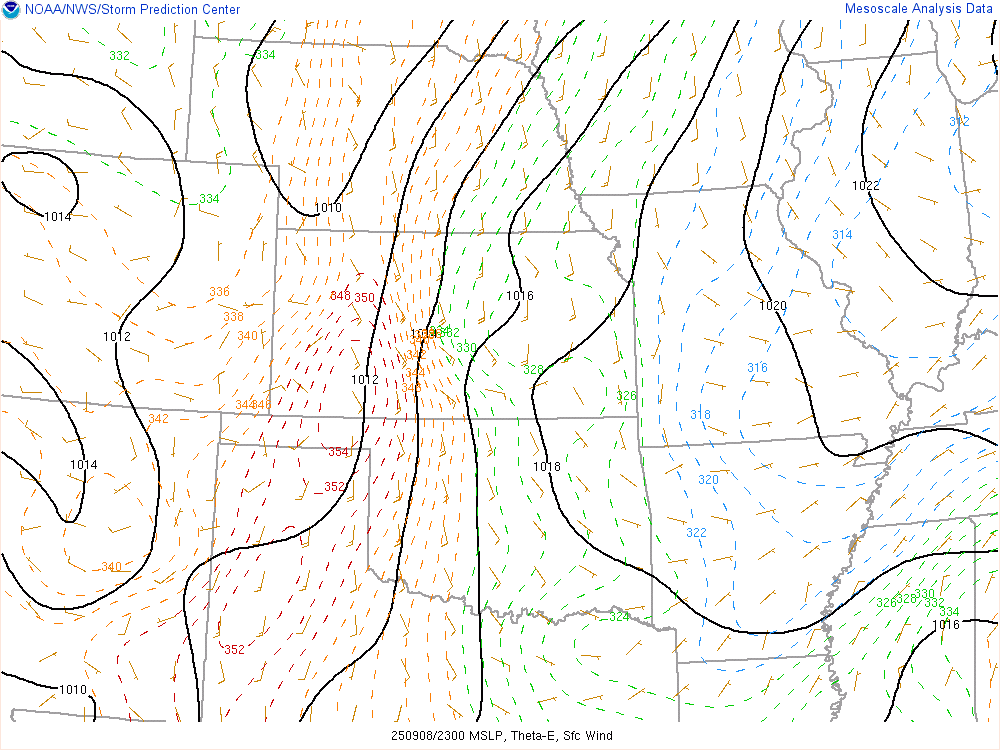
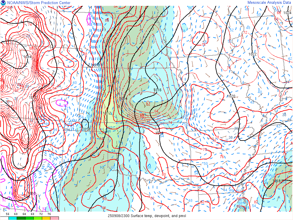
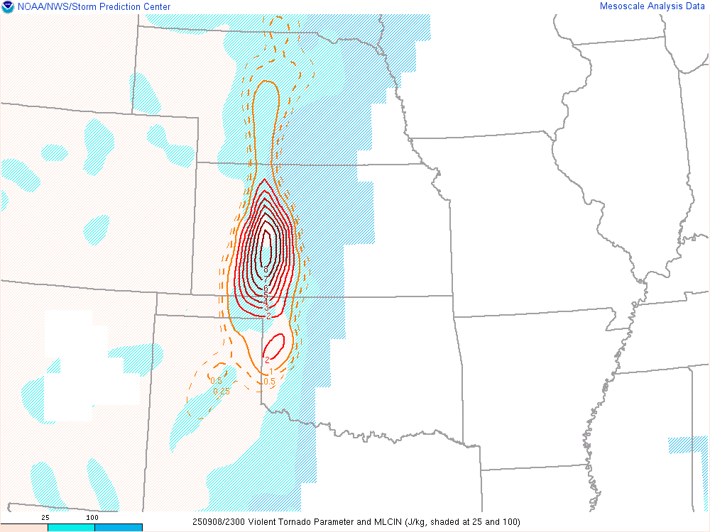
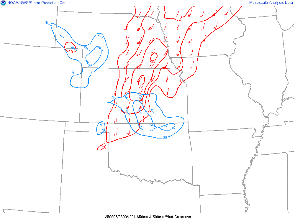
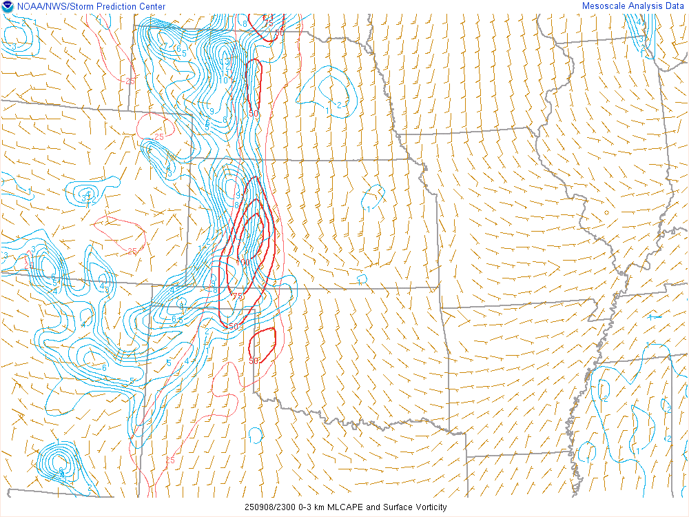
6pm CDT/23Z SPC Mesoanalysis

Willard Oklahoma/Ashland Kansas Tornado
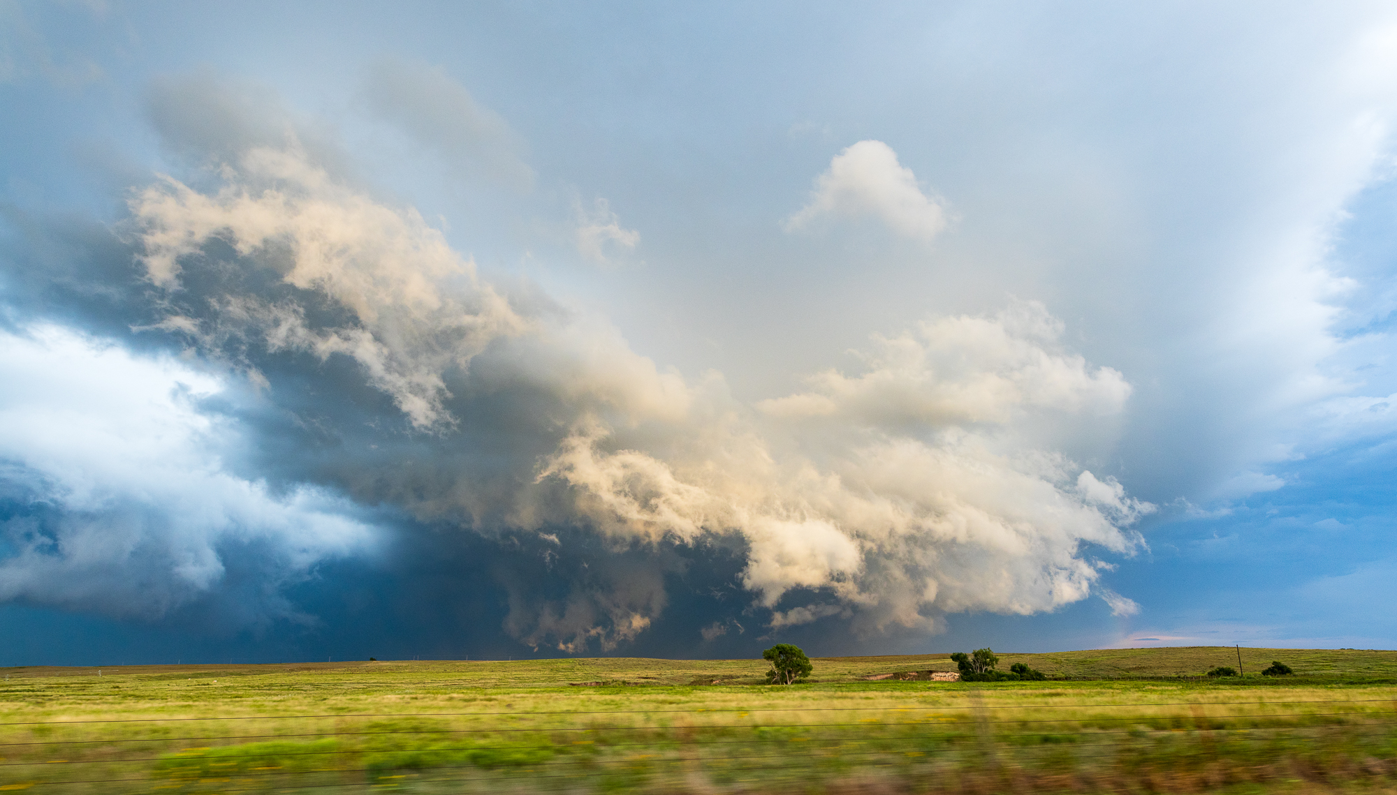
The first tornado I’d observe while heading northbound at the storm on N1830 road, due south of Ashland Kansas and just northwest of Willard Oklahoma. The tornado would have been on the Oklahoma/Kansas border at this point. It was not very thick, nor did it have a lot of contrast.

This tornado lasted a very brief amount of time, less than 2 minutes. I continued north to the Kansas border. The wall cloud was cranking away, here is a short time lapsed version
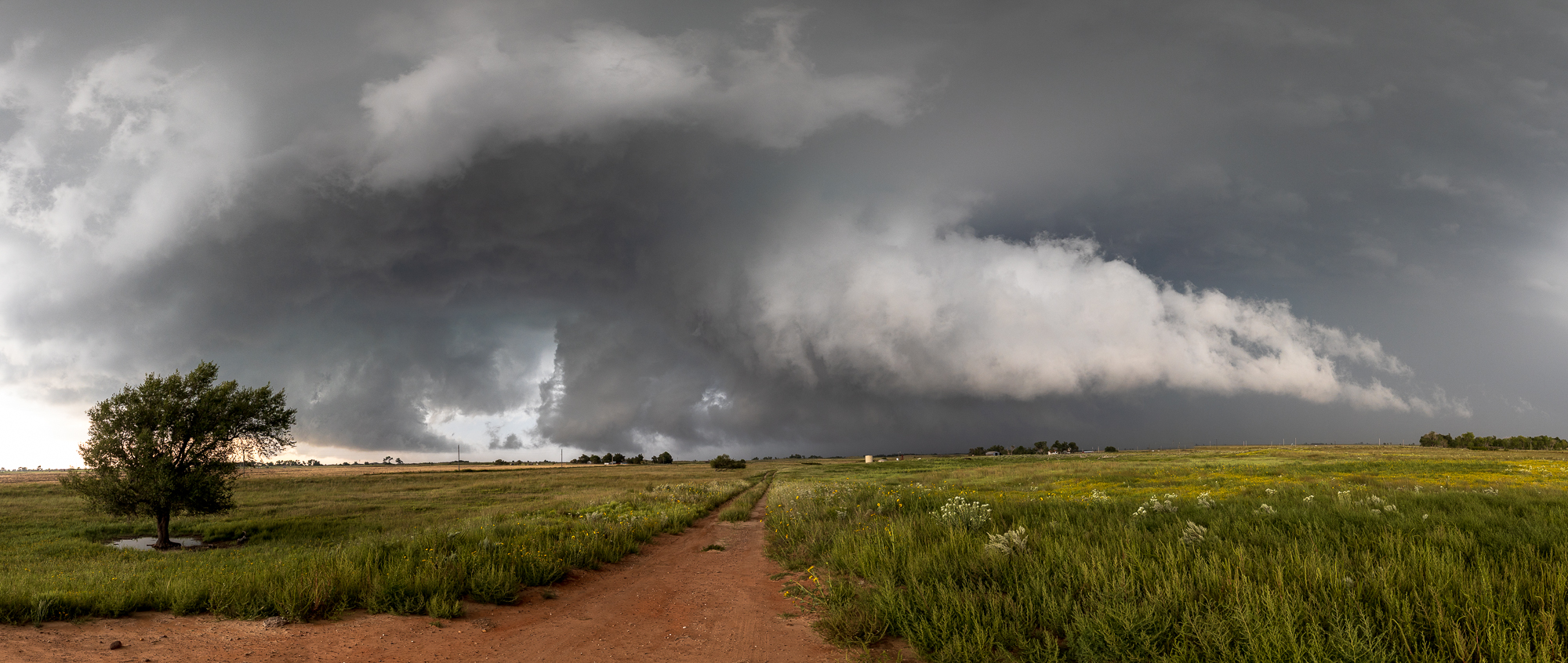
Rosston Oklahoma Tornado
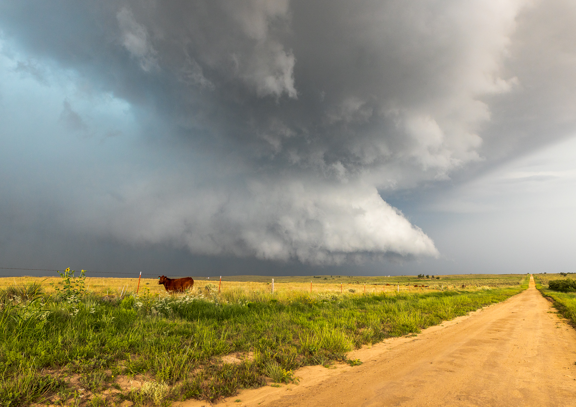
As the storm continued south, I had to re-position to stay out of the hailcore. I ended up going west a few miles as there were some big gaps in the roads out there. I ended up Northeast of Rosston looking at a wall cloud just to my north and west. A funnel appeared, and continued to reach down to be a long “rope” tornado, very skinny.
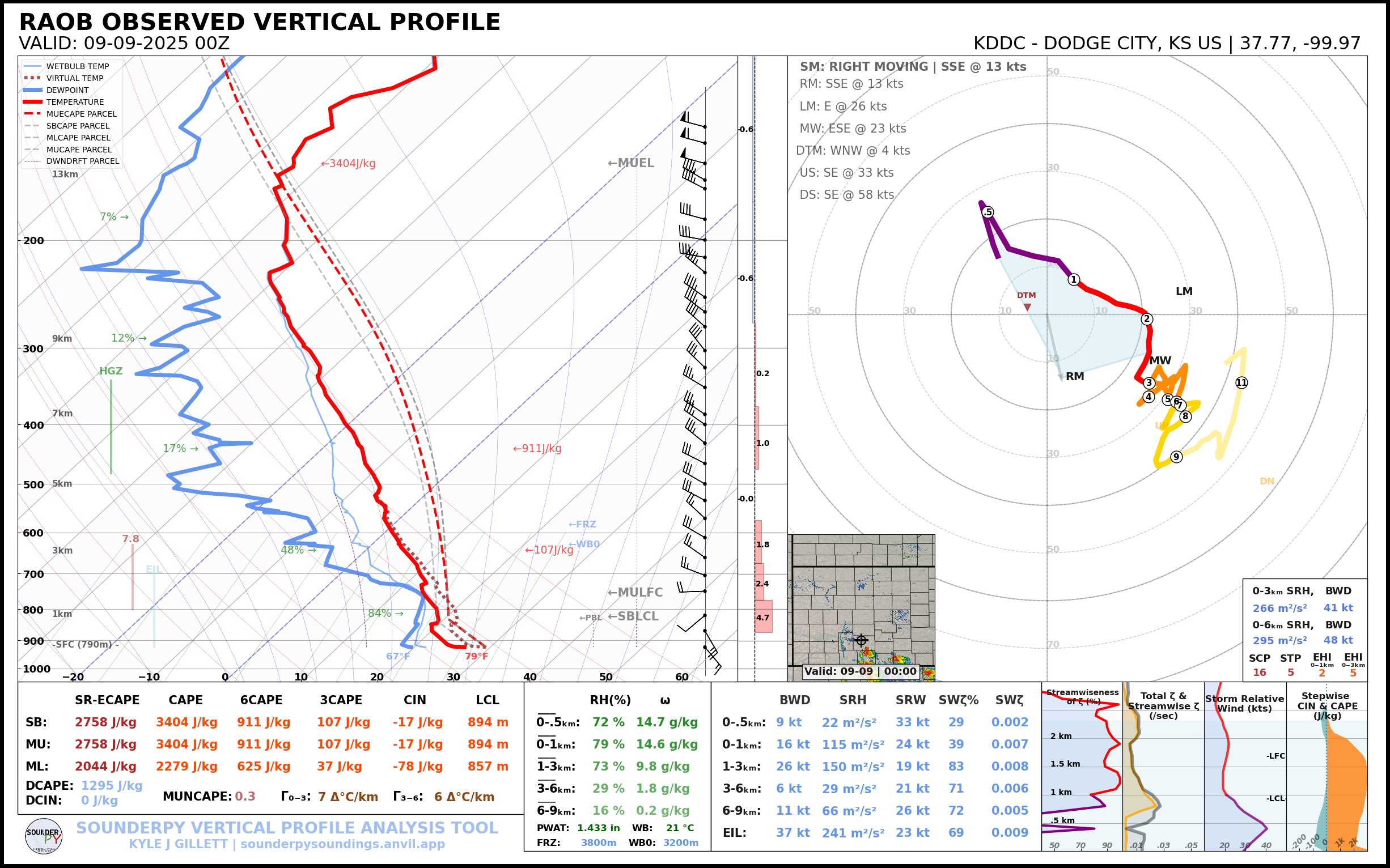
00Z Observed Soundings
Dropping south to US 412
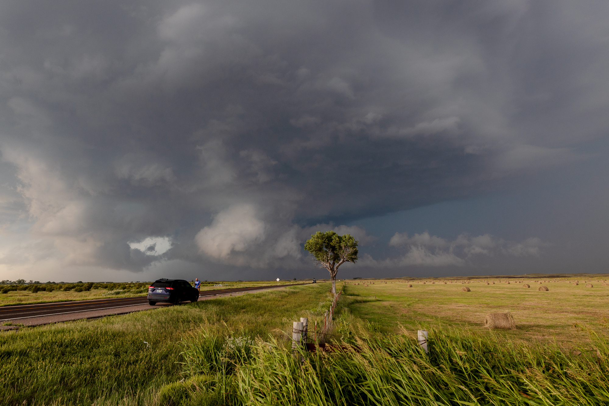
As the storm continued to drift South/Southwest, I had to continue to do the same. Eventually I’d end up at US412 again near Slapout where I ran into Ashton. Surging westward RFD caught my attention, as it’s not something I see very often. I headed north and then west to get a little closer, ending again in Slapout. The hail core was near or would be crossing 412 shortly and the sun was setting, so Bill and I decided the best route to take would be west to FM2741 then south through Follett to Higgins and east. This would avoid most of the hail cores and give us a quick return to OKC/Norman.
Tornado near the Texas/Oklahoma State Line
As we were dropping south on NS 159 Rd, I decided to stop at the Oklahoma/Texas state border to get some photos with the signs. It just so happened there was a brief rope tornado ongoing and I was able to capture the Texas State Line sign with the tornado below. You can see the thin cone under the lowered portion of the storm.

The storm had taken on a pretty look and was being aided by ideal lighting from the setting sun.

Return to Norman
We’d continue south to Follett and then to Higgins. Just south of Follett I’d stop and grab a quick photo of the structure. This storm put on quite the show, but I needed to get home and wanted to avoid the hailcore.

The drive back to Norman went along relatively uneventful once we got to US60 in Higgins. I was running a little low on fuel when I pulled into Arnett and filled up. We ended up back in Oklahoma City around 10pm.


