Storm Chase Details
Miles Logged: 255
States Chased: MI
Severe Risks: SPC Outlooks
Severe Reports: Storm Reports
Forecast Setup
I woke up Sunday morning in a Slight/5% tornado risk over Lower Michigan. The setup wasn’t super impressive, but I was seeing decent CAPE on the NAM and RUC. The 00Z NAM was showing 3800 SBCAPE over Lower Michigan, but the 12Z came in not so hot. The RUC was showing anywhere from 3000-3500 in Southwest MI, with a nice tongue of 2000 CAPE going north to M-55.
The RUC was showing anywhere from 3000-3500 in Southwest MI, with a nice tongue of 2000 CAPE going north to about M-55. North of M-55 the CAPE values were lower, but the shear started going up and helicities near the warm front. Due to the terrible chase terrain and lower instability values, I decided not to play up north along the warm front.
I got breakfast and then decided to load up the truck as it appeared the line that was currently making it’s way across Wisconsin was approaching the lake shore. It had mostly been confined up towards Green Bay but had been expanding southward rapidly. I still wasn’t sure this was the main show for the day, but decided that I should head out just in case and could always catch later convection if it fired.
My power steering was completely gone, so it was a long day which ended in sore arms.
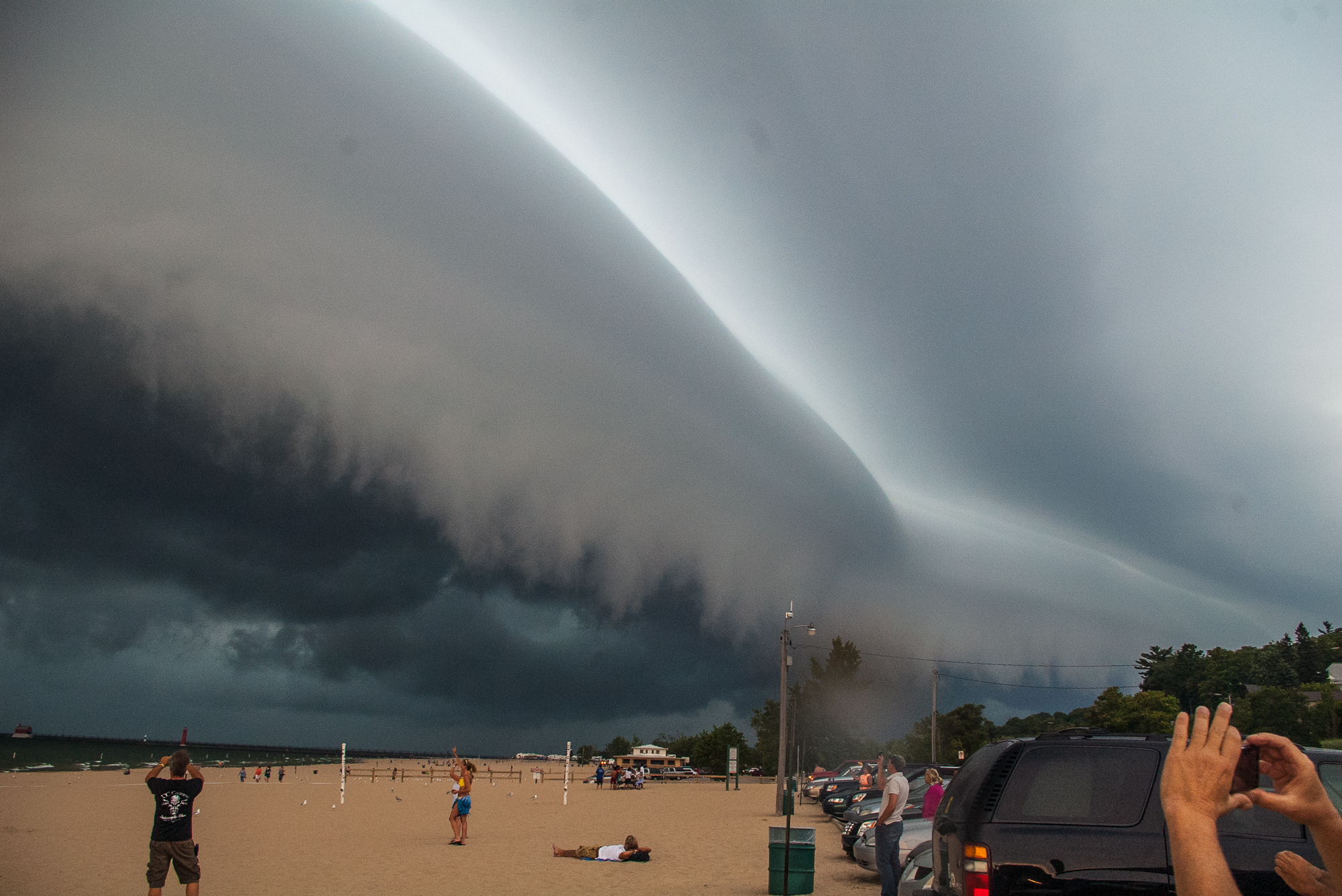
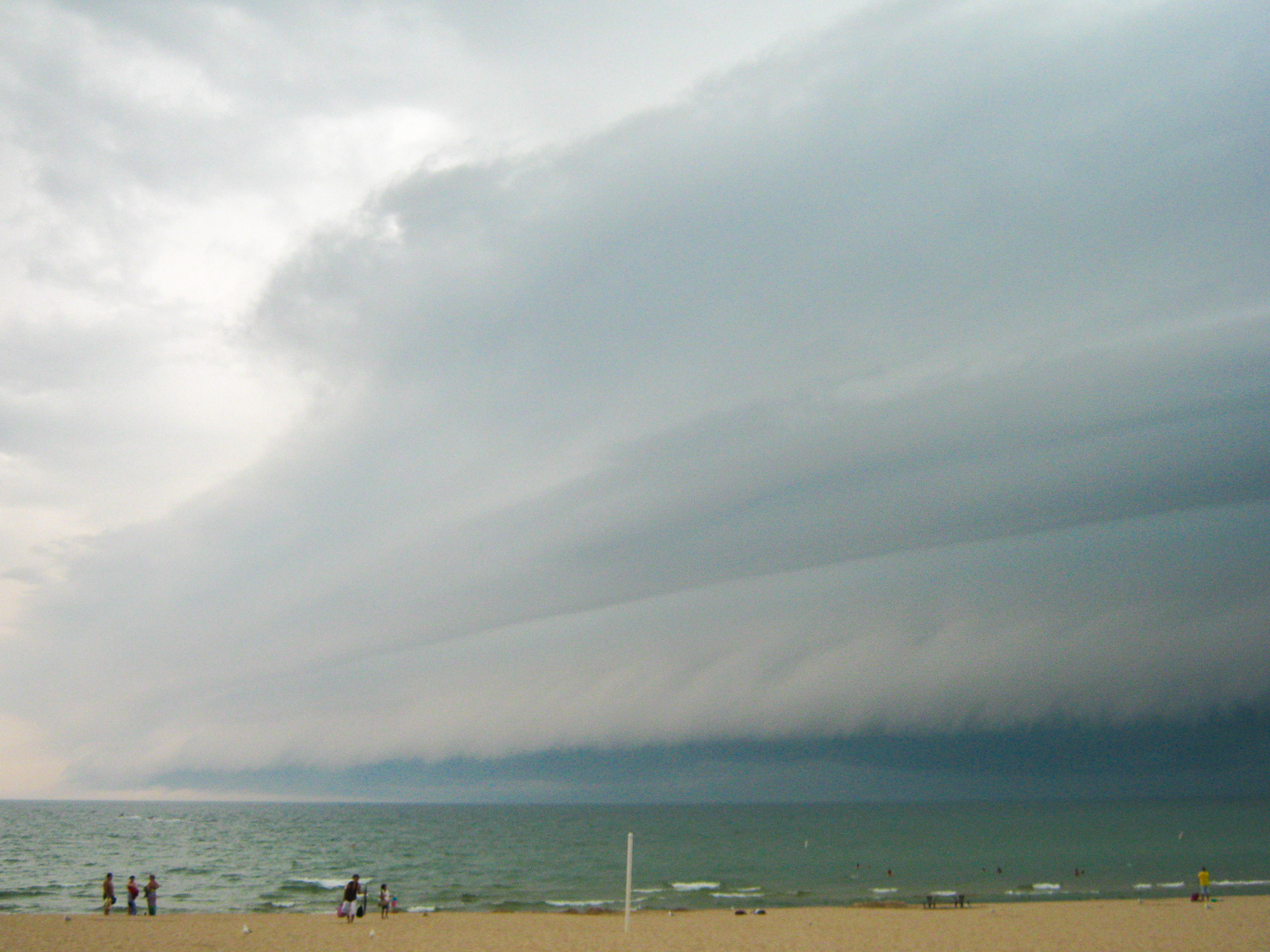
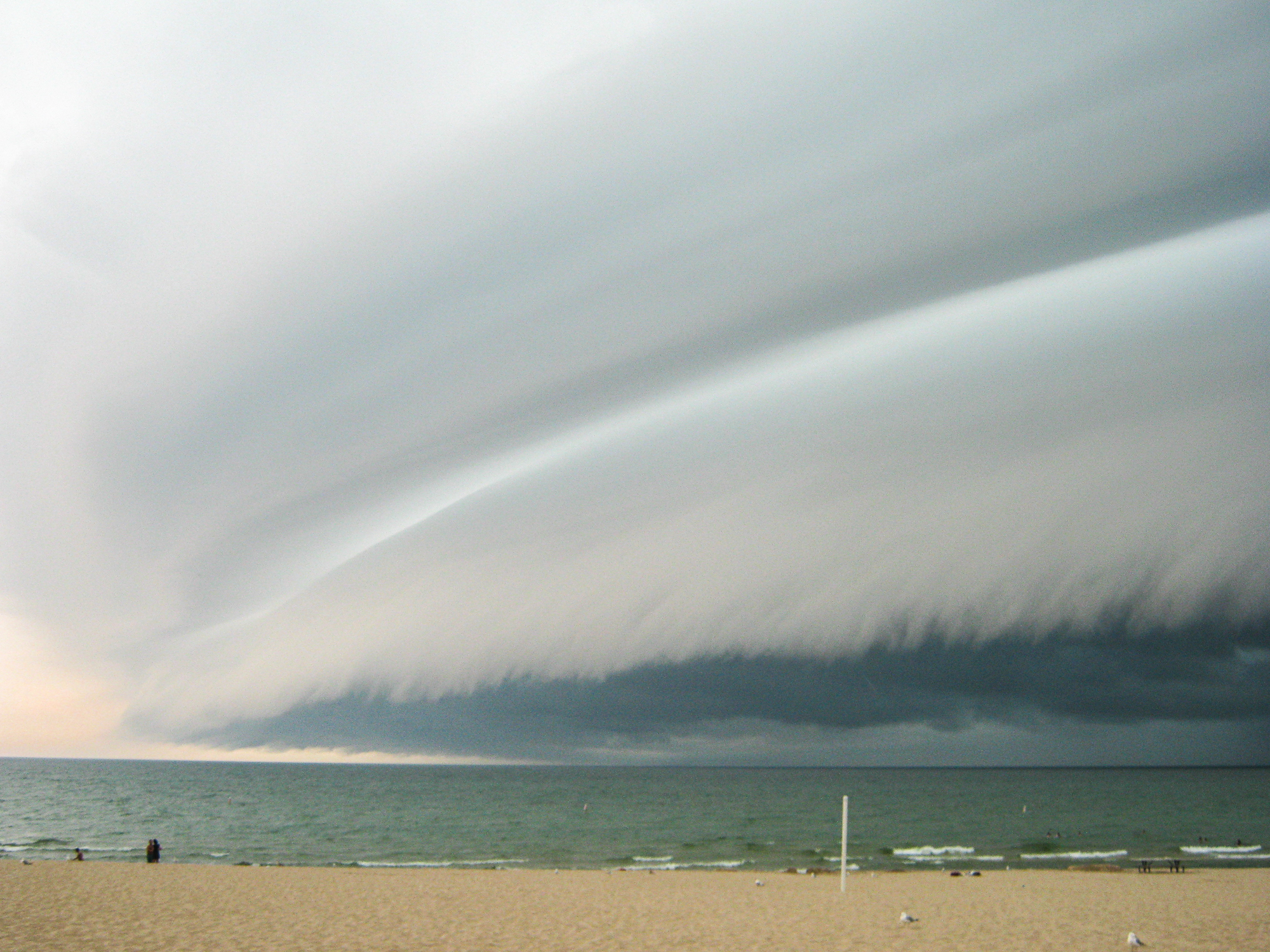
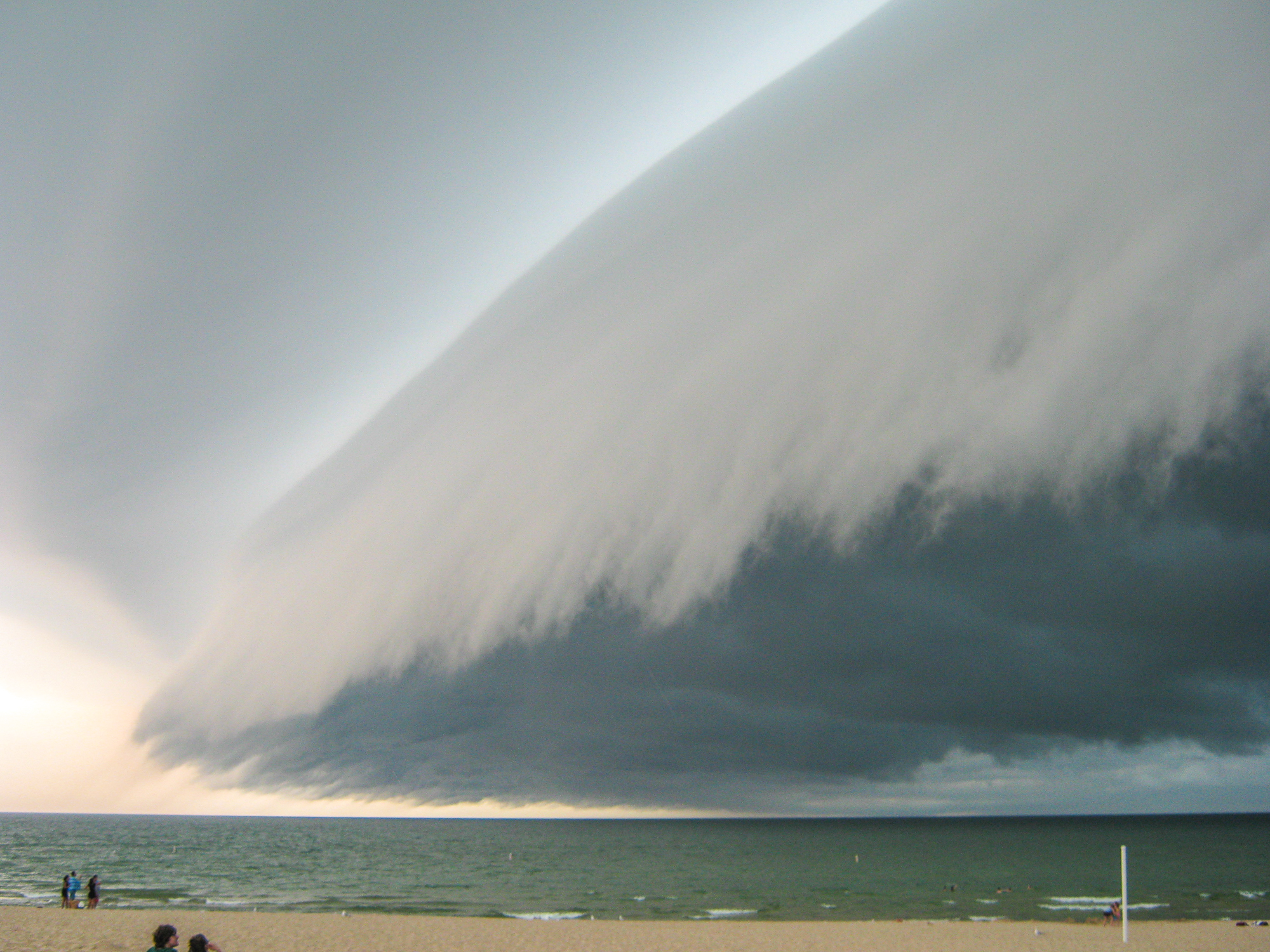
I headed west on I-96 to Grand Haven, which is where the best cell appeared to be setting up to come on shore. I found a parking spot in the city lot at the beach, and setup with my anemometer and live stream. I setup my DSLR and my HD cam on a set of tripods and got everything setup. As it was, the beach is a very visible spot to setup, and I was asked a bunch of questions about being a storm chaser and about the storm.
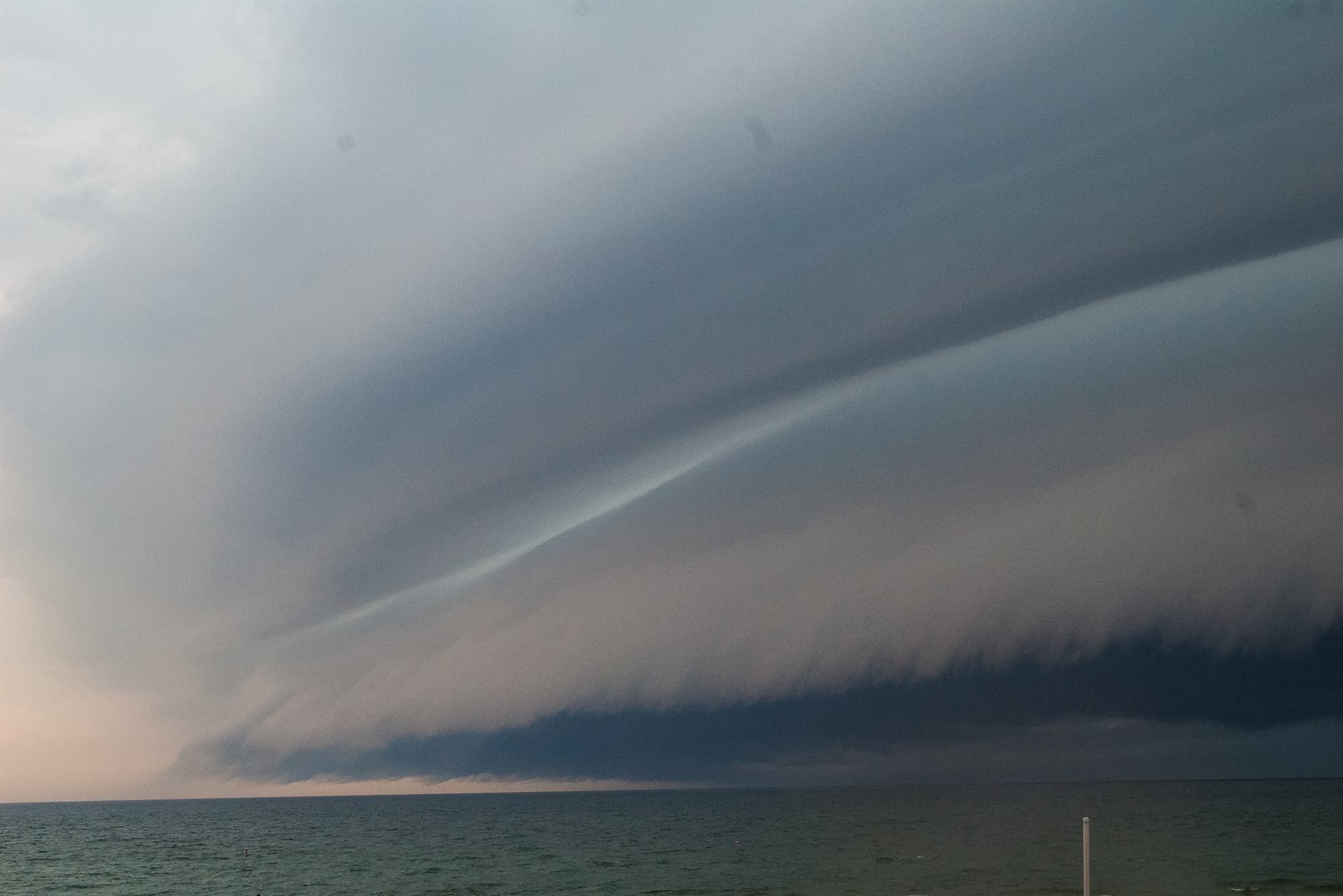
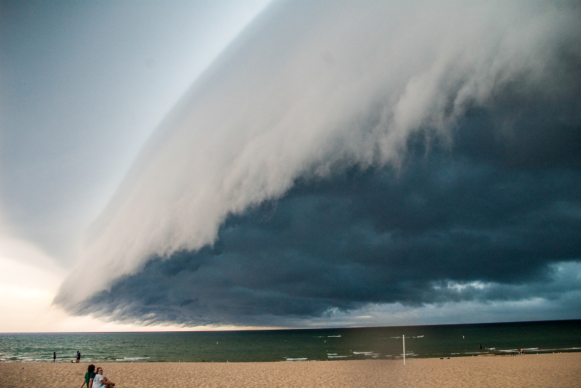
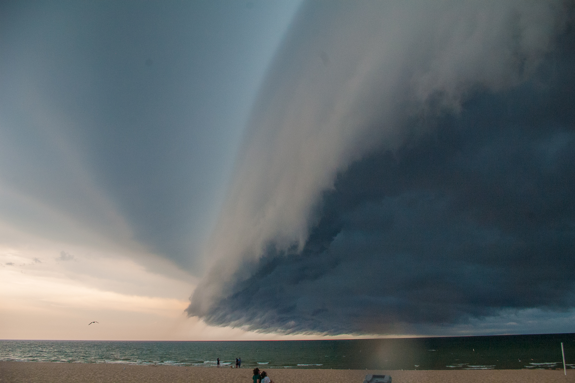
The shelf cloud came ashore from Lake Michigan, and was by far the most beautiful and well sculpted shelf cloud I had ever seen.
Once the shelf passed over, I decided to hit the road and head south towards Holland as it appeared part of the line went well back into the lake. Traffic was slow, but I did manage to get down to Holland. I don’t have a state parks sticker, so I couldn’t get into Holland State Park without paying, and turned around to head further south as the line over the south end of the lake looked promising and the structure on the storms I was on didn’t look very impressive.
I headed down 31 to 196 and ran into traffic. Quite a lengthy backup which set me back about 15 minutes, then I decided to stop and edit some video and get a screener online.
The storm to my east in Allegan County had gone severe warned, and L.B. LaForce was on it. He saw a decent wall cloud, and rapid upward motion, so I started heading that way down M89 towards Plainwell.
The storm had a nice wall cloud that I could see from Allegan. It quickly seemed to fall apart after that,pretty much becoming a blob by the time I got to US 131.
I continued east to M37 where I had a small Deja Vu moment. I had encountered some major wind damage on June 6, 2008 at the intersection I came out to M37 at, and pulled over to the side for a minute. It was about that time Bob Hartig and Kurt Hulst pulled up and we had a quick chat, then decided to head on up and intercept the only severe warned cell left.
By the time we got to Hastings, Bob called me on the phone and we all decided to go to Walldorffs instead. We had just had dinner there on Friday for my going away/moving to Oklahoma party, so it seemed fitting. L.B. LaForce had jumped into the motorcade behind us, so he and his dad Bill joined us. As we were sitting there waiting on our food, Nick Nolte showed up as well.
So while we didn’t get anything spectacular, and it was just another garden variety Michigan Bust, we still enjoyed each others company and talking storms.


