Storm Chase Details
Miles Logged: 200
States Chased: OK
Largest Hail Encountered: 0.75 in.
Highest Wind Encountered: 40 MPH
Severe Risks: SPC Outlooks
Severe Reports: Storm Reports
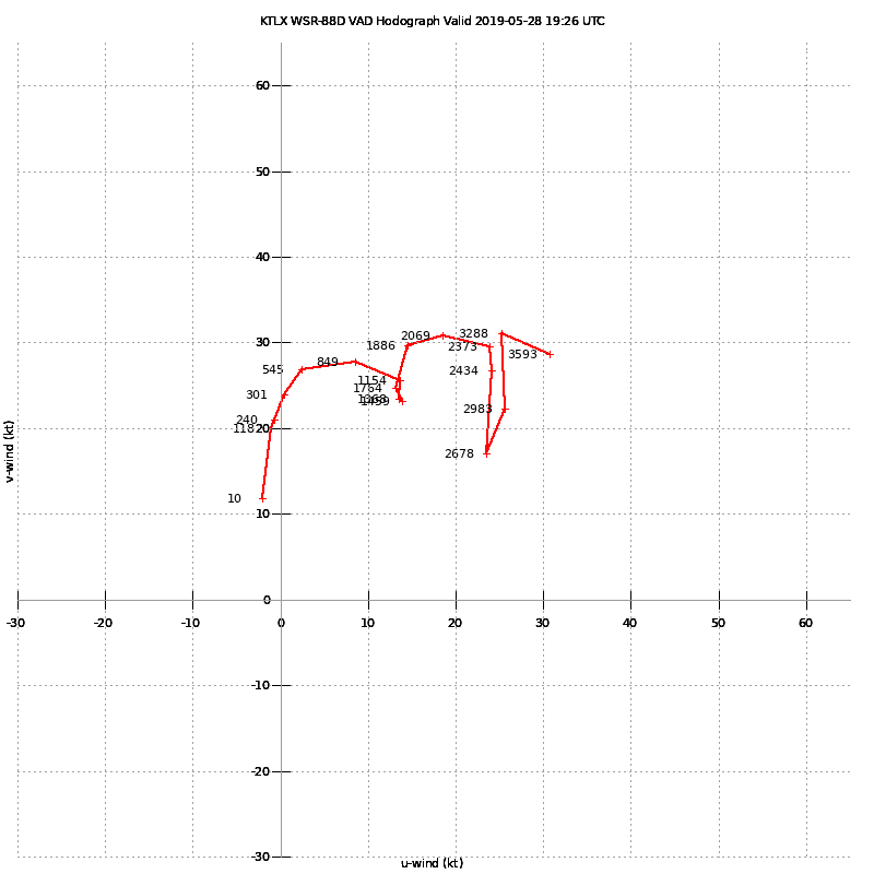
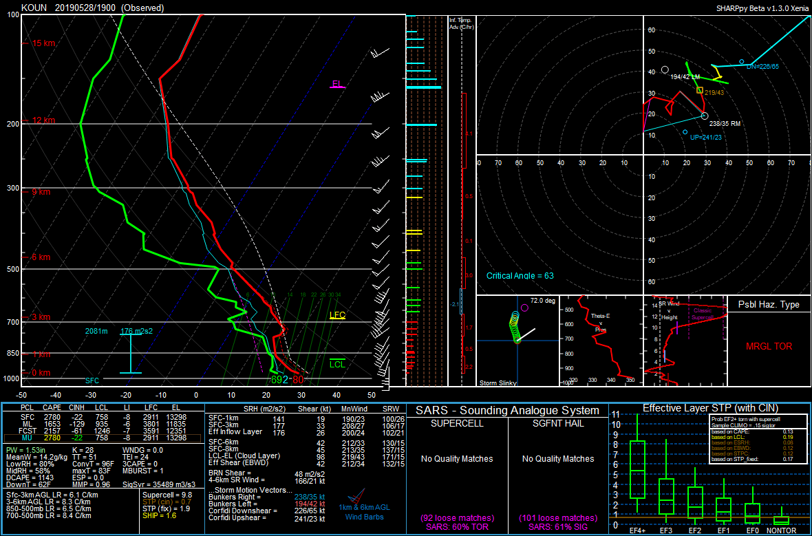
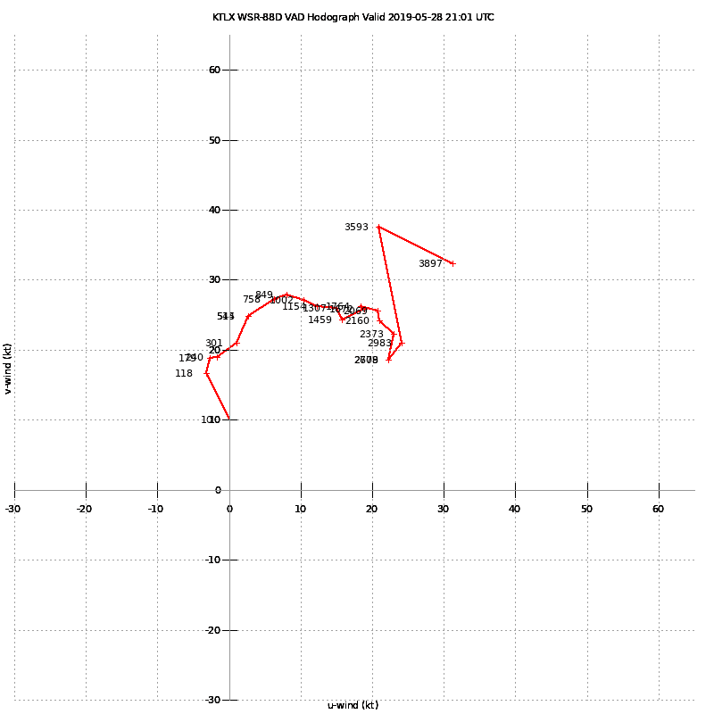
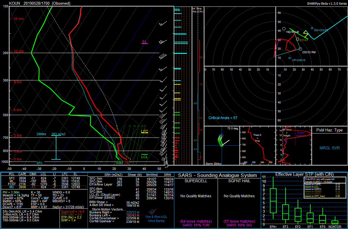
I couldn’t chase but locally on the 28th because of work and a doctors appointment. Before my doctors appointment at 445 storms had already fired along the dryline. I had some concerns with veer-back profiles, showing up on the 17Z and 19Z OUN sounding as well as the VAD profilers at the radar sites.


With that said, I got done with my dr appt about 5:30 and headed up I-35 to the Kilpatrick and then west to intercept the storm that was tornado warned near Piedmont. I got right under the wall cloud near OK-74 and Waterloo road, taking that east and then stair stepping. Unfortunately a lot of the east/west road options were closed, especially once I was into Logan County. I was also behind a few vehicles that were much better equipped than me going slow, so eventually I had to bail on the storm and head back south as I could not find a suitable road east.
The RFD had surged out, kind of like you’d expect for those profiles above. A whales mouth was along the southern edge of the storm, and as I struggled to catch back up with I-35 and then OK-105, I decided at US177 to give up and drop south.
I dropped south through Shawnee and got to the southern storms as they were dying out. What a crappy chase day.


