Storm Chase Details
Miles Logged: 1038
States Chased: TX
Largest Hail Encountered: 2.00 in.
Severe Risks: SPC Outlooks
Severe Reports: Storm Reports
Forecast
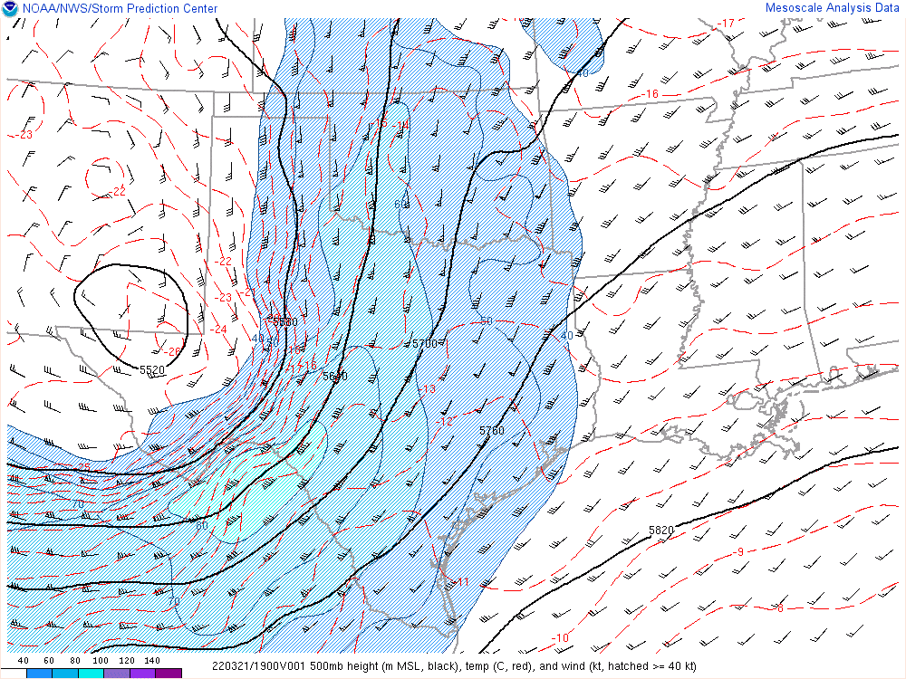
As it was March, I had begun to put perusing the GFS 500mb charts in my daily ritual. This trough caught my eye about a week out. Issues with veer back veer, moisture return, and storm mode had me feeling negative. The SPC, however, was pretty bullish as they outlooked a Day 7 on the 15th and followed through adding a 30% the 17th for Day 5.
As of Saturday night I was pretty sure I was not chasing. The NAM and RAP were showing some pretty bad veer backing as well as some very low critical angles. It was hard to find anything over 40. I also had some serious questions about moisture, with mid 50 degree dewpoints in the north Gulf. The deeper moisture was south of a Tampa to Brownsville line and I had questions on return.
Early runs of the RAP were not good. Almost unidirectional low level shear over the warm sector? Pass. The 18Z HRRR showed messy storm modes.


Monday 00Z Models
Nevertheless, I had already verbally secured Monday off, so it made sense to keep watching. As the Monday/00Z models poured in Sunday night, I was starting to believe I might miss a very significant event. The NAM and RAP had both minimized the veer-backing, especially just east of Austin around 23Z. The target I settled on was around Bastrop at 00Z.

Moisture had started its northward journey. I had visible satellite up all day Sunday. The 00Z Brownsville sounding showed decent moisture, enough to get the job done.

Departure
As I wasn’t prepared to chase, I had to pack. Eventually I got out of the door in Norman around 11pm and headed to Cleburne, TX. I did a quick check and found soundings at 06Z when I arrived at the hotel. The moisture was here, and it was deep moisture.


After a night of sleep, I managed I be on the road again by 11am towards Austin on 35. I made a stop in Temple for lunch and stopped by a friends house nearby. Still somewhat unsure of where I wanted to end up, I left and continued south towards Austin.
Hurry up and wait
One of the issues I was worried about was early initiation. The NAM had possibly hinted at 2-3pm initiation the night prior, and the HRRR showed plenty of elevated convection. I dropped to highway 130 and sat off the highway in Georgetown. Visible satellite was showing better clearing further south, and I needed to keep the Austin metro area in mind with whatever plan I made. A funny tweet I saw from one of the viral videos afterwards said “The tornadoes move a lot faster than the traffic”.
The folks at Texas A&M had launched a special sounding, which they posted on twitter. This showed that capping inversion had almost completely eroded. The show was about to start, so I dropped south on highway 130, exiting at US290.

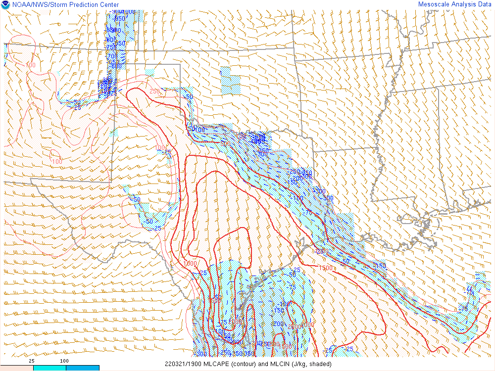
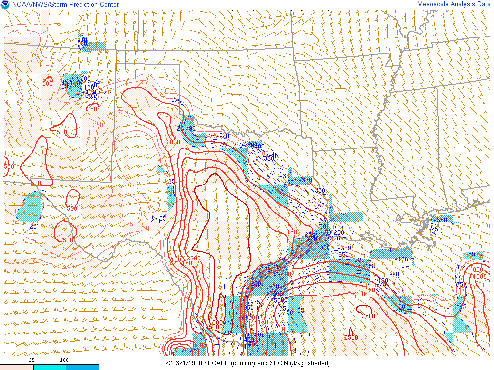
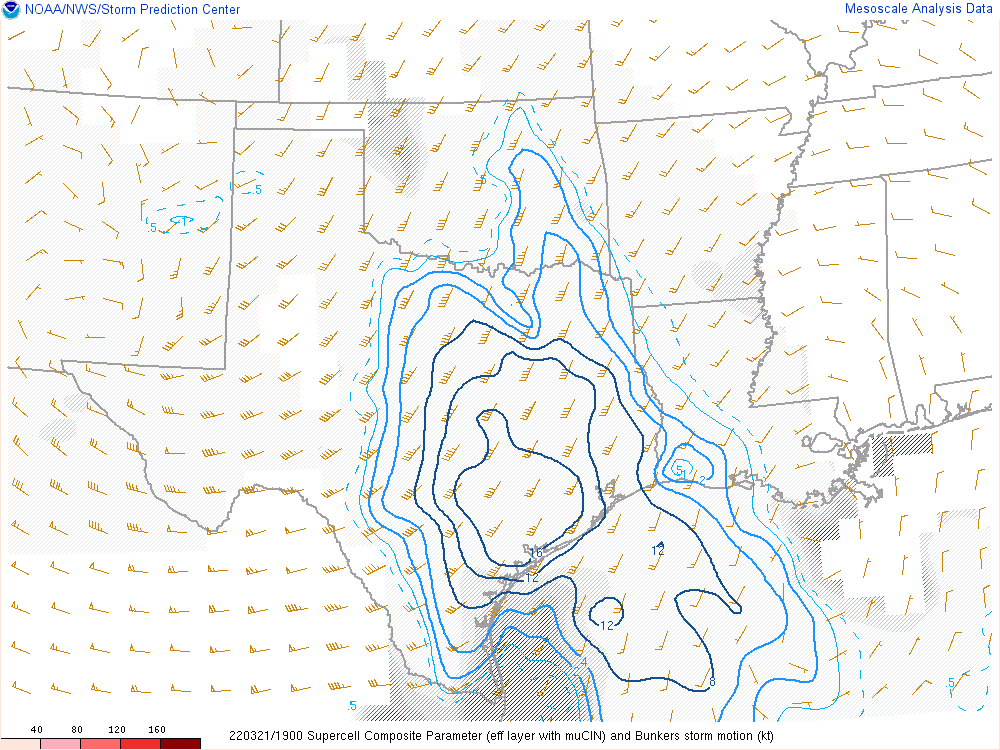
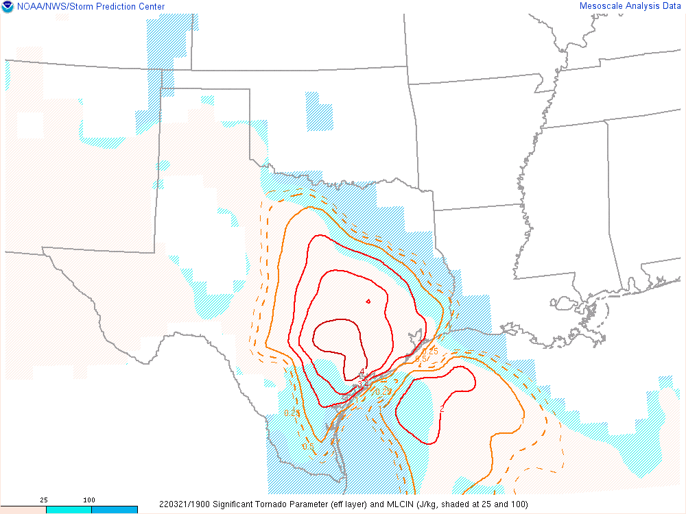
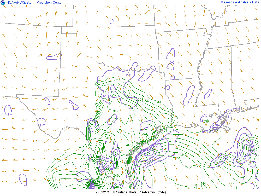
19Z Mesosanlysis
I parked near Manor and started perusing mesoanalysis. I thought I was in a pretty good position, but decided to drop further south to the Austin airport. In a previous visit, I had been on top of the parking structure. Unfortunately, it appeared I would have to purchase a full day of parking to get up there. I ended up parking out by the runway on a quiet side street.
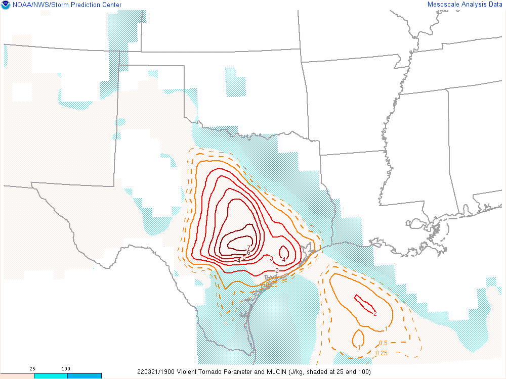
Storms Fire near San Antonio
While I was hanging out near the airport, I was watching the CU field near San Antonio. Eventually they showed up on radar and seemed to be maturing at a very rapid rate. I had to make a call on whether to pursue west of Austin and getting stuck or cut off by the city potentially or miss something in or west of metro. I chose to get aggressive, heading west on 71 to Bee Cave.
At this point there were 2 healthy cells. Being unfamiliar with the area, I hadn’t checked downstream too much, but I started to make a plan. I could just follow this storm to near round rock or north and get back east. I didn’t realize there was only 1 viable crossing on Lake Travis from where I was. I ended up heading back the way I came, heading 290/71 to 130 going through Austin at 5pm.
Tornado Warnings
Radar was lit up with Tornado warnings, including the storm just to my southwest. I stopped briefly to see under the base near Mendoza before continuing south. A friend had texted me a photo from the south storm near Seguin, and the wall cloud looked very healthy. The storm had a more organized look on radar as well.
Navigation Error
A quick glance navigation backfired when I drove past the exit for 183 in Lockhart, thinking 130 continued south. Unfortunately I was heading southwest directly at the storms core. Fortunately, I had time to reach highway 80 and head back east before the worst of the storm got to me. There was also a very noticeable lack of hail.
Storm near Luling
When I first came out of the forward flank, I pulled off to the side and looked due south into the hook. Nothing stuck out to me as well formed yet, even with radar suggesting a tornado.
As visibility was terrible, I started east towards Luling to reposition north of town. As I went east on highway 80, radar highly suggested a tornado right behind me. So I did the sane thing and flipped a U-turn to head back. As radar would suggest, the circulation was occluding to the northwest. It appeared to be wrapped in rain as it crossed 80.
Road Network and Calling it a night
I spent the next hour fighting hills, trees and some awful road holes to keep up with the storm. As I passed through the core, I yet again noticed a lack of ice.


